THE ADVENTURE COLLECTIVE® · Independent discovery and booking for outdoor travel

Ascend from Senaru to Rinjani’s crater rim on a brisk two-day trek that delivers an overnight camp, crater-lake outlooks and sunrise over Bali and the Gilis. This guided 2D/1N route covers steep terrain, dramatic biome changes and authentic cultural touches.
Ascend from Senaru to Rinjani’s crater rim on a brisk two-day trek that delivers an overnight camp, crater-lake outlooks and sunrise over Bali and the Gilis. This guided 2D/1N route covers steep terrain, dramatic biome changes and authentic cultural touches.
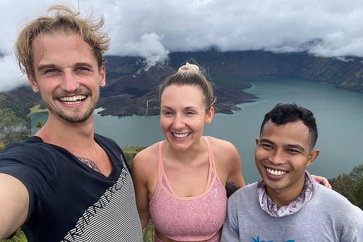
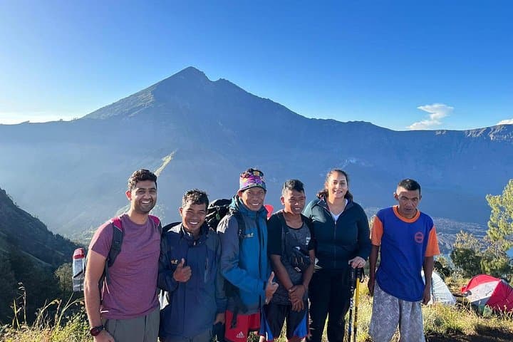
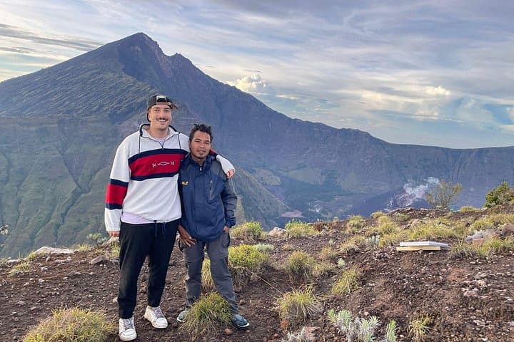
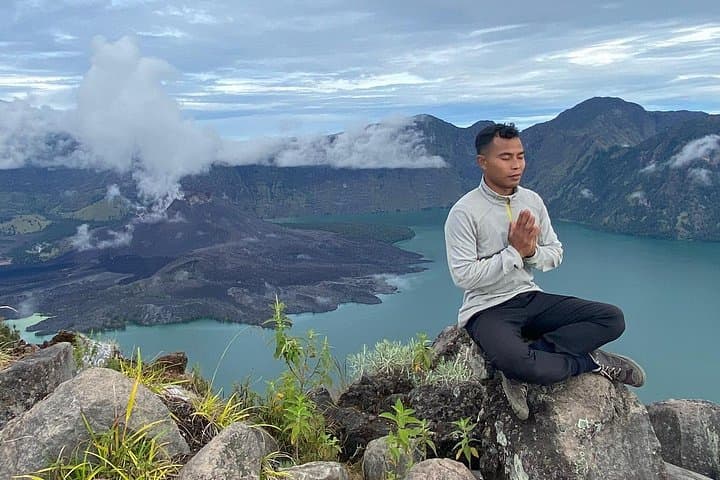
The first steps leave the humid lowland behind: a narrow trail threads through dense tropical forest, then opens to high grass that bends under wind and cloud. By late afternoon you reach Senaru Crater Rim (2,641 m) and set camp with a view that pushes past island silhouettes—Bali’s Mount Agung and the glitter of the Gilis—while the crater lake Segara Anak and the young cone of Gunung Baru sit like a quiet heart below.
Verified experiences and guided adventures in the surrounding area.
Operated by Mount Rinjani Tour · Senaru, West Nusa Tenggara
The first steps leave the humid lowland behind: a narrow trail threads through dense tropical forest, then opens to high grass that bends under wind and cloud. By late afternoon you reach Senaru Crater Rim (2,641 m) and set camp with a view that pushes past island silhouettes—Bali’s Mount Agung and the glitter of the Gilis—while the crater lake Segara Anak and the young cone of Gunung Baru sit like a quiet heart below.
Rinjani is Indonesia’s second-highest volcano and an active stratovolcano shaped by repeated eruptions; the crater lake is a product of those violent geological cycles. The mountain holds cultural weight for the Sasak people and Balinese pilgrims—parts of the route pass sacred spots where offerings are still made. Ecologically the slope moves from tropical rainforest to montane grassland in a short span, producing striking biodiversity and rapid weather shifts that demand respect.
Practically: the itinerary begins at Senaru village (601 m), climbs roughly 2,040 m to the crater rim over a long first day, camps overnight, and returns the next morning. Trails are steep and uneven with loose volcanic scree in places; guides and porters are provided and camping gear is included. Expect 8–10 hours of hiking day one and 4–6 on day two depending on pace.
Carry layered insulation for cold nights, carry at least 3 L water (tour provides 3 L/day), use sturdy boots and a headlamp, and pace conservatively to handle altitude. Permits and park fees are handled locally; plan for wet weather outside the dry season. This is a raw, high-altitude trek that rewards early starts and simple gear with expansive sunrise panoramas.
challenging.
2 days.
Good cardiovascular fitness and prior multi-hour hiking experience recommended; ability to handle steep, uneven trails at altitude.
Expect a long, sustained ascent—roughly 2,040 m of elevation gain over 1 long day. It’s steep and physically demanding but not technical; moderate-to-strong fitness is required.
Yes—guided trek, porters, camping equipment and most meals on trek are included; local park fees are typically handled by the operator but confirm at booking.
Rinjani’s weather changes quickly: warm and humid at low elevations, windy and cold at the rim. Bring rain protection and warm layers; dry season (May–September) is most predictable.
Not recommended for very young children or travelers with serious back, heart or respiratory issues due to sustained exertion and altitude; check medical clearance if unsure.
Rinjani is an active stratovolcano that dominates Lombok’s landscape and carries spiritual significance for the Sasak and Balinese communities who perform rituals at the crater lake.
Park management limits group sizes and requires permits; minimize impact by using established campsites, packing out waste and supporting local guides and porters.
Mount Rinjani Tour operates guided outdoor trips and adventures with an emphasis on safety, stewardship, and memorable experiences.
The first steps leave the humid lowland behind: a narrow trail threads through dense tropical forest, then opens to high grass that bends under wind and cloud. By late afternoon you reach Senaru Crater Rim (2,641 m) and set camp with a view that pushes past island silhouettes—Bali’s Mount Agung and the glitter of the Gilis—while the crater lake Segara Anak and the young cone of Gunung Baru sit like a quiet heart below.
The first steps leave the humid lowland behind: a narrow trail threads through dense tropical forest, then opens to high grass that bends under wind and cloud. By late afternoon you reach Senaru Crater Rim (2,641 m) and set camp with a view that pushes past island silhouettes—Bali’s Mount Agung and the glitter of the Gilis—while the crater lake Segara Anak and the young cone of Gunung Baru sit like a quiet heart below.
Rinjani is Indonesia’s second-highest volcano and an active stratovolcano shaped by repeated eruptions; the crater lake is a product of those violent geological cycles. The mountain holds cultural weight for the Sasak people and Balinese pilgrims—parts of the route pass sacred spots where offerings are still made. Ecologically the slope moves from tropical rainforest to montane grassland in a short span, producing striking biodiversity and rapid weather shifts that demand respect.
Practically: the itinerary begins at Senaru village (601 m), climbs roughly 2,040 m to the crater rim over a long first day, camps overnight, and returns the next morning. Trails are steep and uneven with loose volcanic scree in places; guides and porters are provided and camping gear is included. Expect 8–10 hours of hiking day one and 4–6 on day two depending on pace.
Carry layered insulation for cold nights, carry at least 3 L water (tour provides 3 L/day), use sturdy boots and a headlamp, and pace conservatively to handle altitude. Permits and park fees are handled locally; plan for wet weather outside the dry season. This is a raw, high-altitude trek that rewards early starts and simple gear with expansive sunrise panoramas.