THE ADVENTURE COLLECTIVE® · Independent discovery and booking for outdoor travel

A demanding one-day ridge hike from Belmeken Dam to peaks including Belmeken and Sivri chal, this route delivers raw alpine views of Musala, Pirin and the Rhodopi. Expect exposed ridgelines, scree sections and a full-day commitment from Sofia.
A demanding one-day ridge hike from Belmeken Dam to peaks including Belmeken and Sivri chal, this route delivers raw alpine views of Musala, Pirin and the Rhodopi. Expect exposed ridgelines, scree sections and a full-day commitment from Sofia.
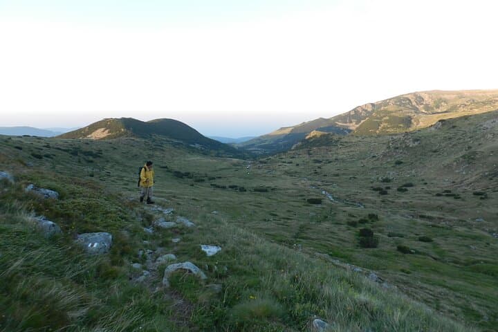
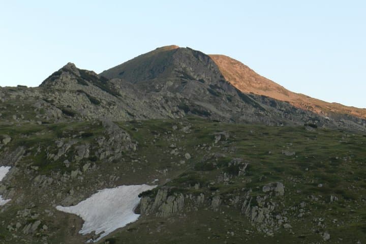
A cold wind pushes across Belmeken Dam as the minivan eases into the high basin of Rila, and the first ridge line of the day comes into view—sheer, exposed and sharp against a wide Balkan sky. Hikers step out at roughly 1,923 m (the dam), shoulder packs tightened, and follow a route that climbs to the saddle between Ravni chal and Belmeken before angling up to Belmeken peak (2,627 m).
Verified experiences and guided adventures in the surrounding area.
Operated by Bulgarian Fairy Tale · Kostenets, Sofia Province
A cold wind pushes across Belmeken Dam as the minivan eases into the high basin of Rila, and the first ridge line of the day comes into view—sheer, exposed and sharp against a wide Balkan sky. Hikers step out at roughly 1,923 m (the dam), shoulder packs tightened, and follow a route that climbs to the saddle between Ravni chal and Belmeken before angling up to Belmeken peak (2,627 m).
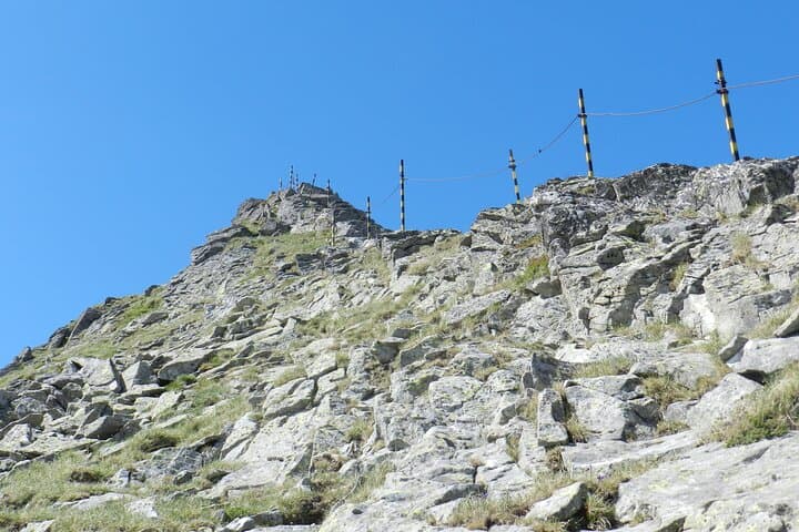
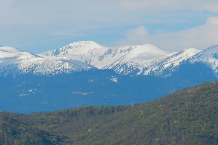
The line of summits—Belmeken, Sivri chal (2,641 m), Kameniti chal and Soufan—was carved by Pleistocene glaciers and later shaped by freeze-thaw on granite and gneiss. The trail alternates alpine meadow, stony scree and narrow ridgeline where steel cables and fixed pillars assist short exposed sections; on clear days the view takes in Musala (2,925 m), Pirin’s jagged teeth and the rounded Rhodopi to the south. Local villages like Kostenets and Momin Prohod supply the cuisine and stories—shepherding and wartime refuge are part of the area’s lived history.
Practicalities: expect roughly 710 m of net elevation gain on steep, sometimes loose terrain; plan for a full 10–12 hour outing including transfers from Sofia. Footwear with firm grip, layered clothing for wind and sun, and 2–3 liters of water are non-negotiable. The route includes short scrambling and fixed-rope sections—use poles only where advised and follow your guide’s route-finding. Timing matters: start early to avoid afternoon storms and allow a relaxed return. This is a strenuous, high-alpine day that rewards persistence with wide, raw panoramas and a real sense of place in Bulgaria’s highest ranges.
challenging.
10–12 hours (including transfers).
Requires high aerobic fitness and strong legs; comfortable with long ascents, descents and exposed scrambling.
The drive to Belmeken dam is approximately 2–2.5 hours depending on traffic and road conditions.
Yes—participants should be experienced day-hikers comfortable with long ascents, ridge exposure and short scrambling sections.
Yes—poles help on long ascents and descents, though some ridge sections require hands-free scrambling; stow poles when using cables.
Not recommended for beginners or those with back, heart or pregnancy restrictions; guides expect a high fitness level.
Rila’s high slopes have hosted pastoral communities and monastic retreats for centuries; the mountains played roles as shelters during conflicts and shaped local folklore.
Stick to established trails and avoid picking alpine flora; Rila’s fragile high-mountain habitats recover slowly from trampling and off-trail erosion.
Bulgarian Fairy Tale operates guided outdoor trips and adventures with an emphasis on safety, stewardship, and memorable experiences.
A cold wind pushes across Belmeken Dam as the minivan eases into the high basin of Rila, and the first ridge line of the day comes into view—sheer, exposed and sharp against a wide Balkan sky. Hikers step out at roughly 1,923 m (the dam), shoulder packs tightened, and follow a route that climbs to the saddle between Ravni chal and Belmeken before angling up to Belmeken peak (2,627 m).
A cold wind pushes across Belmeken Dam as the minivan eases into the high basin of Rila, and the first ridge line of the day comes into view—sheer, exposed and sharp against a wide Balkan sky. Hikers step out at roughly 1,923 m (the dam), shoulder packs tightened, and follow a route that climbs to the saddle between Ravni chal and Belmeken before angling up to Belmeken peak (2,627 m).
The line of summits—Belmeken, Sivri chal (2,641 m), Kameniti chal and Soufan—was carved by Pleistocene glaciers and later shaped by freeze-thaw on granite and gneiss. The trail alternates alpine meadow, stony scree and narrow ridgeline where steel cables and fixed pillars assist short exposed sections; on clear days the view takes in Musala (2,925 m), Pirin’s jagged teeth and the rounded Rhodopi to the south. Local villages like Kostenets and Momin Prohod supply the cuisine and stories—shepherding and wartime refuge are part of the area’s lived history.
Practicalities: expect roughly 710 m of net elevation gain on steep, sometimes loose terrain; plan for a full 10–12 hour outing including transfers from Sofia. Footwear with firm grip, layered clothing for wind and sun, and 2–3 liters of water are non-negotiable. The route includes short scrambling and fixed-rope sections—use poles only where advised and follow your guide’s route-finding. Timing matters: start early to avoid afternoon storms and allow a relaxed return. This is a strenuous, high-alpine day that rewards persistence with wide, raw panoramas and a real sense of place in Bulgaria’s highest ranges.