THE ADVENTURE COLLECTIVE® · Independent discovery and booking for outdoor travel

Turn Richmond’s streets into a gameboard: solve in-person riddles, tackle photo challenges, and uncover local history on a 90–120 minute app-led scavenger hunt. Perfect for groups, bachelorettes, or team-building with flexible start times.
Turn Richmond’s streets into a gameboard: solve in-person riddles, tackle photo challenges, and uncover local history on a 90–120 minute app-led scavenger hunt. Perfect for groups, bachelorettes, or team-building with flexible start times.
You step off the curb at Capitol Square as the city hums—brick façades, street art, and the James River refusing to be ignored. The app pings, a riddle directing you toward a statue whose expression changes depending on the light. From Monument Avenue’s grand avenues to Shockoe Slip’s cobblestones, the city becomes an interactive playground where questions are clues and photos score points.
Verified experiences and guided adventures in the surrounding area.
Operated by Let's Roam · Richmond, Virginia
You step off the curb at Capitol Square as the city hums—brick façades, street art, and the James River refusing to be ignored. The app pings, a riddle directing you toward a statue whose expression changes depending on the light. From Monument Avenue’s grand avenues to Shockoe Slip’s cobblestones, the city becomes an interactive playground where questions are clues and photos score points.
Richmond’s layout follows the fall line where the Piedmont gives way to the Tidewater; that geology shaped its role as a transport and industrial hub. The scavenger hunt threads through neighborhoods steeped in history—from tobacco warehouses converted into lofts to churches tied to Revolutionary and Civil War-era stories. Along the way you’ll pass public art, hidden plaques, and local businesses that reflect Richmond’s craft-beer and food culture.
Practical guidance is straightforward: download the Let’s Roam app, charge your phone, and plan a 90–120 minute window. The route is self-guided and flexible—start when you like, split into teams, and lean into photo challenges that reward curiosity and a sharp eye. Wear comfortable walking shoes; expect uneven sidewalks and some short stairs. Public transit and parking options are available, but starting centrally reduces walking between clues.
This hunt is social by design: it’s a citywalk, a puzzle, and a photo game rolled into one. Treat it like urban exploration—observe respectfully, support local businesses you pass, and leave places as you found them. With a charged phone and a sense of play, Richmond’s streets will push you to notice details you’d otherwise miss.
moderate.
1.5–2 hours.
Moderate: participants should be comfortable walking 2–4 miles over mixed urban terrain.
It’s self-guided through the Let’s Roam app—start any time and work at your own pace without a guide.
Plan for roughly 90–120 minutes depending on pace and how many photo challenges you attempt.
Many parts are accessible—ability varies by specific clues; the operator lists wheelchair accessibility and stroller-friendly notes, but some historic areas have uneven surfaces.
Full refunds are available if you cancel at least 24 hours before the scheduled start time.
Richmond grew at the fall line of the James River and became an early industrial and political center, including service as the Confederate capital during the Civil War.
Local groups focus on James River cleanup and protecting historic districts—respect signage, avoid trampling riverbank vegetation, and support downtown merchants.
Let's Roam operates guided outdoor trips and adventures with an emphasis on safety, stewardship, and memorable experiences.



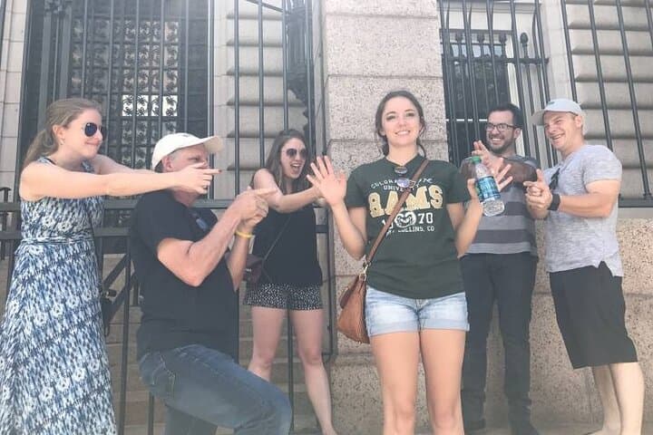
You step off the curb at Capitol Square as the city hums—brick façades, street art, and the James River refusing to be ignored. The app pings, a riddle directing you toward a statue whose expression changes depending on the light. From Monument Avenue’s grand avenues to Shockoe Slip’s cobblestones, the city becomes an interactive playground where questions are clues and photos score points.
You step off the curb at Capitol Square as the city hums—brick façades, street art, and the James River refusing to be ignored. The app pings, a riddle directing you toward a statue whose expression changes depending on the light. From Monument Avenue’s grand avenues to Shockoe Slip’s cobblestones, the city becomes an interactive playground where questions are clues and photos score points.
Richmond’s layout follows the fall line where the Piedmont gives way to the Tidewater; that geology shaped its role as a transport and industrial hub. The scavenger hunt threads through neighborhoods steeped in history—from tobacco warehouses converted into lofts to churches tied to Revolutionary and Civil War-era stories. Along the way you’ll pass public art, hidden plaques, and local businesses that reflect Richmond’s craft-beer and food culture.
Practical guidance is straightforward: download the Let’s Roam app, charge your phone, and plan a 90–120 minute window. The route is self-guided and flexible—start when you like, split into teams, and lean into photo challenges that reward curiosity and a sharp eye. Wear comfortable walking shoes; expect uneven sidewalks and some short stairs. Public transit and parking options are available, but starting centrally reduces walking between clues.
This hunt is social by design: it’s a citywalk, a puzzle, and a photo game rolled into one. Treat it like urban exploration—observe respectfully, support local businesses you pass, and leave places as you found them. With a charged phone and a sense of play, Richmond’s streets will push you to notice details you’d otherwise miss.