THE ADVENTURE COLLECTIVE® · Independent discovery and booking for outdoor travel

Trade Marrakech’s medina for two days of mule tracks, juniper forests and Berber villages in the High Atlas. This two-day Azzaden trek climbs to alpine passes, sleeps in a gîte, and returns via walnut groves and rivers.
Trade Marrakech’s medina for two days of mule tracks, juniper forests and Berber villages in the High Atlas. This two-day Azzaden trek climbs to alpine passes, sleeps in a gîte, and returns via walnut groves and rivers.
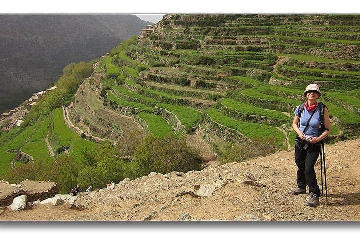
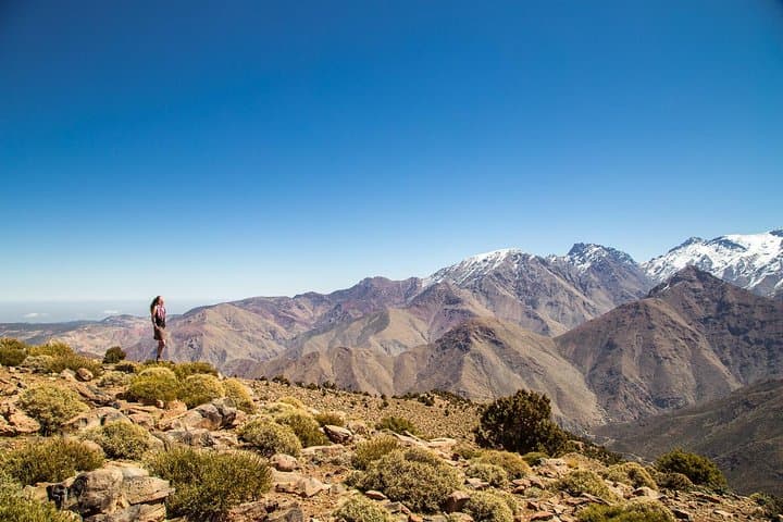
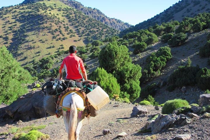
You leave Marrakech’s bustle behind and climb toward air that sharpens the view: stone villages cling to terraced slopes, juniper-scented ridgelines cut the horizon, and the Red Valley opens like a folded map. The first day rises from Imlil to Tizi Mzik (~2,684 m), a steady climb of roughly 700–1,000 m depending on your start, with about 6 hours of walking on rocky mule tracks and scree-tinged passes. From the pass the route drops into Azzaden and Tizi Oussem, through pine and wild juniper, arriving at a family-run gîte where mules and muleteers handle the luggage.
Verified experiences and guided adventures in the surrounding area.
Operated by Marrakech Day Trips · Imlil, Marrakech-Safi
You leave Marrakech’s bustle behind and climb toward air that sharpens the view: stone villages cling to terraced slopes, juniper-scented ridgelines cut the horizon, and the Red Valley opens like a folded map. The first day rises from Imlil to Tizi Mzik (~2,684 m), a steady climb of roughly 700–1,000 m depending on your start, with about 6 hours of walking on rocky mule tracks and scree-tinged passes. From the pass the route drops into Azzaden and Tizi Oussem, through pine and wild juniper, arriving at a family-run gîte where mules and muleteers handle the luggage.
The High Atlas is geologically young—folded sedimentary layers uplifted by the African and Eurasian plates—so the trail alternates hard, granitic scree and softer, eroded terraces. Culturally the route threads Berber villages where flat-roofed stone houses and walnut groves mark centuries of mountain agriculture; you’ll likely sit for a tajine and mint tea and hear local talk of water rights and seasonal grazing.
Practically, expect narrow tracks, river crossings and shaded walnut groves on day two as you climb to Tizi Oudid (~2,100 m) before descending back to Marrakech. The trek uses established trails suitable for hikers with moderate fitness; mules carry overnight luggage. Bring layered clothing for rapid temperature swings, sturdy boots for uneven, sometimes loose terrain, sun protection, and 2–3 litres of water per day. Start early to avoid midday heat, pace the ascents, and leave no trace—these valleys are both working landscapes and fragile mountain ecosystems.
moderate.
2 days (approx. 6–7 hours hiking on day one, 4–5 on day two).
Suitable for hikers with regular cardio fitness and experience on uneven trails; comfortable with sustained uphill walking.
A moderate level of fitness is required: expect sustained uphill walking up to about 900–1,000 m elevation gain in a day and several hours of hiking on uneven terrain.
Yes—muleteers and mules transport overnight luggage; bring a small daypack for items you need during daylight hours.
The highest pass is around 2,684 m; most healthy travelers tolerate this but monitor symptoms, keep hydrated, and ascend at a comfortable pace.
Night one is in a simple family-run gîte with shared facilities—expect basic comforts, local food, and authentic mountain hospitality.
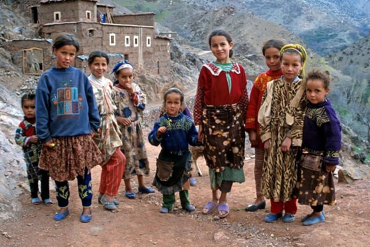
Berber families have farmed Atlas slopes for centuries; many villages retain communal irrigation terraces and stone construction techniques adapted to steep terrain.
Stick to trails, avoid disturbing grazing areas, and use refillable water bottles—the Atlas’s fragile soils and limited water demand low-impact travel.
Marrakech Day Trips operates guided outdoor trips and adventures with an emphasis on safety, stewardship, and memorable experiences.
You leave Marrakech’s bustle behind and climb toward air that sharpens the view: stone villages cling to terraced slopes, juniper-scented ridgelines cut the horizon, and the Red Valley opens like a folded map. The first day rises from Imlil to Tizi Mzik (~2,684 m), a steady climb of roughly 700–1,000 m depending on your start, with about 6 hours of walking on rocky mule tracks and scree-tinged passes. From the pass the route drops into Azzaden and Tizi Oussem, through pine and wild juniper, arriving at a family-run gîte where mules and muleteers handle the luggage.
You leave Marrakech’s bustle behind and climb toward air that sharpens the view: stone villages cling to terraced slopes, juniper-scented ridgelines cut the horizon, and the Red Valley opens like a folded map. The first day rises from Imlil to Tizi Mzik (~2,684 m), a steady climb of roughly 700–1,000 m depending on your start, with about 6 hours of walking on rocky mule tracks and scree-tinged passes. From the pass the route drops into Azzaden and Tizi Oussem, through pine and wild juniper, arriving at a family-run gîte where mules and muleteers handle the luggage.
The High Atlas is geologically young—folded sedimentary layers uplifted by the African and Eurasian plates—so the trail alternates hard, granitic scree and softer, eroded terraces. Culturally the route threads Berber villages where flat-roofed stone houses and walnut groves mark centuries of mountain agriculture; you’ll likely sit for a tajine and mint tea and hear local talk of water rights and seasonal grazing.
Practically, expect narrow tracks, river crossings and shaded walnut groves on day two as you climb to Tizi Oudid (~2,100 m) before descending back to Marrakech. The trek uses established trails suitable for hikers with moderate fitness; mules carry overnight luggage. Bring layered clothing for rapid temperature swings, sturdy boots for uneven, sometimes loose terrain, sun protection, and 2–3 litres of water per day. Start early to avoid midday heat, pace the ascents, and leave no trace—these valleys are both working landscapes and fragile mountain ecosystems.