THE ADVENTURE COLLECTIVE® · Independent discovery and booking for outdoor travel

Use the Let’s Roam app to race or meander around Raleigh’s State Capitol loop—historic buildings, civic plazas and quick urban stories packed into a two-hour scavenger hunt. Ideal for groups, families, or solo explorers who like puzzles with a side of local history.
Use the Let’s Roam app to race or meander around Raleigh’s State Capitol loop—historic buildings, civic plazas and quick urban stories packed into a two-hour scavenger hunt. Ideal for groups, families, or solo explorers who like puzzles with a side of local history.
You step off South Salisbury and the city opens like a map: broad streets, the State Capitol’s pale stone columns ahead, and café tables spilling onto the sidewalk. The Let’s Roam app becomes your guidebook and scorekeeper as teams fan out—searching façades, interpreting plaques, and framing playful, scored photos against stately landmarks.
Verified experiences and guided adventures in the surrounding area.
Operated by Let's Roam · Raleigh, North Carolina
You step off South Salisbury and the city opens like a map: broad streets, the State Capitol’s pale stone columns ahead, and café tables spilling onto the sidewalk. The Let’s Roam app becomes your guidebook and scorekeeper as teams fan out—searching façades, interpreting plaques, and framing playful, scored photos against stately landmarks.
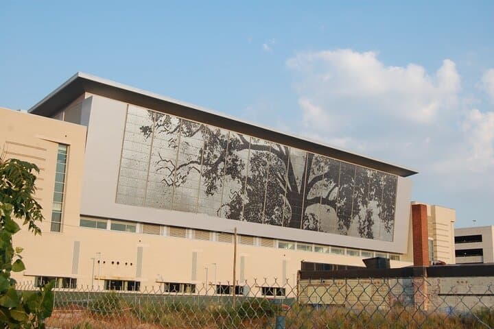
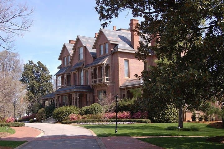
The loop around the Capitol is compact but rich. Raleigh was laid out as North Carolina’s planned capital in the 1790s; the State Capitol building that anchors this hunt dates to the mid-19th century and carries civic stories in its brick and limestone. Nearby Shaw University’s Estey Hall and the Executive Mansion add social and architectural layers: post-Civil War education, gubernatorial history and a walkable grid that tells the city’s growth from a government town to a lively downtown.
Geologically the area sits on the Coastal Plain—gentle slopes, red clays and broad river plains a few miles away—so expect flat walking and predictable footing. Culture here is civic and collegiate: public art, small museums and food trucks punctuate blocks between monuments.
Practically, the hunt runs about two hours and covers roughly 1.5–2 miles on paved sidewalks with minimal elevation. Download the Let’s Roam app, charge your phone, and allow location access. Wear comfortable walking shoes and bring water; downtown has plenty of stops for coffee or a late snack if you want to stretch the tour into an afternoon of exploration.
The scavenger format rewards curiosity—observe plaques, read inscriptions and let the city surprise you.
moderate.
2 hours.
Moderately fit: you should be comfortable walking 1.5–2 miles and standing for short periods.
No reservation is required; scavenger hunts are app-led and can start whenever you're ready within business hours.
Yes—routes are stroller-accessible and family-friendly, though some clues may require reading or adult assistance.
The standard route is about 2 hours and roughly 1.5–2 miles on mostly flat, paved sidewalks.
Follow the Let’s Roam app redemption steps, ensure you’re on a mobile device, and contact Let’s Roam support with your TripAdvisor order number if problems persist.
Raleigh was planned as North Carolina’s capital in the 1790s; the State Capitol building that anchors this route was completed in the mid-19th century and reflects the city’s civic origins.
Stick to sidewalks and public paths, dispose of trash at city bins, and support local preservation efforts—downtown historic districts rely on respectful tourism and maintenance.
Let's Roam operates guided outdoor trips and adventures with an emphasis on safety, stewardship, and memorable experiences.

You step off South Salisbury and the city opens like a map: broad streets, the State Capitol’s pale stone columns ahead, and café tables spilling onto the sidewalk. The Let’s Roam app becomes your guidebook and scorekeeper as teams fan out—searching façades, interpreting plaques, and framing playful, scored photos against stately landmarks.
You step off South Salisbury and the city opens like a map: broad streets, the State Capitol’s pale stone columns ahead, and café tables spilling onto the sidewalk. The Let’s Roam app becomes your guidebook and scorekeeper as teams fan out—searching façades, interpreting plaques, and framing playful, scored photos against stately landmarks.
The loop around the Capitol is compact but rich. Raleigh was laid out as North Carolina’s planned capital in the 1790s; the State Capitol building that anchors this hunt dates to the mid-19th century and carries civic stories in its brick and limestone. Nearby Shaw University’s Estey Hall and the Executive Mansion add social and architectural layers: post-Civil War education, gubernatorial history and a walkable grid that tells the city’s growth from a government town to a lively downtown.
Geologically the area sits on the Coastal Plain—gentle slopes, red clays and broad river plains a few miles away—so expect flat walking and predictable footing. Culture here is civic and collegiate: public art, small museums and food trucks punctuate blocks between monuments.
Practically, the hunt runs about two hours and covers roughly 1.5–2 miles on paved sidewalks with minimal elevation. Download the Let’s Roam app, charge your phone, and allow location access. Wear comfortable walking shoes and bring water; downtown has plenty of stops for coffee or a late snack if you want to stretch the tour into an afternoon of exploration.
The scavenger format rewards curiosity—observe plaques, read inscriptions and let the city surprise you.