THE ADVENTURE COLLECTIVE® · Independent discovery and booking for outdoor travel

A high‑altitude day trek from Cusco to Vinicunca (Rainbow Mountain) that combines vivid mineral-striped ridgelines with a buffet lunch in Cusipata. Expect long drives, thin air and dramatic views — plan to acclimatize first.
A high‑altitude day trek from Cusco to Vinicunca (Rainbow Mountain) that combines vivid mineral-striped ridgelines with a buffet lunch in Cusipata. Expect long drives, thin air and dramatic views — plan to acclimatize first.
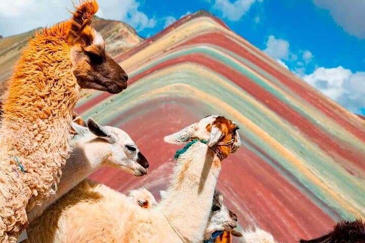
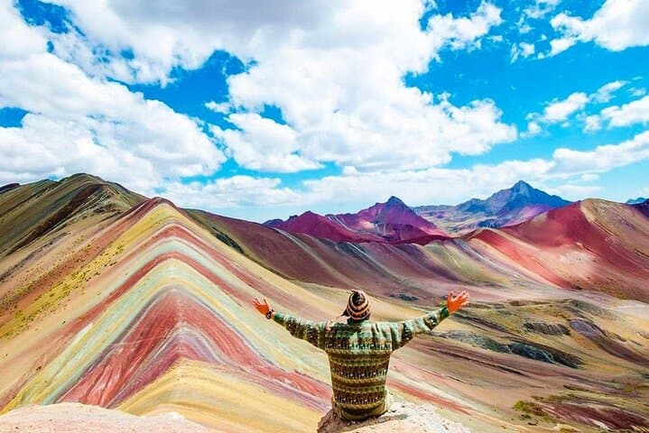
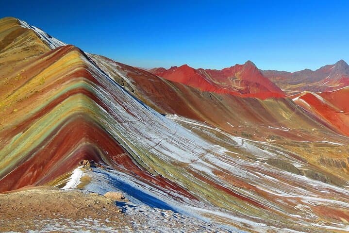
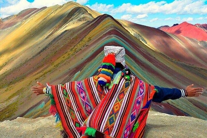
Dawn breaks over the high Andes as your minivan slips south from Cusco and the road begins to climb. By the time you unload at the trailhead the air is thin and clear; the path rises through puna grass and stone cairns, each step bringing a sharper view of the surrounding ridges. After roughly two hours of steady uphill you arrive at the sweep of color that gives the place its name — ochres, rusts, and minty bands peeling across a high crest.
Verified experiences and guided adventures in the surrounding area.
Operated by Machupicchu Adventour · Cusco, Cusco
Dawn breaks over the high Andes as your minivan slips south from Cusco and the road begins to climb. By the time you unload at the trailhead the air is thin and clear; the path rises through puna grass and stone cairns, each step bringing a sharper view of the surrounding ridges. After roughly two hours of steady uphill you arrive at the sweep of color that gives the place its name — ochres, rusts, and minty bands peeling across a high crest.
Geology here is obvious: iron, copper, and other mineral deposits compressed and exposed by glacial and erosional forces. The stripes are recent in tourist fame but ancient in formation, framed by peaks tied to the Austangate massif and a landscape long inhabited by Quechua shepherding communities. The route also crosses Red Valley, a quieter stretch where the ground itself seems to push color toward the horizon.
Practicalities matter at 5,000 meters. The summit sits at about 5,020 m (16,460 ft); expect roughly 400–600 m (1,300–2,000 ft) of elevation gain from the parking area and 4–6 km round-trip on uneven, rocky trail. Tours usually include pickup from Cusco, breakfast, oxygen and trekking poles, and a buffet lunch in Cusipata on the return.
Plan on at least one full day for the trip and 24–48 hours of acclimatization in Cusco. Dress in layers, carry strong sun protection and 1–2 liters of water, and move deliberately uphill — altitude, not distance, is the challenge. Respect trail closures, follow your guide, and leave no trace; the mountain’s bright face is fragile and easy to erode.
challenging.
11–12 hours.
Good cardiovascular fitness recommended and ability to hike uphill at high altitude; prior acclimatization strongly advised
The main viewpoint sits around 5,020 m (16,460 ft). The trail from the parking area involves 400–600 m of ascent over 1–2 hours; the distance is moderate but the altitude makes it challenging.
Some operators include the local access fee but many collect it at the site; confirm with your tour operator and bring small cash in Peruvian soles just in case.
Basic toilets are available at the parking/start area and sometimes at viewpoints; expect pay-per-use and limited supplies, so bring hand sanitizer and toilet paper.
Travelers with serious heart, respiratory, or spinal conditions, or pregnant travelers, should avoid this trip; those with moderate fitness who acclimatize can usually complete the hike.
The colored bands are sedimentary and mineral layers exposed by uplift and erosion; the region is part of long-standing Quechua grazing territory tied to the Ausangate range.
High visitor numbers accelerate trail erosion and litter; follow marked trails, carry out trash, and support local guides and community initiatives.
Machupicchu Adventour operates guided outdoor trips and adventures with an emphasis on safety, stewardship, and memorable experiences.
Dawn breaks over the high Andes as your minivan slips south from Cusco and the road begins to climb. By the time you unload at the trailhead the air is thin and clear; the path rises through puna grass and stone cairns, each step bringing a sharper view of the surrounding ridges. After roughly two hours of steady uphill you arrive at the sweep of color that gives the place its name — ochres, rusts, and minty bands peeling across a high crest.
Dawn breaks over the high Andes as your minivan slips south from Cusco and the road begins to climb. By the time you unload at the trailhead the air is thin and clear; the path rises through puna grass and stone cairns, each step bringing a sharper view of the surrounding ridges. After roughly two hours of steady uphill you arrive at the sweep of color that gives the place its name — ochres, rusts, and minty bands peeling across a high crest.
Geology here is obvious: iron, copper, and other mineral deposits compressed and exposed by glacial and erosional forces. The stripes are recent in tourist fame but ancient in formation, framed by peaks tied to the Austangate massif and a landscape long inhabited by Quechua shepherding communities. The route also crosses Red Valley, a quieter stretch where the ground itself seems to push color toward the horizon.
Practicalities matter at 5,000 meters. The summit sits at about 5,020 m (16,460 ft); expect roughly 400–600 m (1,300–2,000 ft) of elevation gain from the parking area and 4–6 km round-trip on uneven, rocky trail. Tours usually include pickup from Cusco, breakfast, oxygen and trekking poles, and a buffet lunch in Cusipata on the return.
Plan on at least one full day for the trip and 24–48 hours of acclimatization in Cusco. Dress in layers, carry strong sun protection and 1–2 liters of water, and move deliberately uphill — altitude, not distance, is the challenge. Respect trail closures, follow your guide, and leave no trace; the mountain’s bright face is fragile and easy to erode.