THE ADVENTURE COLLECTIVE® · Independent discovery and booking for outdoor travel

A pre-dawn drive from Cusco leads to a high‑altitude hike across multicolored sandstone and Andean sheep pastures. Learn how geology and Quechua culture shape the Rainbow Mountain experience, and what practical steps you should take to enjoy it safely.
A pre-dawn drive from Cusco leads to a high‑altitude hike across multicolored sandstone and Andean sheep pastures. Learn how geology and Quechua culture shape the Rainbow Mountain experience, and what practical steps you should take to enjoy it safely.
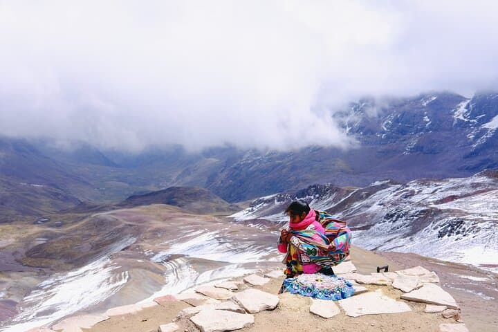
You leave Cusco before dawn, the van slicing through a cold South Valley where the first light paints the peaks above Ausangate. By the time you step out at Llacto (4,638 m), the air is thin and bright; wind tugs at your jacket and the glaciers of Ausangate watch like a quiet authority.
Verified experiences and guided adventures in the surrounding area.
Operated by Andean Road Peru · Cusco, Cusco Region
You leave Cusco before dawn, the van slicing through a cold South Valley where the first light paints the peaks above Ausangate. By the time you step out at Llacto (4,638 m), the air is thin and bright; wind tugs at your jacket and the glaciers of Ausangate watch like a quiet authority.
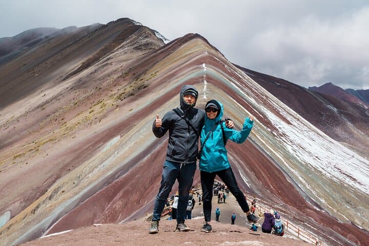
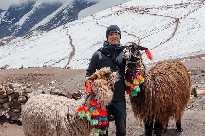
Geology hands you the headline here: iron, copper, sulphur and other minerals oxidized over millennia to stain sandstone in bands of rust, ochre, and mint—Vinicunca’s stripes are a direct readout of high‑altitude chemistry and erosion. The valley tells a longer human story: Quechua families tend alpaca herds and maintain ancient terraces first shaped for irrigation centuries ago, and Ausangate remains an Apu, a mountain with spiritual significance in Andean cosmology.
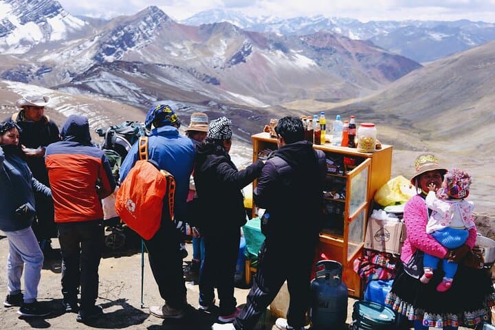
Expect a steady climb on gravel and compacted trail, with occasional steep switchbacks and panoramic breaks revealing glaciers, condor thermals and shepherds in traditional hats. The summit sits around 5,020 m; many groups reach it in roughly 1–2 hours from the trailhead depending on pace and acclimatization. Weather can flip fast—sun, sleet and wind all within an hour—so prepare accordingly.
Practical guidance: acclimate in Cusco for 48 hours if possible, pack layers, high‑SPF sun protection, 2–3 liters of water and snacks. Walk conservatively, use poles if you have them, and respect local communities—ask before photographing people. The route is fragile: stay on trail and carry out trash. If altitude symptoms appear (severe headache, confusion, vomiting), descend immediately.
challenging.
9–10 hours.
Moderate to good cardiovascular fitness recommended; must be acclimatized to high altitude.
The viewpoint is around 5,020 m (16,470 ft). Altitude can affect anyone—acclimate in Cusco, stay hydrated and descend if symptoms worsen.
From Llacto the hike to the viewpoint typically takes 1–2 hours each way depending on pace and conditions.
The dry season (May–September) offers the most reliable weather and clearer views; afternoons in the wet season can be stormy.
Yes—Quechua families maintain terraces and herd alpacas; respectful interaction is welcome and often part of the cultural experience.
The area blends pre‑Inca and Inca agricultural engineering; Ausangate is an Apu in Andean belief and has long guided local ceremonies.
The high‑altitude soils and pigmented sediments are fragile—stick to marked trails, avoid collecting rocks, and pack out all waste to protect the landscape.
Andean Road Peru operates guided outdoor trips and adventures with an emphasis on safety, stewardship, and memorable experiences.
You leave Cusco before dawn, the van slicing through a cold South Valley where the first light paints the peaks above Ausangate. By the time you step out at Llacto (4,638 m), the air is thin and bright; wind tugs at your jacket and the glaciers of Ausangate watch like a quiet authority.
You leave Cusco before dawn, the van slicing through a cold South Valley where the first light paints the peaks above Ausangate. By the time you step out at Llacto (4,638 m), the air is thin and bright; wind tugs at your jacket and the glaciers of Ausangate watch like a quiet authority.
Geology hands you the headline here: iron, copper, sulphur and other minerals oxidized over millennia to stain sandstone in bands of rust, ochre, and mint—Vinicunca’s stripes are a direct readout of high‑altitude chemistry and erosion. The valley tells a longer human story: Quechua families tend alpaca herds and maintain ancient terraces first shaped for irrigation centuries ago, and Ausangate remains an Apu, a mountain with spiritual significance in Andean cosmology.
Expect a steady climb on gravel and compacted trail, with occasional steep switchbacks and panoramic breaks revealing glaciers, condor thermals and shepherds in traditional hats. The summit sits around 5,020 m; many groups reach it in roughly 1–2 hours from the trailhead depending on pace and acclimatization. Weather can flip fast—sun, sleet and wind all within an hour—so prepare accordingly.
Practical guidance: acclimate in Cusco for 48 hours if possible, pack layers, high‑SPF sun protection, 2–3 liters of water and snacks. Walk conservatively, use poles if you have them, and respect local communities—ask before photographing people. The route is fragile: stay on trail and carry out trash. If altitude symptoms appear (severe headache, confusion, vomiting), descend immediately.