THE ADVENTURE COLLECTIVE® · Independent discovery and booking for outdoor travel

A full-day ascent to Vinicunca (Rainbow Mountain) blends high-altitude hiking with striking mineral bands and Andean culture. Expect a long day of driving, a steep high-elevation approach, and sudden mountain weather—plan layers and a slow pace.
A full-day ascent to Vinicunca (Rainbow Mountain) blends high-altitude hiking with striking mineral bands and Andean culture. Expect a long day of driving, a steep high-elevation approach, and sudden mountain weather—plan layers and a slow pace.
Dawn breaks on the high puna as minibuses thread a thin road toward Vilcanota’s higher ridgelines, the air sharp and thin enough to make every breath deliberate. By the time you step out at the Chilca trailhead (~4,300 m / 14,100 ft), the Andes have already begun to show themselves: wind-sculpted grasses, scattered alpaca, and a horizon of snow-capped peaks that seem to push the sky down.
Verified experiences and guided adventures in the surrounding area.
Operated by Valencia Travel Agency S.a.c. · Cusco, Cusco
Dawn breaks on the high puna as minibuses thread a thin road toward Vilcanota’s higher ridgelines, the air sharp and thin enough to make every breath deliberate. By the time you step out at the Chilca trailhead (~4,300 m / 14,100 ft), the Andes have already begun to show themselves: wind-sculpted grasses, scattered alpaca, and a horizon of snow-capped peaks that seem to push the sky down.
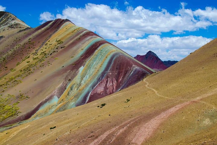
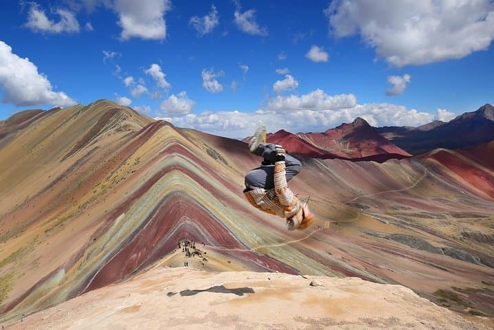
Vinicunca — commonly called Rainbow Mountain — is the exposed skin of ancient, mineral-rich sedimentary layers, tilted and worn by glaciers that once dominated these valleys. The colors you see are iron oxides, copper sulfates, and other minerals laid down over millennia, revealed as climate and erosion strip away overlying rock.
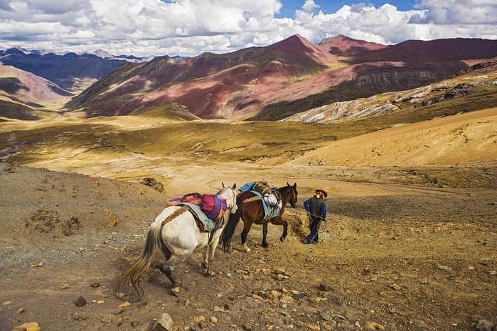
This is also Quechua country: small herding communities, stone corrals, and llamas as practical neighbors. Guides usually weave local lore into the walk, noting how Ausangate’s glaciers shaped water routes and pastoral cycles.
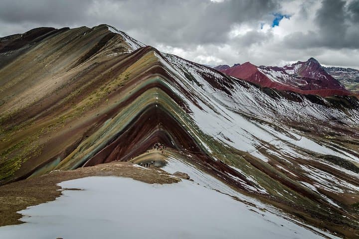
Practically, expect a long day: around 3.5 hours of high-elevation driving from Cusco, then a steep 3–4 hour roundtrip hike with significant elevation gain. Hike slowly, drink often, and use pole support on loose scree. Weather flips quickly — sun, wind and snow can appear in a single afternoon — so layers and rain protection are essential.
Plan for a pre-dawn departure, permit and park fees handled by many operators, and a steady pace uphill to protect altitude-sensitive lungs. At the ridge, take time: the striped slopes pull your gaze across geologic time while glaciers and herds continue their slow, visible work.
moderate.
10–12 hours.
Good cardiovascular fitness and experience with high-elevation day hikes; be prepared for steep climbs and thin air.
Expect about 3–4 hours roundtrip on the trail from Chilca with significant uphill sections; the combination of distance and altitude makes it moderately strenuous.
Many visitors go with organized tours for transport, guidance, and local fees; independent visits are possible but require arranging transport and acclimatization plans.
The dry season (May–September) offers the most stable weather and clear views; afternoons can still be windy, and mornings cold year-round.
Yes—Vinicunca sits above 5,000 m; acclimatize in Cusco for 48+ hours, hydrate, avoid alcohol, and descend if severe symptoms appear.
The ridges expose sedimentary layers from ancient marine and glacial cycles; local Quechua communities have grazed these highlands for centuries, guided by Ausangate’s cultural significance.
Increased visitation strains fragile high‑altitude soils and community resources; stick to trails, pack out waste, and support local guides who contribute fees to conservation and community projects.
Valencia Travel Agency S.a.c. operates guided outdoor trips and adventures with an emphasis on safety, stewardship, and memorable experiences.
Dawn breaks on the high puna as minibuses thread a thin road toward Vilcanota’s higher ridgelines, the air sharp and thin enough to make every breath deliberate. By the time you step out at the Chilca trailhead (~4,300 m / 14,100 ft), the Andes have already begun to show themselves: wind-sculpted grasses, scattered alpaca, and a horizon of snow-capped peaks that seem to push the sky down.
Dawn breaks on the high puna as minibuses thread a thin road toward Vilcanota’s higher ridgelines, the air sharp and thin enough to make every breath deliberate. By the time you step out at the Chilca trailhead (~4,300 m / 14,100 ft), the Andes have already begun to show themselves: wind-sculpted grasses, scattered alpaca, and a horizon of snow-capped peaks that seem to push the sky down.
Vinicunca — commonly called Rainbow Mountain — is the exposed skin of ancient, mineral-rich sedimentary layers, tilted and worn by glaciers that once dominated these valleys. The colors you see are iron oxides, copper sulfates, and other minerals laid down over millennia, revealed as climate and erosion strip away overlying rock.
This is also Quechua country: small herding communities, stone corrals, and llamas as practical neighbors. Guides usually weave local lore into the walk, noting how Ausangate’s glaciers shaped water routes and pastoral cycles.
Practically, expect a long day: around 3.5 hours of high-elevation driving from Cusco, then a steep 3–4 hour roundtrip hike with significant elevation gain. Hike slowly, drink often, and use pole support on loose scree. Weather flips quickly — sun, wind and snow can appear in a single afternoon — so layers and rain protection are essential.
Plan for a pre-dawn departure, permit and park fees handled by many operators, and a steady pace uphill to protect altitude-sensitive lungs. At the ridge, take time: the striped slopes pull your gaze across geologic time while glaciers and herds continue their slow, visible work.