THE ADVENTURE COLLECTIVE® · Independent discovery and booking for outdoor travel

A compact multi-day trek that links Cotopaxi’s high-altitude vistas with the green, dramatic Toachi Canyon. Expect steep descents, village hospitality and 4–5 hour hiking days across volcanic landscapes.
A compact multi-day trek that links Cotopaxi’s high-altitude vistas with the green, dramatic Toachi Canyon. Expect steep descents, village hospitality and 4–5 hour hiking days across volcanic landscapes.
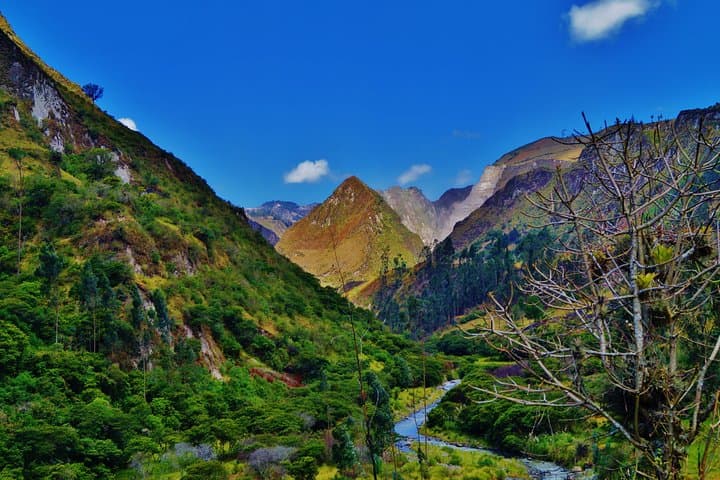
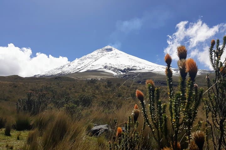
You step off the rim and the crater seems to lean toward you—Quilotoa’s jewel-toned lake daring you down its steep switchbacks. The first day’s high passes and Cotopaxi’s glacier-lit cone linger in the mind as the trail drops into farming terraces, puna grasslands and the quieter, greener corridors that lead to Toachi Canyon.
Verified experiences and guided adventures in the surrounding area.
Operated by Ecuador Local Guide · Quilotoa, Cotopaxi
You step off the rim and the crater seems to lean toward you—Quilotoa’s jewel-toned lake daring you down its steep switchbacks. The first day’s high passes and Cotopaxi’s glacier-lit cone linger in the mind as the trail drops into farming terraces, puna grasslands and the quieter, greener corridors that lead to Toachi Canyon.
This route threads together two of Ecuador’s most distinct landscapes: the volcanic highlands dominated by Cotopaxi (5,897 m) and the carved valleys of the Toachi watershed. The Quilotoa Loop has long connected indigenous highland villages—Zumbahua, Quilotoa, Chugchilan and Isinlivi—so hikers encounter active agricultural life, stone corrals, and markets running on local rhythms as much as they see geological history: volcanic craters, pumice soils and deep river incision.
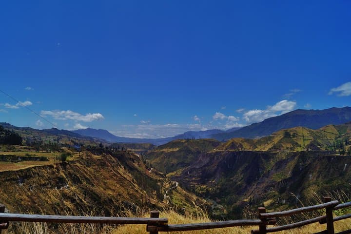
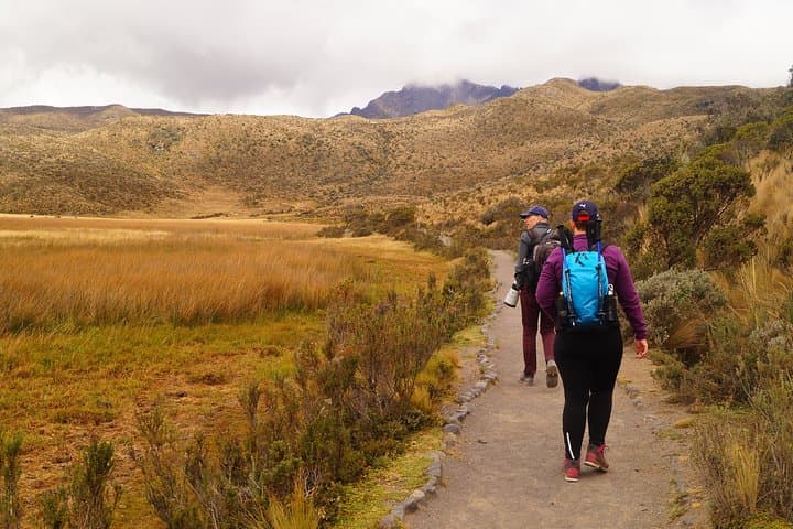
Expect dirt roads, single-track trail shortcuts and steady elevation changes; daily hiking is typically 4–5 hours, with day distances of roughly 10–12 km and descents from rim heights (~3,900–4,600 m near Cotopaxi) down toward valley levels (around 2,400–3,200 m). The terrain alternates rocky crater steps, grassy slopes and narrow canyon shelves with exposed viewpoints.
Practical edge: acclimatize in Quito, carry layers for fast weather swings, and use trekking poles for the steep descents. Water treatment, sun protection and a steady pace keep energy for villages and viewpoints. Local guides provide cultural context and route safety—book private transport between trailheads if you prefer less logistics stress. The hike rewards with close-up volcano views, river canyons that feel alive, and evenings in simple hostel accommodations with local meals.
moderate.
3 days (active hiking 4–5 hours/day).
Moderate fitness—able to hike 10–12 km with sustained elevation loss/gain and high-altitude breathing challenges.
You start near 3,800–4,600 m on day one and descend to valley levels; moderate acclimatization and a conservative pace reduce acute symptoms—talk to your guide if you have concerns.
Cotopaxi National Park and Quilotoa viewpoints may have small entrance fees; your guide or operator usually handles admissions as part of the tour.
This private trip includes simple hostels or mountain lodges (double rooms) in Quilotoa and Chugchilan with meals as listed—expect basic, clean lodging run by local hosts.
Yes, but weather varies: dry season (June–September) tends to have clearer skies; rainy season brings afternoon showers and muddier trails—plan clothing accordingly.
The loop follows centuries-old mule and footpaths linking indigenous agricultural communities; volcanic eruptions and ash layers shaped local soils and settlement patterns.
Stay on established trails and avoid disturbing terraces—erosion is a concern on steep descents. Choosing local guides and hostels supports the small highland economies and reduces informal camping pressure.
Ecuador Local Guide operates guided outdoor trips and adventures with an emphasis on safety, stewardship, and memorable experiences.
You step off the rim and the crater seems to lean toward you—Quilotoa’s jewel-toned lake daring you down its steep switchbacks. The first day’s high passes and Cotopaxi’s glacier-lit cone linger in the mind as the trail drops into farming terraces, puna grasslands and the quieter, greener corridors that lead to Toachi Canyon.
You step off the rim and the crater seems to lean toward you—Quilotoa’s jewel-toned lake daring you down its steep switchbacks. The first day’s high passes and Cotopaxi’s glacier-lit cone linger in the mind as the trail drops into farming terraces, puna grasslands and the quieter, greener corridors that lead to Toachi Canyon.
This route threads together two of Ecuador’s most distinct landscapes: the volcanic highlands dominated by Cotopaxi (5,897 m) and the carved valleys of the Toachi watershed. The Quilotoa Loop has long connected indigenous highland villages—Zumbahua, Quilotoa, Chugchilan and Isinlivi—so hikers encounter active agricultural life, stone corrals, and markets running on local rhythms as much as they see geological history: volcanic craters, pumice soils and deep river incision.
Expect dirt roads, single-track trail shortcuts and steady elevation changes; daily hiking is typically 4–5 hours, with day distances of roughly 10–12 km and descents from rim heights (~3,900–4,600 m near Cotopaxi) down toward valley levels (around 2,400–3,200 m). The terrain alternates rocky crater steps, grassy slopes and narrow canyon shelves with exposed viewpoints.
Practical edge: acclimatize in Quito, carry layers for fast weather swings, and use trekking poles for the steep descents. Water treatment, sun protection and a steady pace keep energy for villages and viewpoints. Local guides provide cultural context and route safety—book private transport between trailheads if you prefer less logistics stress. The hike rewards with close-up volcano views, river canyons that feel alive, and evenings in simple hostel accommodations with local meals.