THE ADVENTURE COLLECTIVE® · Independent discovery and booking for outdoor travel

Descend into a volcanic caldera and circle a vivid turquoise lagoon on this full-day hike from Quito. Expect high-altitude skies, steep descents, Andean market stops and a demanding climb back to the rim.
Descend into a volcanic caldera and circle a vivid turquoise lagoon on this full-day hike from Quito. Expect high-altitude skies, steep descents, Andean market stops and a demanding climb back to the rim.
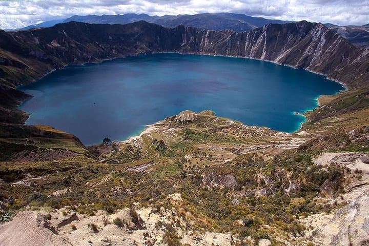
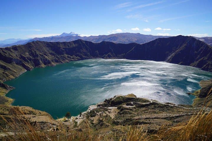
A wind-driven rim frames the first view: a bowl of deep turquoise cupped by steep volcanic walls, and the Panamerican corridor dropping away toward remote Andean villages. You arrive on a high plain where air is thin and bright, and the lake below seems to hold its color like a secret.
Verified experiences and guided adventures in the surrounding area.
Operated by Galapagos Tours Nature Galapagos & Ecuador · Quilotoa, Cotopaxi
A wind-driven rim frames the first view: a bowl of deep turquoise cupped by steep volcanic walls, and the Panamerican corridor dropping away toward remote Andean villages. You arrive on a high plain where air is thin and bright, and the lake below seems to hold its color like a secret.
Quilotoa is a collapsed volcanic caldera shaped by a violent eruption centuries ago; its mineral-rich waters reflect the sky and trace the lake’s volcanic origin. The route from Quito follows the Avenue of the Volcanoes—views of jagged cones and cultivated highland fields—and passes through market towns such as Saquisilí, Zumbahua and Pujilí where indigenous farmers trade, and Tigua where painters work with local pigments.
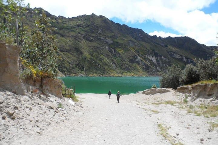
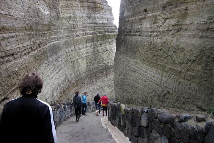
The hike itself is straightforward but physically honest: a steep descent from the rim to the shoreline across loose, volcanic scree, then a demanding climb back that tests lungs at roughly 3,800 meters above sea level. Local culture is present in adobe houses, ponchos, and small markets selling handcrafted goods—an immediate reminder that this landscape supports communities as much as it awes visitors.
Practical notes: acclimatize in Quito at least 24–48 hours, bring layered warm and waterproof clothing, and pack water and snacks. Entrance fees to the crater rim are typically paid locally and optional extras such as mule rides or kayak rentals are not included. Stay on marked paths to protect fragile high-altitude grasslands; avoid swimming—the water’s chemistry and conservation concerns make it inadvisable. Expect variable weather and plan for an 8-hour day with several hours hiking and long drives.
moderate.
6–8 hours (including transport).
Moderately fit: comfortable with steep downhill and a hard ascent at high altitude; cardiovascular fitness helps.
No, the crater entrance fee is typically paid on-site and is not included in the marketed price.
Swimming is not recommended due to the lake’s mineral content and conservation policies, and it’s generally discouraged by local guides.
The hike is technically easy but physically demanding because you start around 3,800 m; expect breathlessness on the ascent and allow time to rest.
Yes, mules or horses are often offered at the crater rim for an extra fee, but availability and safety standards vary—confirm before you rely on them.
The Quilotoa basin is a volcanic caldera formed by a major explosive eruption centuries ago; the surrounding communities have long farmed the highland páramo.
The high-altitude páramo is fragile—stay on trails, avoid introducing pollutants, and support local guides and community initiatives when possible.
Galapagos Tours Nature Galapagos & Ecuador operates guided outdoor trips and adventures with an emphasis on safety, stewardship, and memorable experiences.
A wind-driven rim frames the first view: a bowl of deep turquoise cupped by steep volcanic walls, and the Panamerican corridor dropping away toward remote Andean villages. You arrive on a high plain where air is thin and bright, and the lake below seems to hold its color like a secret.
A wind-driven rim frames the first view: a bowl of deep turquoise cupped by steep volcanic walls, and the Panamerican corridor dropping away toward remote Andean villages. You arrive on a high plain where air is thin and bright, and the lake below seems to hold its color like a secret.
Quilotoa is a collapsed volcanic caldera shaped by a violent eruption centuries ago; its mineral-rich waters reflect the sky and trace the lake’s volcanic origin. The route from Quito follows the Avenue of the Volcanoes—views of jagged cones and cultivated highland fields—and passes through market towns such as Saquisilí, Zumbahua and Pujilí where indigenous farmers trade, and Tigua where painters work with local pigments.
The hike itself is straightforward but physically honest: a steep descent from the rim to the shoreline across loose, volcanic scree, then a demanding climb back that tests lungs at roughly 3,800 meters above sea level. Local culture is present in adobe houses, ponchos, and small markets selling handcrafted goods—an immediate reminder that this landscape supports communities as much as it awes visitors.
Practical notes: acclimatize in Quito at least 24–48 hours, bring layered warm and waterproof clothing, and pack water and snacks. Entrance fees to the crater rim are typically paid locally and optional extras such as mule rides or kayak rentals are not included. Stay on marked paths to protect fragile high-altitude grasslands; avoid swimming—the water’s chemistry and conservation concerns make it inadvisable. Expect variable weather and plan for an 8-hour day with several hours hiking and long drives.