THE ADVENTURE COLLECTIVE® · Independent discovery and booking for outdoor travel

A digital, interactive map that unlocks 500+ curated beaches, rivers, viewpoints, and cultural spots across Puerto Rico. Use it to plan self-driven days of swimming, hiking, and roadside feasts—with tips and lifetime updates.
A digital, interactive map that unlocks 500+ curated beaches, rivers, viewpoints, and cultural spots across Puerto Rico. Use it to plan self-driven days of swimming, hiking, and roadside feasts—with tips and lifetime updates.
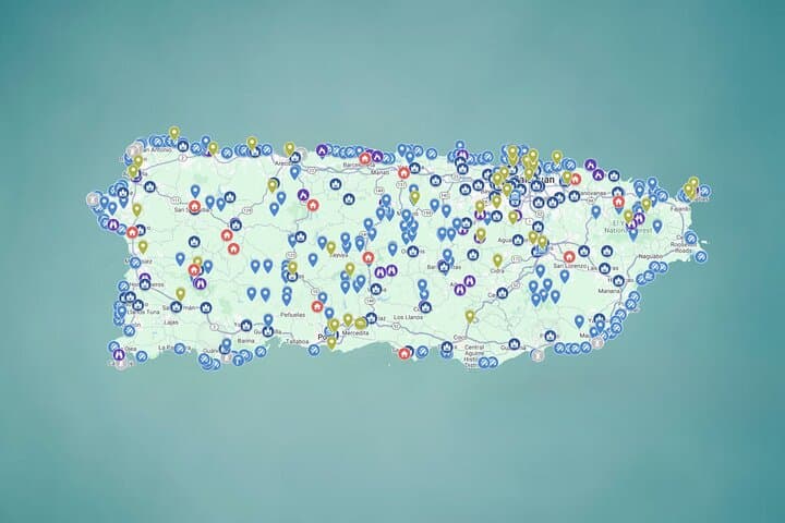
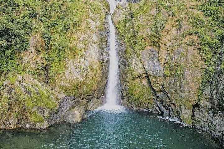
The map opens like a promise: a grid of pins across an island where the Atlantic and Caribbean trade light on limestone cliffs and rainforest canopy. Tap a pin and the road ahead rearranges itself — a coastal lane toward a narrow crescent of sand, a switchback into misted mountains, a roadside pool that glints like a secret. This is self-directed exploration at scale: no guide, no schedule, only choices.
Verified experiences and guided adventures in the surrounding area.
Operated by El Yunque Tours - The most AMAZING adventure in Puerto Rico (Private tour / transportation included) · San Juan, Puerto Rico
The map opens like a promise: a grid of pins across an island where the Atlantic and Caribbean trade light on limestone cliffs and rainforest canopy. Tap a pin and the road ahead rearranges itself — a coastal lane toward a narrow crescent of sand, a switchback into misted mountains, a roadside pool that glints like a secret. This is self-directed exploration at scale: no guide, no schedule, only choices.
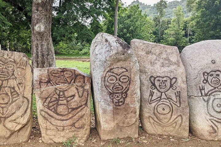
Puerto Rico’s landscape is an active script of geology and history. Volcanic and sedimentary layers uplifted over millions of years form karst north coasts and steep central ranges; rivers carve deep gorges and feed the island’s famous natural pools. Colonial plazas and Spanish forts mark centuries of trade and conflict, while Taíno place names still map the island’s original stewards. Local culture is equal parts music, food, and welcome — roadside kiosks sell fritters and coffee that feel like invitations to slow down.
Practically, this map is a curated toolkit: 500+ points spanning beaches, waterfalls, viewpoints, historic sites, and food stops. Expect a mix of paved roads and gravel turnoffs, short hikes to viewpoints, and remote river access that can be dangerous after rain. Navigation is via Google Maps pins, so cellular service and a charged phone are essential. Plan days by region—east for El Yunque and coastal bays, southwest for quieter beaches, central for mountain lookouts—allowing time for detours, swims, and spontaneous meals.
Bring water, sun protection, and respect: these places stay special if visitors leave them intact. Check weather, especially before river visits, and enjoy the freedom of exploring an island that rewards curiosity.
moderate.
Self-paced; multi-day.
Moderate fitness recommended — able to handle short hikes, stairs, and occasional uneven terrain
No — this product is an interactive Google Map with 500+ curated locations for self-guided exploration; no guide or scheduled itinerary is included.
You receive instant, lifetime access to a Google Map link and can open pins directly in Google Maps on your phone for navigation.
Many sites are safe only in dry weather; heavy rain raises water levels and creates dangerous currents, so always check forecasts and local conditions before visiting rivers.
Yes — a rental car is recommended to reach dispersed sites; some locations require driving on secondary or unpaved roads.
Puerto Rico’s landmarks reflect Taíno heritage and centuries of Spanish colonial presence; forts and plazas in old towns received trade ships and military fleets for generations.
Visitors should follow leave-no-trace principles, avoid trampling fragile coastal vegetation, and refrain from entering rivers after rain to protect both safety and local ecosystems.
El Yunque Tours - The most AMAZING adventure in Puerto Rico (Private tour / transportation included) operates guided outdoor trips and adventures with an emphasis on safety, stewardship, and memorable experiences.
The map opens like a promise: a grid of pins across an island where the Atlantic and Caribbean trade light on limestone cliffs and rainforest canopy. Tap a pin and the road ahead rearranges itself — a coastal lane toward a narrow crescent of sand, a switchback into misted mountains, a roadside pool that glints like a secret. This is self-directed exploration at scale: no guide, no schedule, only choices.
The map opens like a promise: a grid of pins across an island where the Atlantic and Caribbean trade light on limestone cliffs and rainforest canopy. Tap a pin and the road ahead rearranges itself — a coastal lane toward a narrow crescent of sand, a switchback into misted mountains, a roadside pool that glints like a secret. This is self-directed exploration at scale: no guide, no schedule, only choices.
Puerto Rico’s landscape is an active script of geology and history. Volcanic and sedimentary layers uplifted over millions of years form karst north coasts and steep central ranges; rivers carve deep gorges and feed the island’s famous natural pools. Colonial plazas and Spanish forts mark centuries of trade and conflict, while Taíno place names still map the island’s original stewards. Local culture is equal parts music, food, and welcome — roadside kiosks sell fritters and coffee that feel like invitations to slow down.
Practically, this map is a curated toolkit: 500+ points spanning beaches, waterfalls, viewpoints, historic sites, and food stops. Expect a mix of paved roads and gravel turnoffs, short hikes to viewpoints, and remote river access that can be dangerous after rain. Navigation is via Google Maps pins, so cellular service and a charged phone are essential. Plan days by region—east for El Yunque and coastal bays, southwest for quieter beaches, central for mountain lookouts—allowing time for detours, swims, and spontaneous meals.
Bring water, sun protection, and respect: these places stay special if visitors leave them intact. Check weather, especially before river visits, and enjoy the freedom of exploring an island that rewards curiosity.