THE ADVENTURE COLLECTIVE® · Independent discovery and booking for outdoor travel

A focused two-day private ascent of Jbel Toubkal from Imlil—high-altitude hiking across granite ridges, a night in the refuge, and sunrise from North Africa’s highest peak. Plan for boulder fields, early starts, and strong views.
A focused two-day private ascent of Jbel Toubkal from Imlil—high-altitude hiking across granite ridges, a night in the refuge, and sunrise from North Africa’s highest peak. Plan for boulder fields, early starts, and strong views.
You leave Marrakech before dawn, the city’s heat thinning behind you as the road carves into the High Atlas. By midmorning the valley opens—terraced fields, mule tracks and flat-roofed stone houses—until Imlil sits below like a last outpost before the rocks. The approach climbs steadily; the refuge at 3,207 m perches beneath a jumble of granite, and the summit of Jbel Toubkal (4,167 m) waits like a blunt, wind-scoured crown.
Verified experiences and guided adventures in the surrounding area.
Operated by Morocco Tours Services · Imlil, Marrakesh-Safi
You leave Marrakech before dawn, the city’s heat thinning behind you as the road carves into the High Atlas. By midmorning the valley opens—terraced fields, mule tracks and flat-roofed stone houses—until Imlil sits below like a last outpost before the rocks. The approach climbs steadily; the refuge at 3,207 m perches beneath a jumble of granite, and the summit of Jbel Toubkal (4,167 m) waits like a blunt, wind-scoured crown.
Geologically the High Atlas is a young, jagged range born of the African–Eurasian collision; its peaks are mostly granite and metamorphic rock, scoured into steep cols and boulder fields. Culturally the route runs through Amazigh (Berber) farming villages—seasonal markets, walnut and cherry orchards—and stops at the small shrine of Sidi Chamharouch, a local pilgrim spot that marks the high valley’s human presence.
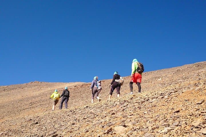
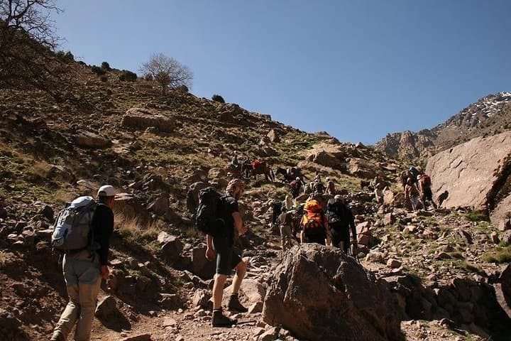
Expect early starts and alpine weather that can flip from sun to wind-driven snow. The summit day is a strenuous, route-finding ascent across scree and large blocks rather than technical climbing; altitude makes otherwise easy steps feel hard. Local muleteers, mountain guides and a basic refuge reduce logistical load and are standard here.
Practical guidance: acclimatize in Imlil if you can, carry layers, reinforced hiking boots and poles for the boulder sections, and pack water and high-calorie snacks. Start the summit push pre-dawn to avoid afternoon wind and to catch the expansive views—north over the Marrakech plain, south toward the Anti-Atlas and Sahara. Respect fragile alpine vegetation, follow your guide’s pace, and be prepared to turn back if weather or altitude dictates.
challenging.
2 days (approx. 9–10 hours hiking on summit day).
Good aerobic fitness and experience with sustained uphill hiking; ability to handle long days with packs.
A guide is strongly recommended for safety, logistics and local knowledge; there is no formal summit permit system, but organized groups and guides are standard and support local communities.
The route is non-technical but strenuous—altitude makes the final ascent demanding; prior high-elevation hiking or at least conservative acclimatization is advised.
Overnight is typically in a mountain refuge with basic dormitory-style sleeping; bedding varies so bring a warm liner and earplugs.
Weather is variable—warm sun in the valley and strong wind or snow near the summit; layer clothing, carry waterproofs, and be ready for rapid changes.
Toubkal sits in traditional Amazigh lands; local villages have long supported muleteers and mountain guides who link high pastures to Marrakech markets.
Alpine soils and vegetation are fragile—stick to established tracks, carry out waste, and use local guides to minimize impact.
Morocco Tours Services operates guided outdoor trips and adventures with an emphasis on safety, stewardship, and memorable experiences.

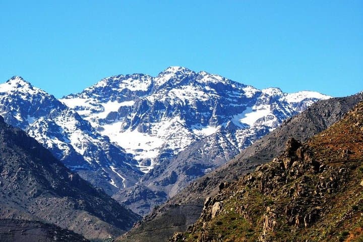
You leave Marrakech before dawn, the city’s heat thinning behind you as the road carves into the High Atlas. By midmorning the valley opens—terraced fields, mule tracks and flat-roofed stone houses—until Imlil sits below like a last outpost before the rocks. The approach climbs steadily; the refuge at 3,207 m perches beneath a jumble of granite, and the summit of Jbel Toubkal (4,167 m) waits like a blunt, wind-scoured crown.
You leave Marrakech before dawn, the city’s heat thinning behind you as the road carves into the High Atlas. By midmorning the valley opens—terraced fields, mule tracks and flat-roofed stone houses—until Imlil sits below like a last outpost before the rocks. The approach climbs steadily; the refuge at 3,207 m perches beneath a jumble of granite, and the summit of Jbel Toubkal (4,167 m) waits like a blunt, wind-scoured crown.
Geologically the High Atlas is a young, jagged range born of the African–Eurasian collision; its peaks are mostly granite and metamorphic rock, scoured into steep cols and boulder fields. Culturally the route runs through Amazigh (Berber) farming villages—seasonal markets, walnut and cherry orchards—and stops at the small shrine of Sidi Chamharouch, a local pilgrim spot that marks the high valley’s human presence.
Expect early starts and alpine weather that can flip from sun to wind-driven snow. The summit day is a strenuous, route-finding ascent across scree and large blocks rather than technical climbing; altitude makes otherwise easy steps feel hard. Local muleteers, mountain guides and a basic refuge reduce logistical load and are standard here.
Practical guidance: acclimatize in Imlil if you can, carry layers, reinforced hiking boots and poles for the boulder sections, and pack water and high-calorie snacks. Start the summit push pre-dawn to avoid afternoon wind and to catch the expansive views—north over the Marrakech plain, south toward the Anti-Atlas and Sahara. Respect fragile alpine vegetation, follow your guide’s pace, and be prepared to turn back if weather or altitude dictates.