THE ADVENTURE COLLECTIVE® · Independent discovery and booking for outdoor travel

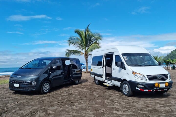
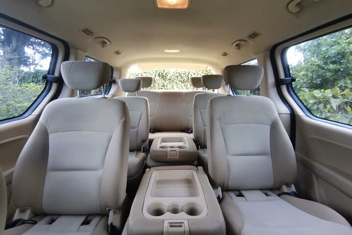
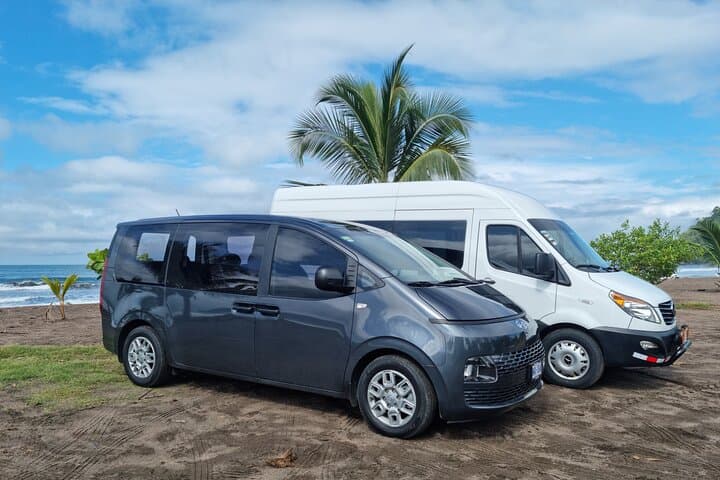
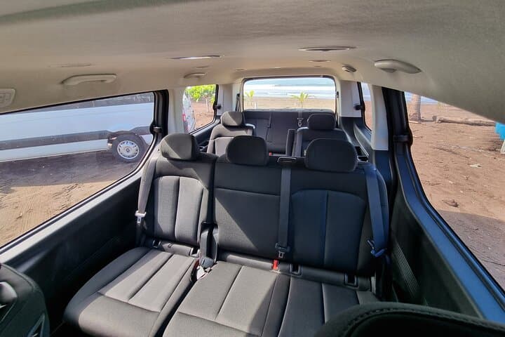
A private, door-to-door transfer between SJO (San José) and Manuel Antonio/Quepos with flight tracking and a possible Crocodile Bridge stop. Comfortable vehicles, bilingual drivers, and complimentary drinks make this a reliable coastal transfer.
A private, door-to-door transfer between SJO (San José) and Manuel Antonio/Quepos with flight tracking and a possible Crocodile Bridge stop. Comfortable vehicles, bilingual drivers, and complimentary drinks make this a reliable coastal transfer.
The engine hums and the Pacific coast creeps into view through a smear of humidity on the window as you leave San José’s central valley behind. In three hours you descend from the airport’s high plateau toward sea level, through volcanic soils and a stretch of highway where the Tárcoles River dares you to look — and where crocodiles often wait at the Crocodile Bridge.
Verified experiences and guided adventures in the surrounding area.
Operated by TicoWay · Quepos, Puntarenas Province
The engine hums and the Pacific coast creeps into view through a smear of humidity on the window as you leave San José’s central valley behind. In three hours you descend from the airport’s high plateau toward sea level, through volcanic soils and a stretch of highway where the Tárcoles River dares you to look — and where crocodiles often wait at the Crocodile Bridge.
This route threads Costa Rica’s geography: the Central Valley’s weathered volcanic ridges give way to the drier coastal plain of Puntarenas. The Inter-American Highway here has driven commerce and tourism for decades, opening access to fishing towns like Quepos and the compact national park at Manuel Antonio, created in the 1970s to protect coastal rainforest and beaches.
Drivers are usually bilingual and familiar with local rhythms—coffee-growing slopes, roadside sodas, and seasonal traffic surges during holidays. Expect a paved route with mountain passes and coastal views; elevation drops roughly 900–1,100 meters between SJO and Manuel Antonio, depending on your starting point.
Practical guidance: allow about three hours for the transfer (distance ~160–170 km), confirm flight tracking so your driver adjusts pickup, and note the included Crocodile Bridge stop is daylight- and weather-dependent. Vehicles are air-conditioned, offer bottled water and local drinks, and can accommodate infant seats and service animals when requested. Bring a camera, light layers for changing temperatures between the valley and the coast, and be ready for quick stops at viewpoints or roadside eateries. This trip is straightforward, efficient, and a good first impression of Costa Rica’s shifting landscapes.
easy.
3 hours.
No special fitness required; suitable for travelers of all physical levels.
No—the driver will stop at the Tárcoles viewpoint when daylight and weather permit; nighttime or adverse conditions may prevent the stop.
Yes—drivers track flights and adjust pickup times to accommodate delays or early arrivals.
Specialized infant and child seats are available upon request; indicate this during booking.
Service animals are allowed; check with the operator about other pets and any size or containment rules.
The coastal road linking San José to Puntarenas and Quepos opened communities to tourism and trade; Manuel Antonio became protected in the 1970s to preserve its coastal rainforest.
Tourism pressures are concentrated on fragile coastal and mangrove habitats—avoid feeding wildlife, stick to designated viewpoints, and support operators who follow local park rules.
TicoWay operates guided outdoor trips and adventures with an emphasis on safety, stewardship, and memorable experiences.
The engine hums and the Pacific coast creeps into view through a smear of humidity on the window as you leave San José’s central valley behind. In three hours you descend from the airport’s high plateau toward sea level, through volcanic soils and a stretch of highway where the Tárcoles River dares you to look — and where crocodiles often wait at the Crocodile Bridge.
The engine hums and the Pacific coast creeps into view through a smear of humidity on the window as you leave San José’s central valley behind. In three hours you descend from the airport’s high plateau toward sea level, through volcanic soils and a stretch of highway where the Tárcoles River dares you to look — and where crocodiles often wait at the Crocodile Bridge.
This route threads Costa Rica’s geography: the Central Valley’s weathered volcanic ridges give way to the drier coastal plain of Puntarenas. The Inter-American Highway here has driven commerce and tourism for decades, opening access to fishing towns like Quepos and the compact national park at Manuel Antonio, created in the 1970s to protect coastal rainforest and beaches.
Drivers are usually bilingual and familiar with local rhythms—coffee-growing slopes, roadside sodas, and seasonal traffic surges during holidays. Expect a paved route with mountain passes and coastal views; elevation drops roughly 900–1,100 meters between SJO and Manuel Antonio, depending on your starting point.
Practical guidance: allow about three hours for the transfer (distance ~160–170 km), confirm flight tracking so your driver adjusts pickup, and note the included Crocodile Bridge stop is daylight- and weather-dependent. Vehicles are air-conditioned, offer bottled water and local drinks, and can accommodate infant seats and service animals when requested. Bring a camera, light layers for changing temperatures between the valley and the coast, and be ready for quick stops at viewpoints or roadside eateries. This trip is straightforward, efficient, and a good first impression of Costa Rica’s shifting landscapes.