THE ADVENTURE COLLECTIVE® · Independent discovery and booking for outdoor travel

A guided, roughly 15 km hike that explores Genoa’s little-known hilltop forts, including Forte Diamante and Forte Puin. Expect panoramic sea views, stony tracks and a mix of funicular and foot travel on a 5–6 hour outing.
A guided, roughly 15 km hike that explores Genoa’s little-known hilltop forts, including Forte Diamante and Forte Puin. Expect panoramic sea views, stony tracks and a mix of funicular and foot travel on a 5–6 hour outing.
You start on a narrow path leaving the city noise behind; cork oaks and chestnuts rise as the hills of Genoa take hold and the sea angles into the distance. The trail climbs and contours, the slopes daring you to look back where the harbor shrinks to a scatter of sails. Over roughly 15 km the route threads old military tracks, terraces, and woodland, arriving at the ridge that holds Fort Diamond.
Verified experiences and guided adventures in the surrounding area.
Operated by Michele Lorefice · Genoa, Liguria
You start on a narrow path leaving the city noise behind; cork oaks and chestnuts rise as the hills of Genoa take hold and the sea angles into the distance. The trail climbs and contours, the slopes daring you to look back where the harbor shrinks to a scatter of sails. Over roughly 15 km the route threads old military tracks, terraces, and woodland, arriving at the ridge that holds Fort Diamond.
These forts date to the 18th–19th centuries, part of Genoa’s ring of defensive works that followed the city wall system. Geologically the terrain is typical Ligurian Apennines—steep, folded limestone and clay soils that shed water quickly and create stony trails and panoramic outcrops. Culturally the hills have long been a working landscape of vineyards, olive terraces and small hamlets; echoes of military organization mix with rural life here.
Your guide shapes the route: a mix of funicular access and foot travel, with a close approach to Forte Diamante and views of nearby Forte Puin. Expect uneven singletrack, stone steps and some steep pitches; total ascent is moderate, with a cumulative elevation gain commonly in the 500–700 m range depending on variations.
Practical notes: the tour includes a funicular ticket, runs about 5–6 hours, and is best started in the morning to avoid heat and lingering city haze. Wear grippy shoes, carry 1.5–2 L water, layered clothing, and a small first-aid kit. Follow your guide’s instructions on fragile terraces and keep to trails to limit erosion; cell service can be intermittent on ridgelines.
moderate.
5–6 hours.
Suitable for hikers with moderate fitness who can handle sustained uphill sections and uneven terrain.
The tour runs about 5–6 hours and covers roughly 15 km with moderate climbs; it’s classified as moderate and requires steady walking on uneven terrain.
Yes—the funicular ticket is included; it shortens some climbs and connects you to higher trailheads, making the route more accessible.
Restroom and food options are limited on the hillside; plan to use facilities in Genoa before departure and bring snacks and water for the hike.
The tour is not recommended for travelers with serious mobility limitations, spinal or cardiovascular issues; children able to hike 15 km with breaks can participate under guidance.
Genoa’s hill forts were built and reorganized across the 18th–19th centuries as part of a wider defensive ring tied to the city’s sea power and strategic hillside positions.
Trails cross fragile terraces and cultivated slopes—stay on paths, avoid trampling vines, and pack out litter to reduce erosion and protect local agriculture.
Michele Lorefice operates guided outdoor trips and adventures with an emphasis on safety, stewardship, and memorable experiences.
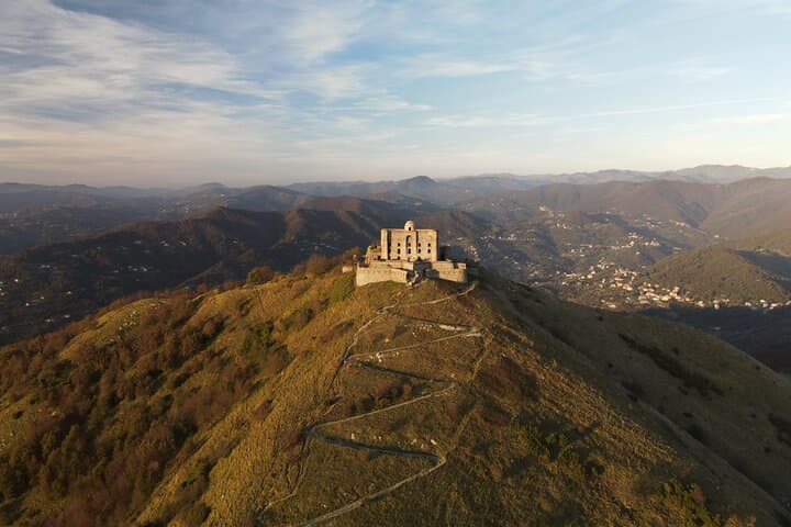
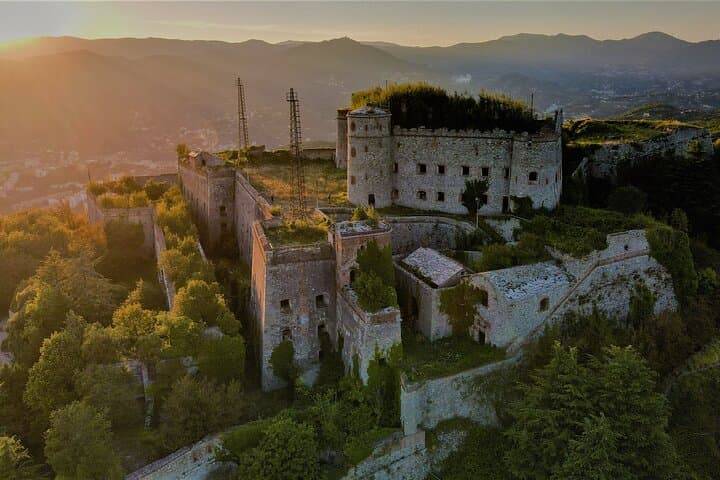
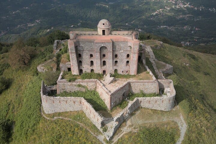
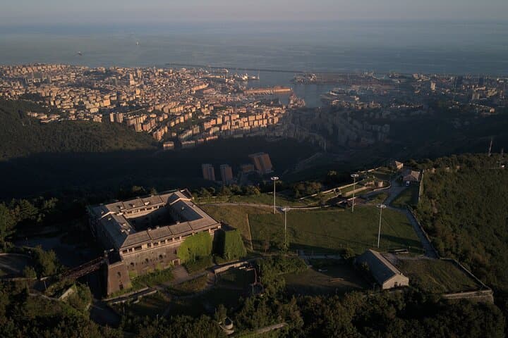
You start on a narrow path leaving the city noise behind; cork oaks and chestnuts rise as the hills of Genoa take hold and the sea angles into the distance. The trail climbs and contours, the slopes daring you to look back where the harbor shrinks to a scatter of sails. Over roughly 15 km the route threads old military tracks, terraces, and woodland, arriving at the ridge that holds Fort Diamond.
You start on a narrow path leaving the city noise behind; cork oaks and chestnuts rise as the hills of Genoa take hold and the sea angles into the distance. The trail climbs and contours, the slopes daring you to look back where the harbor shrinks to a scatter of sails. Over roughly 15 km the route threads old military tracks, terraces, and woodland, arriving at the ridge that holds Fort Diamond.
These forts date to the 18th–19th centuries, part of Genoa’s ring of defensive works that followed the city wall system. Geologically the terrain is typical Ligurian Apennines—steep, folded limestone and clay soils that shed water quickly and create stony trails and panoramic outcrops. Culturally the hills have long been a working landscape of vineyards, olive terraces and small hamlets; echoes of military organization mix with rural life here.
Your guide shapes the route: a mix of funicular access and foot travel, with a close approach to Forte Diamante and views of nearby Forte Puin. Expect uneven singletrack, stone steps and some steep pitches; total ascent is moderate, with a cumulative elevation gain commonly in the 500–700 m range depending on variations.
Practical notes: the tour includes a funicular ticket, runs about 5–6 hours, and is best started in the morning to avoid heat and lingering city haze. Wear grippy shoes, carry 1.5–2 L water, layered clothing, and a small first-aid kit. Follow your guide’s instructions on fragile terraces and keep to trails to limit erosion; cell service can be intermittent on ridgelines.