THE ADVENTURE COLLECTIVE® · Independent discovery and booking for outdoor travel

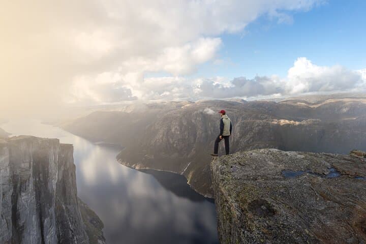
A private guided trip from Stavanger to Kjeragbolten combines a scenic drive with a challenging mountain hike. Expect 2.5–3 hours each way on a rocky, exposed trail and an exclusive viewpoint over Lysefjord when conditions allow.
A private guided trip from Stavanger to Kjeragbolten combines a scenic drive with a challenging mountain hike. Expect 2.5–3 hours each way on a rocky, exposed trail and an exclusive viewpoint over Lysefjord when conditions allow.
On the road toward Lysefjord the air tightens and the road narrows; peaks push up on both sides and the guide points out rock bands carved by ancient ice.
Verified experiences and guided adventures in the surrounding area.
Operated by Get Guided Norway · Lysebotn, Rogaland
On the road toward Lysefjord the air tightens and the road narrows; peaks push up on both sides and the guide points out rock bands carved by ancient ice.
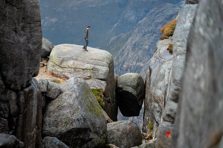
By the trailhead the landscape opens—peaty plateaus give way to angular granite and a path that climbs steadily. The route to Kjeragbolten is a classic Norwegian mountain day: exposed slabs, rooted forest, short steep scrambles and sudden frames of fjord appearing below.
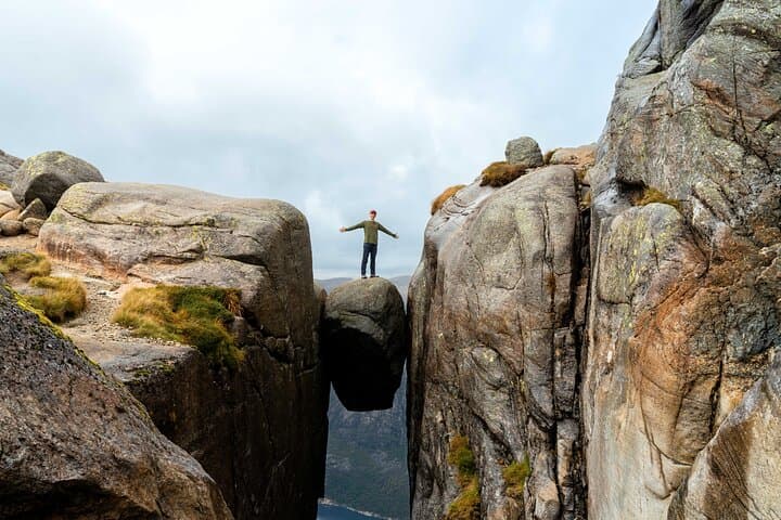
Geologically, Kjerag sits on hard Precambrian gneiss scoured by glacial action; the famous boulder is a glacial erratic jammed in a crevice, suspended over Lysefjord about 1,000 meters below. Culturally the area has long been used by local shepherds and, more recently, by adventure seekers drawn to its dramatic drop-offs and clear northern light.
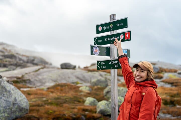
Practically: expect roughly 10–12 km round-trip with 600–700 m of elevation gain and 2.5–3 hours each way on the trail from Øygardstøl. Terrain alternates packed soil, wet boardwalks, and bare rock; footwear with sticky rubber and ankle support helps on the slabs. A private guide adds route knowledge, a safety briefing, and opportunities to visit a seldom-seen viewpoint over the fjord when conditions allow.
Timing matters—start early for stable weather and fewer people. Carry 1.5–2 liters of water, layered clothing for wind and sudden sun, and a charged phone for photos and emergency contact. The payoff is tangible: standing on Kjeragbolten, the fjord dares you to look down while the stone holds steady beneath your boots.
challenging.
10–13 hours (including drive).
Good cardiovascular fitness and comfort with sustained uphill hiking and uneven terrain; able to hike 5–6 hours on rocky ground.
The trail from Øygardstøl is about 2.5–3 hours each way for most hikers, roughly 10–12 km round-trip with 600–700 m elevation gain.
With dry rock and calm weather it is generally safe, but it is exposed; guides offer photo assistance and will advise stepping onto the boulder only when conditions and your comfort level permit.
Private guide, scenic round-trip transport in a licensed electric vehicle, safety briefing, a café stop, small Norwegian chocolate, and optional access to a hidden viewpoint when conditions allow.
Summer (June–August) offers the most stable conditions and long daylight; late spring and early fall can be good but expect colder, wetter weather higher on the trail.
The Kjerag area was shaped by repeated glaciation; local farming and shepherding traditions persisted here before tourism grew in the 20th century.
Stay on marked trails to avoid fragile alpine vegetation and pack out all waste; the area is sensitive to erosion from high foot traffic.
Get Guided Norway operates guided outdoor trips and adventures with an emphasis on safety, stewardship, and memorable experiences.
On the road toward Lysefjord the air tightens and the road narrows; peaks push up on both sides and the guide points out rock bands carved by ancient ice.
On the road toward Lysefjord the air tightens and the road narrows; peaks push up on both sides and the guide points out rock bands carved by ancient ice.
By the trailhead the landscape opens—peaty plateaus give way to angular granite and a path that climbs steadily. The route to Kjeragbolten is a classic Norwegian mountain day: exposed slabs, rooted forest, short steep scrambles and sudden frames of fjord appearing below.
Geologically, Kjerag sits on hard Precambrian gneiss scoured by glacial action; the famous boulder is a glacial erratic jammed in a crevice, suspended over Lysefjord about 1,000 meters below. Culturally the area has long been used by local shepherds and, more recently, by adventure seekers drawn to its dramatic drop-offs and clear northern light.
Practically: expect roughly 10–12 km round-trip with 600–700 m of elevation gain and 2.5–3 hours each way on the trail from Øygardstøl. Terrain alternates packed soil, wet boardwalks, and bare rock; footwear with sticky rubber and ankle support helps on the slabs. A private guide adds route knowledge, a safety briefing, and opportunities to visit a seldom-seen viewpoint over the fjord when conditions allow.
Timing matters—start early for stable weather and fewer people. Carry 1.5–2 liters of water, layered clothing for wind and sudden sun, and a charged phone for photos and emergency contact. The payoff is tangible: standing on Kjeragbolten, the fjord dares you to look down while the stone holds steady beneath your boots.