THE ADVENTURE COLLECTIVE® · Independent discovery and booking for outdoor travel

A quick, high-value trek from Pokhara to Poon Hill delivers a sunrise panorama of Annapurna and Dhaulagiri in just three days. Expect village culture, rhododendron forests and steep stone steps with teahouse nights.
A quick, high-value trek from Pokhara to Poon Hill delivers a sunrise panorama of Annapurna and Dhaulagiri in just three days. Expect village culture, rhododendron forests and steep stone steps with teahouse nights.
Before first light you follow a line of headlamps up a narrow stone stair—breath fogs, your pace slows, the world compresses to footfalls and the promise of light.
Verified experiences and guided adventures in the surrounding area.
Operated by Mega Mount Trekking Expedition P. Ltd · Pokhara, Gandaki Province
Before first light you follow a line of headlamps up a narrow stone stair—breath fogs, your pace slows, the world compresses to footfalls and the promise of light.
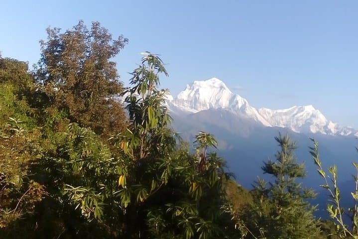
On Poon Hill the sky pulls apart and Annapurna South, Hiunchuli and a crescent of Dhaulagiri reveal themselves in hard-edged color; clouds hang low in the valleys, and terraced hills below hold villages like beads.
This compact trek threads lower Annapurna foothills and Gurung–Magar villages shaped by subsistence farming and trans-Himalayan trade. Geologically the route sits on the young Himalayan frontal range—folded greywacke and crystalline thrusts—so trails climb steep stone steps and traverse rhododendron forests that bloom flamboyantly in spring. The Annapurna Conservation Area (ACAP) governs permits and a network of teahouses supports the route.
Practical route: most itineraries drive ~1.5 hours from Pokhara to Nayapul, then 3–4 hours to Tirkhedunga (1,520 m) on day one; 6–7 hours to Ghorepani (2,853 m) on day two; day three begins with a 30–45 minute pre-dawn ascent to Poon Hill (~3,210 m) for sunrise, then descent to Ulleri and a jeep or public transfer back to Pokhara. Expect stone stair sections, muddy steps after rain and short steep pitches.
Bring layered insulation, a reliable rain shell, and cash for teahouse meals and tips; carry water treatment and allow for mild altitude effects above 2,500 m. Leave no trace, respect local customs—remove hats in traditional prayer areas—and plan early starts for the best weather window and the sunrise crowd.
moderate.
3 days.
Moderate fitness—able to hike 5–7 hours on uneven, stepped trails and handle short steep sections at altitude
Yes—carry a TIMS card and an Annapurna Conservation Area Project (ACAP) permit; checkpoints at Birethanti will check these.
It's suitable for fit beginners with prior day‑hike experience, though steep stone steps and altitude gain require steady pacing and basic fitness.
October–November and March–May offer the most reliable weather and clear mountain views; monsoon months (June–August) are wet and slippery.
Yes—basic teahouses provide dorm or private rooms, meals and usually hot showers for a fee; bring cash and a headlamp for nights.
The route passes Gurung and Magar villages—ethnic groups with hill agriculture and long histories of service in Gurkha regiments; ACAP protects this culturally rich landscape.
ACAP manages trekking impacts—use marked trails, buy local services to support communities and carry out non‑biodegradable waste.
Mega Mount Trekking Expedition P. Ltd operates guided outdoor trips and adventures with an emphasis on safety, stewardship, and memorable experiences.



Before first light you follow a line of headlamps up a narrow stone stair—breath fogs, your pace slows, the world compresses to footfalls and the promise of light.
Before first light you follow a line of headlamps up a narrow stone stair—breath fogs, your pace slows, the world compresses to footfalls and the promise of light.
On Poon Hill the sky pulls apart and Annapurna South, Hiunchuli and a crescent of Dhaulagiri reveal themselves in hard-edged color; clouds hang low in the valleys, and terraced hills below hold villages like beads.
This compact trek threads lower Annapurna foothills and Gurung–Magar villages shaped by subsistence farming and trans-Himalayan trade. Geologically the route sits on the young Himalayan frontal range—folded greywacke and crystalline thrusts—so trails climb steep stone steps and traverse rhododendron forests that bloom flamboyantly in spring. The Annapurna Conservation Area (ACAP) governs permits and a network of teahouses supports the route.
Practical route: most itineraries drive ~1.5 hours from Pokhara to Nayapul, then 3–4 hours to Tirkhedunga (1,520 m) on day one; 6–7 hours to Ghorepani (2,853 m) on day two; day three begins with a 30–45 minute pre-dawn ascent to Poon Hill (~3,210 m) for sunrise, then descent to Ulleri and a jeep or public transfer back to Pokhara. Expect stone stair sections, muddy steps after rain and short steep pitches.
Bring layered insulation, a reliable rain shell, and cash for teahouse meals and tips; carry water treatment and allow for mild altitude effects above 2,500 m. Leave no trace, respect local customs—remove hats in traditional prayer areas—and plan early starts for the best weather window and the sunrise crowd.