THE ADVENTURE COLLECTIVE® · Independent discovery and booking for outdoor travel

A private guided walk along Ponta São Lourenço takes you to Madeira’s easternmost cliffs where north and south seas meet. Expect exposed, windy ridgelines, volcanic rock formations and concentrated coastal wildlife over a roughly 7 km route.
A private guided walk along Ponta São Lourenço takes you to Madeira’s easternmost cliffs where north and south seas meet. Expect exposed, windy ridgelines, volcanic rock formations and concentrated coastal wildlife over a roughly 7 km route.
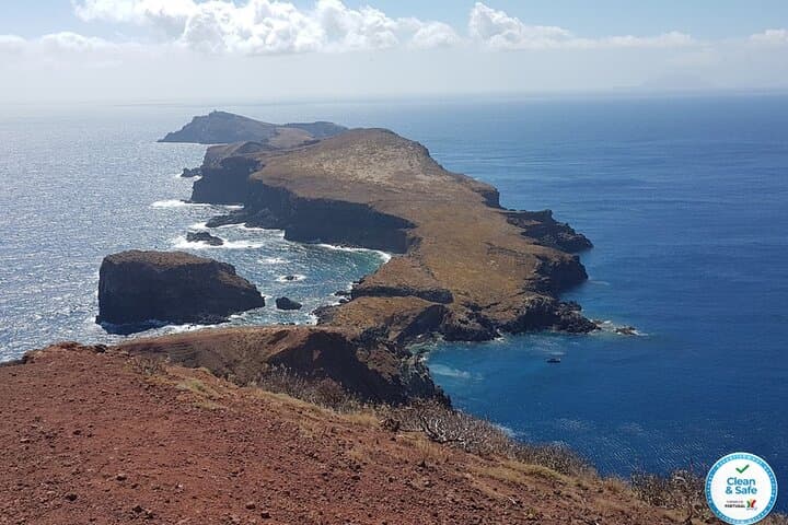
A salt-scented wind cuts along a narrow spine of rock at Portugal’s eastern edge; the path runs like a spine out to sea and the dry, ochre cliffs frame wide Atlantic views. Start near Caniçal and walk a 7.2 km loop where the south’s calm water and the north’s turbulent surf sit opposite each other, daring you to stand between them.
Verified experiences and guided adventures in the surrounding area.
Operated by Pearl of the Atlantic · Caniçal, Madeira
A salt-scented wind cuts along a narrow spine of rock at Portugal’s eastern edge; the path runs like a spine out to sea and the dry, ochre cliffs frame wide Atlantic views. Start near Caniçal and walk a 7.2 km loop where the south’s calm water and the north’s turbulent surf sit opposite each other, daring you to stand between them.
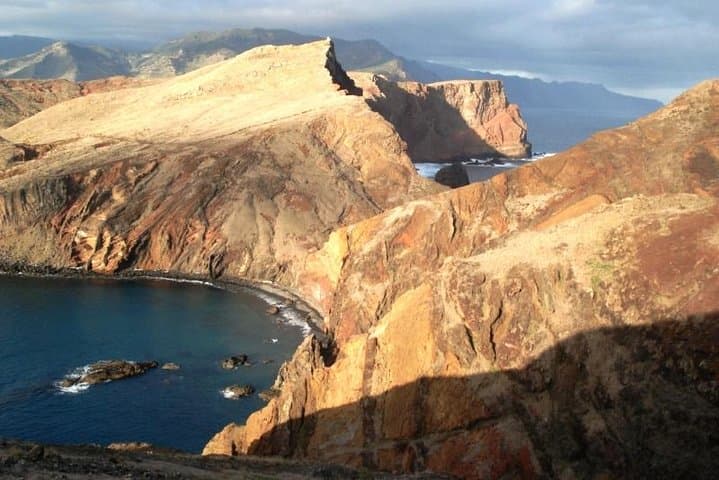
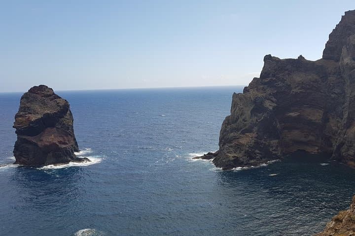
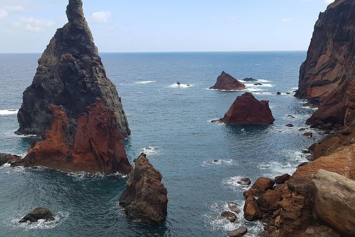
The headland is part of Madeira Natural Park and a visible record of volcanic forces: eroded basalt and tuff form jagged escarpments and curious hoodoo-like shapes. Mariners and local fishing communities long used the point as a landmark; today, conservation efforts protect its endemic flora—low shrubs and rare saxifrages—and an array of seabirds that ride the cliffs.
Culturally the area reads as working coastline: old whale lookouts and the village of Caniçal remind you the land and sea have always been linked by labor and navigation. Geologically, the lava flows and marine terraces tell of uplift and erosion that created dramatic vantage points and small sandy coves.
Practical guidance: the trail is exposed and windy—bring layers, sun protection and solid footwear for rocky, sometimes loose terrain. Expect 2–3 hours of walking at a steady pace, with moments that require careful footing near steep drop-offs. A private guide adds context—botany, bird ID and geology—plus hotel pickup. Hydrate before you go, start early to avoid strongest winds and crowds, and mind cliff edges; cell coverage is intermittent. The walk delivers big ocean panoramas, close-up geological detail and reliable wildlife viewing for anyone prepared for coastal, exposed hiking.
moderate.
2–3 hours.
Suitable for regular walkers comfortable with steady uphill/uneven terrain and exposed sections; basic endurance needed.
The route is about 7.2 km and typically takes 2–3 hours; it’s exposed with some uneven ground but does not require technical climbing.
A guide isn’t required but a private guide adds local interpretation—bird ID, geology and safer navigation of cliff-edge sections—and includes pickup.
Children may join but must be accompanied by an adult; supervise them closely near cliffs and uneven terrain.
Sturdy hiking shoes with good traction are recommended to handle rocky, loose, and sometimes dusty surfaces.
The point was historically a navigational marker for local fishermen and whalers; its human use reflects Madeira’s long maritime culture.
Ponta São Lourenço lies within Madeira Natural Park; visitors should stick to paths to protect fragile endemic plants and avoid disturbing nesting seabirds.
Pearl of the Atlantic operates guided outdoor trips and adventures with an emphasis on safety, stewardship, and memorable experiences.
A salt-scented wind cuts along a narrow spine of rock at Portugal’s eastern edge; the path runs like a spine out to sea and the dry, ochre cliffs frame wide Atlantic views. Start near Caniçal and walk a 7.2 km loop where the south’s calm water and the north’s turbulent surf sit opposite each other, daring you to stand between them.
A salt-scented wind cuts along a narrow spine of rock at Portugal’s eastern edge; the path runs like a spine out to sea and the dry, ochre cliffs frame wide Atlantic views. Start near Caniçal and walk a 7.2 km loop where the south’s calm water and the north’s turbulent surf sit opposite each other, daring you to stand between them.
The headland is part of Madeira Natural Park and a visible record of volcanic forces: eroded basalt and tuff form jagged escarpments and curious hoodoo-like shapes. Mariners and local fishing communities long used the point as a landmark; today, conservation efforts protect its endemic flora—low shrubs and rare saxifrages—and an array of seabirds that ride the cliffs.
Culturally the area reads as working coastline: old whale lookouts and the village of Caniçal remind you the land and sea have always been linked by labor and navigation. Geologically, the lava flows and marine terraces tell of uplift and erosion that created dramatic vantage points and small sandy coves.
Practical guidance: the trail is exposed and windy—bring layers, sun protection and solid footwear for rocky, sometimes loose terrain. Expect 2–3 hours of walking at a steady pace, with moments that require careful footing near steep drop-offs. A private guide adds context—botany, bird ID and geology—plus hotel pickup. Hydrate before you go, start early to avoid strongest winds and crowds, and mind cliff edges; cell coverage is intermittent. The walk delivers big ocean panoramas, close-up geological detail and reliable wildlife viewing for anyone prepared for coastal, exposed hiking.