THE ADVENTURE COLLECTIVE® · Independent discovery and booking for outdoor travel

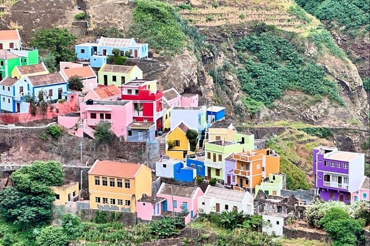
Walk from the working port of Ponta do Sol to Fontainhas, one of Santo Antão’s most photographed cliff villages. This roughly three-hour coastal hike combines village life, volcanic coastal scenery and painted cliffside houses—ideal for travelers who want culture and views in a single morning.
Walk from the working port of Ponta do Sol to Fontainhas, one of Santo Antão’s most photographed cliff villages. This roughly three-hour coastal hike combines village life, volcanic coastal scenery and painted cliffside houses—ideal for travelers who want culture and views in a single morning.
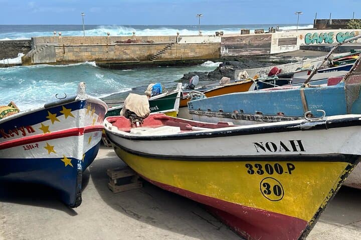
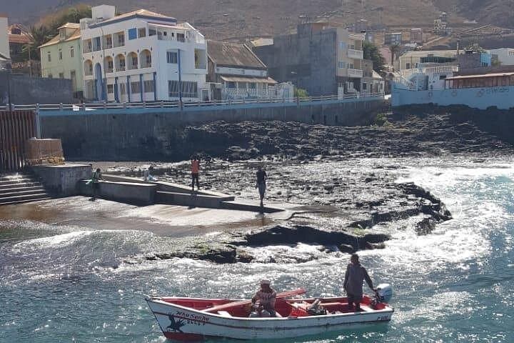
Morning fog lifts off the Atlantic as you step out of Ponta do Sol’s small port: nets are being coiled, wooden boats painted in vivid blues bob, and a rooster crows from a rooftop terrace. The coastal path threads past seaside homes, low stone walls and tiny plots of sugarcane and mango—local life happening at the edge of the ocean. The sea pushes and pulls at the shoreline like a live thing; the path answers in gravel and old volcanic rock.
Verified experiences and guided adventures in the surrounding area.
Operated by Green Line Tours Cabo Verde · Ponta do Sol, Santo Antão
Morning fog lifts off the Atlantic as you step out of Ponta do Sol’s small port: nets are being coiled, wooden boats painted in vivid blues bob, and a rooster crows from a rooftop terrace. The coastal path threads past seaside homes, low stone walls and tiny plots of sugarcane and mango—local life happening at the edge of the ocean. The sea pushes and pulls at the shoreline like a live thing; the path answers in gravel and old volcanic rock.
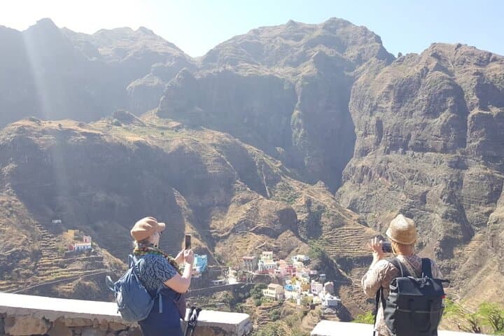
Santo Antão is a volcanic island shaped by deep ravines and terraced agriculture carved over generations. Ponta do Sol’s colonial-era buildings and the working fishing port reflect Portuguese-era patterns of settlement; Fontainhas, perched on a basalt bluff, is famous for its steep streets and brightly painted houses that cling to the cliff face. Along the route you’ll pass plots irrigated by traditional levadas and see donkeys still used to move water and supplies.
On the ground, expect roughly 4–6 km of walking (total time about 3 hours with stops). The trail is mostly coastal singletrack with short steep sections and uneven volcanic cobbles—moderate fitness and steady shoes recommended. Bring 1–2 liters of water, sun protection and a light wind- or rain-layer; start early to avoid midday sun and to watch fishing boats return. Local guides add cultural context and help with narrow, residential stretches. Move respectfully through villages, ask before photographing people, and leave no trace: these paths are both route and living room for residents.
moderate.
3 hours.
Moderate—able to walk uneven terrain and short steep sections for a few hours.
Yes—this offering includes a professional local guide who leads the route, provides cultural context and handles logistics.
The walk is rated moderate; it includes uneven volcanic cobbles and short steep sections, so it’s not ideal for people with serious back or heart conditions.
Pickups can be arranged from local accommodations or you can meet at a central point (Tiduca Hotel is a common meeting spot).
Service animals are allowed; non-service pets should be checked with the operator in advance due to village streets and other animals like donkeys.
The north coast of Santo Antão developed around Portuguese-era fishing villages and terraced agriculture; many houses and port structures reflect that late-colonial pattern.
The island’s terraced agriculture and thin soils are fragile—stick to paths, avoid trampling terraces and carry out all trash to protect local water sources and soil.
Green Line Tours Cabo Verde operates guided outdoor trips and adventures with an emphasis on safety, stewardship, and memorable experiences.
Morning fog lifts off the Atlantic as you step out of Ponta do Sol’s small port: nets are being coiled, wooden boats painted in vivid blues bob, and a rooster crows from a rooftop terrace. The coastal path threads past seaside homes, low stone walls and tiny plots of sugarcane and mango—local life happening at the edge of the ocean. The sea pushes and pulls at the shoreline like a live thing; the path answers in gravel and old volcanic rock.
Morning fog lifts off the Atlantic as you step out of Ponta do Sol’s small port: nets are being coiled, wooden boats painted in vivid blues bob, and a rooster crows from a rooftop terrace. The coastal path threads past seaside homes, low stone walls and tiny plots of sugarcane and mango—local life happening at the edge of the ocean. The sea pushes and pulls at the shoreline like a live thing; the path answers in gravel and old volcanic rock.
Santo Antão is a volcanic island shaped by deep ravines and terraced agriculture carved over generations. Ponta do Sol’s colonial-era buildings and the working fishing port reflect Portuguese-era patterns of settlement; Fontainhas, perched on a basalt bluff, is famous for its steep streets and brightly painted houses that cling to the cliff face. Along the route you’ll pass plots irrigated by traditional levadas and see donkeys still used to move water and supplies.
On the ground, expect roughly 4–6 km of walking (total time about 3 hours with stops). The trail is mostly coastal singletrack with short steep sections and uneven volcanic cobbles—moderate fitness and steady shoes recommended. Bring 1–2 liters of water, sun protection and a light wind- or rain-layer; start early to avoid midday sun and to watch fishing boats return. Local guides add cultural context and help with narrow, residential stretches. Move respectfully through villages, ask before photographing people, and leave no trace: these paths are both route and living room for residents.