THE ADVENTURE COLLECTIVE® · Independent discovery and booking for outdoor travel

Spend a full day from Arequipa exploring the otherworldly Imata Stone Forest at 4,300m and the high‑altitude Pillones waterfalls at 4,600m. This route combines volcanic geology, Andean wildlife and sweeping puna landscapes on a long, accessible walking tour.
Spend a full day from Arequipa exploring the otherworldly Imata Stone Forest at 4,300m and the high‑altitude Pillones waterfalls at 4,600m. This route combines volcanic geology, Andean wildlife and sweeping puna landscapes on a long, accessible walking tour.
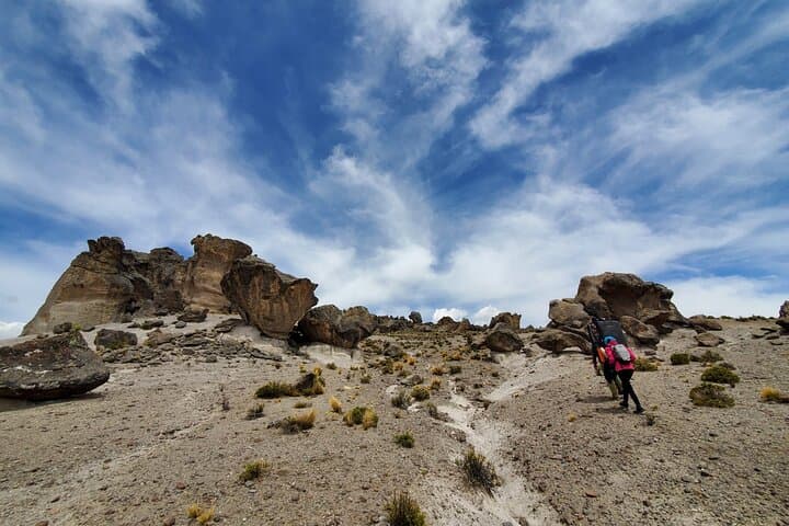
You leave Arequipa before dawn, the city shrinking behind the rising shoulders of Volcán Chachani as puna grass and salt flats unfold. The bus hums along the Arequipa–Puno road; cold, thin air sharpens the views. At 4,300m the Stone Forest of Imata appears: vertical pillars and eroded volcanic rock that seem to argue with gravity, their shapes casting strict shadows across a high plain.
Verified experiences and guided adventures in the surrounding area.
Operated by Tangol · Arequipa, Arequipa
You leave Arequipa before dawn, the city shrinking behind the rising shoulders of Volcán Chachani as puna grass and salt flats unfold. The bus hums along the Arequipa–Puno road; cold, thin air sharpens the views. At 4,300m the Stone Forest of Imata appears: vertical pillars and eroded volcanic rock that seem to argue with gravity, their shapes casting strict shadows across a high plain.
This route threads history and geology. The road passes Pampa de Arrieros, once a train gateway into the highlands, and skirts the Salinas y Aguada Blanca Reserve where vicuñas, llamas and guanacos graze under watchful volcanic peaks. Imata’s formations are volcanic tuff and ignimbrite sculpted by wind, water and frost over millennia. A short walking loop lets you read the layers: columns, arches and fins that local Quechua communities historically referenced on pastoral routes.
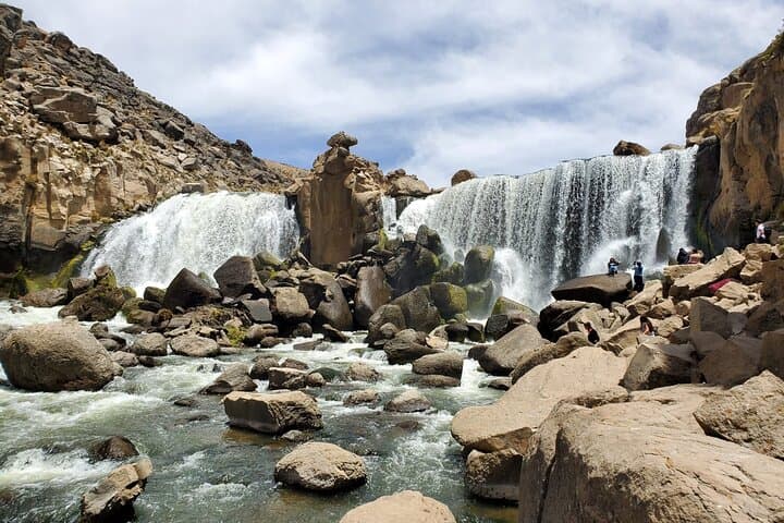
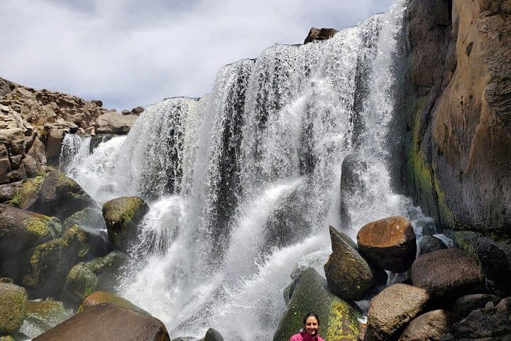
From the stone forest the trail drops and the Pillones waterfalls announce themselves — a sudden cadence of water daring the altitude. At about 4,600m the falls collect pools frequented by Andean ducks and swallows, and boulders offer vantage points for photos and quiet observation.
Practical guidance: this is a long day (roughly 10–11 hours) at high altitude — expect easy walking but bring warm layers, sun protection and extra water. Start early to avoid afternoon winds, allow time for acclimatization in Arequipa and carry cash for optional lunch en route.
moderate.
10–11 hours.
Suitable for people who can walk 2–3 hours over uneven ground; good cardiovascular baseline advised due to high elevation.
The full excursion is about 10–11 hours round trip, typically returning to Arequipa in the late afternoon.
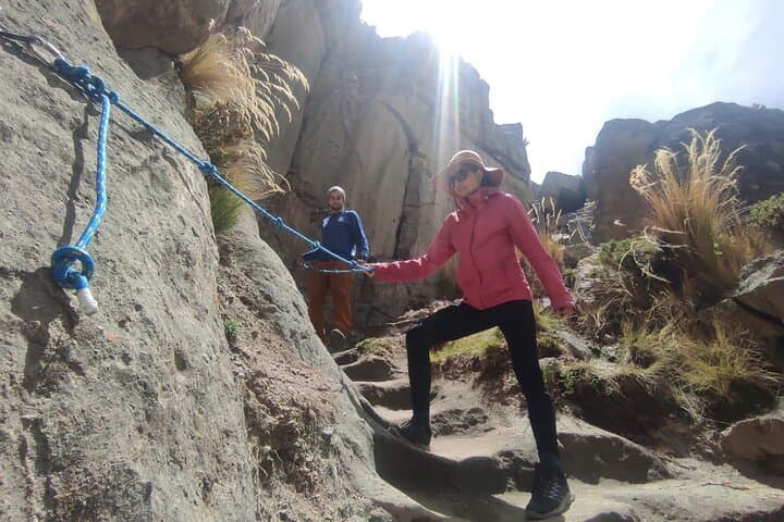
Walking segments are moderate but at high altitude; short sections are uneven. Young children and people with serious mobility limits or cardiovascular issues should consult guides before booking.
Yes — in the Salinas y Aguada Blanca area you may spot vicuñas, guanacos and llamas; near the falls watch for Andean ducks and swallows.
A breakfast snack is provided per the tour; lunch is usually an optional stop with local restaurants and requires cash.
The route traces historic pastoral and transport corridors; Pampa de Arrieros was once a railway gateway linking the highlands with Arequipa.
Salinas y Aguada Blanca Reserve protects high‑altitude grasslands and native camelids; visitors should avoid feeding wildlife, stick to paths and pack out waste.
Tangol operates guided outdoor trips and adventures with an emphasis on safety, stewardship, and memorable experiences.
You leave Arequipa before dawn, the city shrinking behind the rising shoulders of Volcán Chachani as puna grass and salt flats unfold. The bus hums along the Arequipa–Puno road; cold, thin air sharpens the views. At 4,300m the Stone Forest of Imata appears: vertical pillars and eroded volcanic rock that seem to argue with gravity, their shapes casting strict shadows across a high plain.
You leave Arequipa before dawn, the city shrinking behind the rising shoulders of Volcán Chachani as puna grass and salt flats unfold. The bus hums along the Arequipa–Puno road; cold, thin air sharpens the views. At 4,300m the Stone Forest of Imata appears: vertical pillars and eroded volcanic rock that seem to argue with gravity, their shapes casting strict shadows across a high plain.
This route threads history and geology. The road passes Pampa de Arrieros, once a train gateway into the highlands, and skirts the Salinas y Aguada Blanca Reserve where vicuñas, llamas and guanacos graze under watchful volcanic peaks. Imata’s formations are volcanic tuff and ignimbrite sculpted by wind, water and frost over millennia. A short walking loop lets you read the layers: columns, arches and fins that local Quechua communities historically referenced on pastoral routes.
From the stone forest the trail drops and the Pillones waterfalls announce themselves — a sudden cadence of water daring the altitude. At about 4,600m the falls collect pools frequented by Andean ducks and swallows, and boulders offer vantage points for photos and quiet observation.
Practical guidance: this is a long day (roughly 10–11 hours) at high altitude — expect easy walking but bring warm layers, sun protection and extra water. Start early to avoid afternoon winds, allow time for acclimatization in Arequipa and carry cash for optional lunch en route.