THE ADVENTURE COLLECTIVE® · Independent discovery and booking for outdoor travel

A full‑day private hike from Cali up to Pico de Loro (≈2,780 m) through tropical jungle and Andean forest, finishing with lunch in Pance and a riverside cooldown. Expect steady climbs, cloud‑shrouded views, and a mix of muddy trails and rocky ridgework.
A full‑day private hike from Cali up to Pico de Loro (≈2,780 m) through tropical jungle and Andean forest, finishing with lunch in Pance and a riverside cooldown. Expect steady climbs, cloud‑shrouded views, and a mix of muddy trails and rocky ridgework.
You set out from Cali before dawn, the city shrinking behind you as the road climbs and the air cools. The trail begins near 1,400 m and threads through humid tropical jungle that quickly tightens into Andean cloud forest. In the climb’s middle reaches the trees open and mist presses against your pack — the summit of Pico de Loro perches at roughly 2,780 m, a stony shoulder that often rises into the clouds and rewards clear days with sweeping views over the Cauca Valley.
Verified experiences and guided adventures in the surrounding area.
Operated by Guía Farallones · Cali, Valle del Cauca
You set out from Cali before dawn, the city shrinking behind you as the road climbs and the air cools. The trail begins near 1,400 m and threads through humid tropical jungle that quickly tightens into Andean cloud forest. In the climb’s middle reaches the trees open and mist presses against your pack — the summit of Pico de Loro perches at roughly 2,780 m, a stony shoulder that often rises into the clouds and rewards clear days with sweeping views over the Cauca Valley.
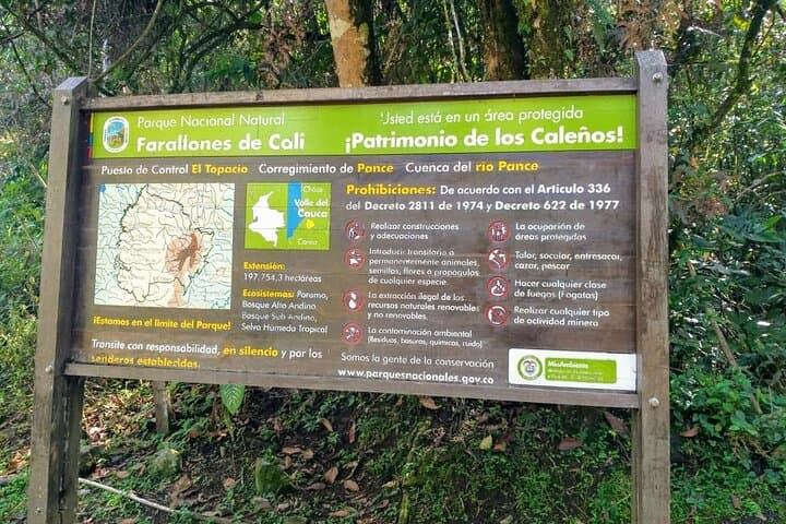
The Farallones de Cali are part of a larger biosphere reserve shaped by uplift and erosion; volcanic and sedimentary layers produce steep ridges, deep gullies and the cold, clear streams that feed the Pance River. The area has long been used by local communities — Pueblito Pance sits within these slopes and offers a glimpse of rural Valle del Cauca life and traditional mountain agriculture.
Practically, expect 3–4 hours of steady ascent on uneven, sometimes muddy trail, an hour at the top, then 2–3 hours back to trailhead. The tour includes private transport, park entrance, a guide, lunch in Pance and basic accident insurance. Footwear with good traction, layered clothing for a 1,400–2,780 m temperature swing, and 2–3 liters of water are sensible. If weather turns, the guide will adjust plans — afternoon storms in the mountains are common. After the descent you can cool off in Pance River pools before returning to Cali at sunset, having climbed through jungle, cloud forest and one of the Farallones’ representative peaks.
moderate.
6–8 hours (active hiking time) — total tour 12 hours.
Good baseline fitness with regular activity; comfortable with sustained uphill hiking and uneven terrain
Ascent typically 3–4 hours, summit stop ~1 hour, descent 2–3 hours; rated intermediate — suitable for people who exercise regularly.
Yes — the tour visits Pance village and the Pance River, where you can cool off; bring a towel and a change of clothes if you plan to swim.
The top is about 2,780 m; most healthy visitors tolerate this fine but allow for slower pace if you feel short of breath and stay hydrated.
Yes — the private transfer, park entrance, guide and lunch in Pance are included per the tour description.
The Farallones de Cali are part of a biosphere reserve with a mix of Andean and Chocó influences; local communities have long used the slopes for agriculture and cultural practices.
The area is protected within a national park and biosphere reserve; stick to trails, pack out trash and avoid disturbing wildlife to support conservation.
Guía Farallones operates guided outdoor trips and adventures with an emphasis on safety, stewardship, and memorable experiences.
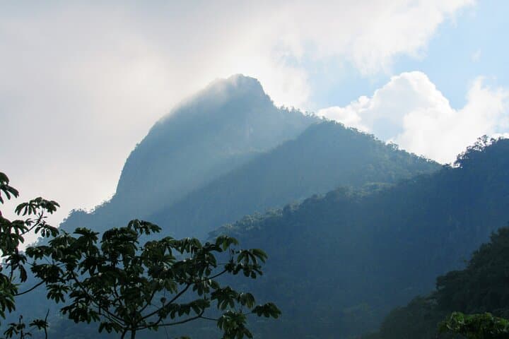
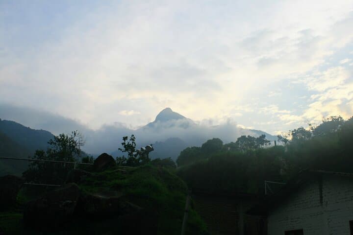
You set out from Cali before dawn, the city shrinking behind you as the road climbs and the air cools. The trail begins near 1,400 m and threads through humid tropical jungle that quickly tightens into Andean cloud forest. In the climb’s middle reaches the trees open and mist presses against your pack — the summit of Pico de Loro perches at roughly 2,780 m, a stony shoulder that often rises into the clouds and rewards clear days with sweeping views over the Cauca Valley.
You set out from Cali before dawn, the city shrinking behind you as the road climbs and the air cools. The trail begins near 1,400 m and threads through humid tropical jungle that quickly tightens into Andean cloud forest. In the climb’s middle reaches the trees open and mist presses against your pack — the summit of Pico de Loro perches at roughly 2,780 m, a stony shoulder that often rises into the clouds and rewards clear days with sweeping views over the Cauca Valley.
The Farallones de Cali are part of a larger biosphere reserve shaped by uplift and erosion; volcanic and sedimentary layers produce steep ridges, deep gullies and the cold, clear streams that feed the Pance River. The area has long been used by local communities — Pueblito Pance sits within these slopes and offers a glimpse of rural Valle del Cauca life and traditional mountain agriculture.
Practically, expect 3–4 hours of steady ascent on uneven, sometimes muddy trail, an hour at the top, then 2–3 hours back to trailhead. The tour includes private transport, park entrance, a guide, lunch in Pance and basic accident insurance. Footwear with good traction, layered clothing for a 1,400–2,780 m temperature swing, and 2–3 liters of water are sensible. If weather turns, the guide will adjust plans — afternoon storms in the mountains are common. After the descent you can cool off in Pance River pools before returning to Cali at sunset, having climbed through jungle, cloud forest and one of the Farallones’ representative peaks.