THE ADVENTURE COLLECTIVE® · Independent discovery and booking for outdoor travel

A gentle yet scenic day hike above Sembalun Valley, Pergasingan Hill offers sweeping views of Mount Rinjani, rice fields, and open summit meadows—ideal for hikers wanting big vistas on a one-day outing.
A gentle yet scenic day hike above Sembalun Valley, Pergasingan Hill offers sweeping views of Mount Rinjani, rice fields, and open summit meadows—ideal for hikers wanting big vistas on a one-day outing.
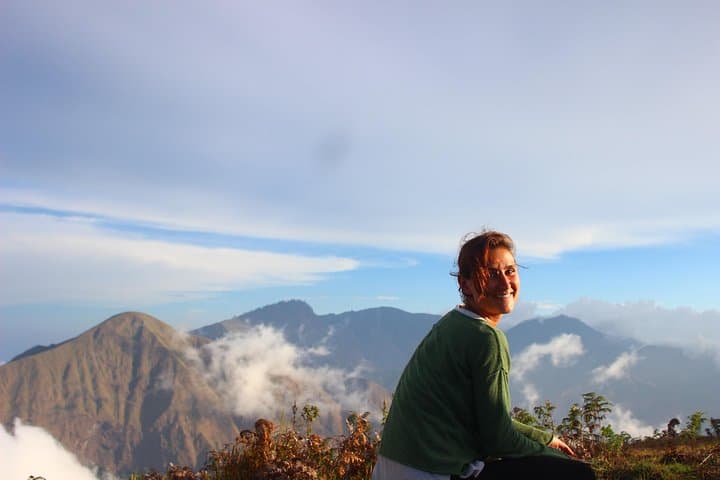
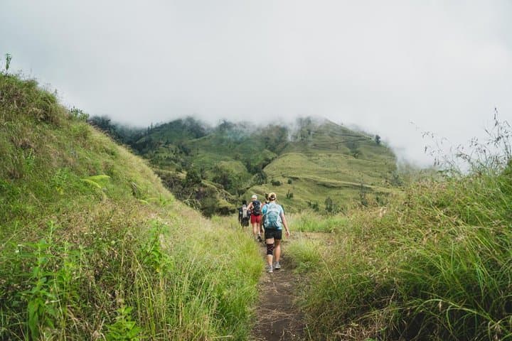
A cool mountain wind greets hikers as they step out of the village and onto the switchback that climbs Pergasingan Hill. Grass slopes roll away like a living map; Mount Rinjani looms to the west, sometimes shrouded in cloud, sometimes cutting a clean volcanic silhouette against blue. walkers move at a steady, unhurried pace—this is soft trekking, meant to showcase landscape rather than punish the body.
Verified experiences and guided adventures in the surrounding area.
Operated by Lombok Network Holidays · Sembalun, West Nusa Tenggara
A cool mountain wind greets hikers as they step out of the village and onto the switchback that climbs Pergasingan Hill. Grass slopes roll away like a living map; Mount Rinjani looms to the west, sometimes shrouded in cloud, sometimes cutting a clean volcanic silhouette against blue. walkers move at a steady, unhurried pace—this is soft trekking, meant to showcase landscape rather than punish the body.
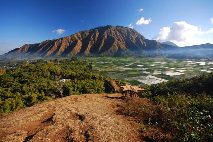
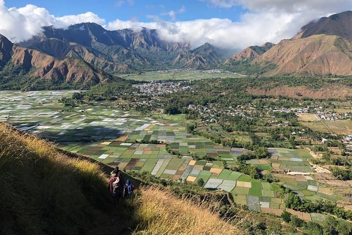
The Sembalun Valley sits on a 1,200–1,700m plateau carved by Rinjani’s eruptions. Fertile volcanic ash feeds neat rice plots and the Sasak farmers who shape the valley’s rhythms. Pergasingan’s flatter summit was once used by locals for grazing and is now a popular training ground for Rinjani-bound trekkers; its geology is a mix of volcanic soil, grassy heath, and rocky spine that gives way to sweeping vistas.
Expect 6–7 hours on trail with steady climbs, short steep pitches and open ridgelines exposed to sun and wind. The summit field is an ideal lunch spot and, for those with an eye, a launch for occasional paragliders or mountain bikers.
Practical guidance: start early to avoid midday heat, carry 2L+ of water, and wear sturdy shoes with grip for loose volcanic scree. Hire a local guide or porter if you prefer support—guides know weather shifts and local footpaths. Respect farm boundaries, leave no trace, and time your visit in the dry season (June–September) for the clearest views. Pergasingan delivers big Lombok panoramas without a multi-day commitment—accessible, scenic, and rooted in local mountain culture.
moderate.
6–7 hours.
Suitable for hikers with moderate fitness—able to sustain uphill walking for several hours and handle short steep sections.
The typical outing takes 6–7 hours round-trip with steady climbs and a few short steep pitches; overall elevation gain is moderate and manageable for fit day hikers.
A guide is recommended for navigation, local insight, and weather updates; porters are optional but useful if you prefer lighter loads.
Yes, the summit field is commonly used for short camps, but confirm permissions with locals and follow leave-no-trace practices.
The dry season (roughly June–September) offers the clearest views of Mount Rinjani; early mornings reduce haze and cloud cover year-round.
Sembalun Valley’s fertile volcanic soils have supported Sasak farming communities for generations; the area also serves as a frequent acclimatization route for Rinjani expeditions.
Stick to established trails to limit erosion, pack out all waste, and support local guides to ensure tourism benefits village economies.
Lombok Network Holidays operates guided outdoor trips and adventures with an emphasis on safety, stewardship, and memorable experiences.
A cool mountain wind greets hikers as they step out of the village and onto the switchback that climbs Pergasingan Hill. Grass slopes roll away like a living map; Mount Rinjani looms to the west, sometimes shrouded in cloud, sometimes cutting a clean volcanic silhouette against blue. walkers move at a steady, unhurried pace—this is soft trekking, meant to showcase landscape rather than punish the body.
A cool mountain wind greets hikers as they step out of the village and onto the switchback that climbs Pergasingan Hill. Grass slopes roll away like a living map; Mount Rinjani looms to the west, sometimes shrouded in cloud, sometimes cutting a clean volcanic silhouette against blue. walkers move at a steady, unhurried pace—this is soft trekking, meant to showcase landscape rather than punish the body.
The Sembalun Valley sits on a 1,200–1,700m plateau carved by Rinjani’s eruptions. Fertile volcanic ash feeds neat rice plots and the Sasak farmers who shape the valley’s rhythms. Pergasingan’s flatter summit was once used by locals for grazing and is now a popular training ground for Rinjani-bound trekkers; its geology is a mix of volcanic soil, grassy heath, and rocky spine that gives way to sweeping vistas.
Expect 6–7 hours on trail with steady climbs, short steep pitches and open ridgelines exposed to sun and wind. The summit field is an ideal lunch spot and, for those with an eye, a launch for occasional paragliders or mountain bikers.
Practical guidance: start early to avoid midday heat, carry 2L+ of water, and wear sturdy shoes with grip for loose volcanic scree. Hire a local guide or porter if you prefer support—guides know weather shifts and local footpaths. Respect farm boundaries, leave no trace, and time your visit in the dry season (June–September) for the clearest views. Pergasingan delivers big Lombok panoramas without a multi-day commitment—accessible, scenic, and rooted in local mountain culture.