THE ADVENTURE COLLECTIVE® · Independent discovery and booking for outdoor travel

A flexible 70-mile self-drive through the Peak District that pairs postcard valleys and gritstone ridges with practical route maps and sample 3–14 day itineraries. Instant, mobile-ready access gives you the freedom to pick towns, walks, and scenic stops on your own schedule.
A flexible 70-mile self-drive through the Peak District that pairs postcard valleys and gritstone ridges with practical route maps and sample 3–14 day itineraries. Instant, mobile-ready access gives you the freedom to pick towns, walks, and scenic stops on your own schedule.
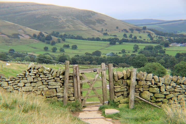
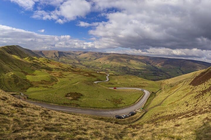
Pull off the A6 before the moorland opens and the air changes—sharper, cooler, with peat and limestone carrying the scent of rain. The road unfurls through low dry-stone walls and sudden drops into dales where sheep patrol narrow lanes. This online self-guided road trip stitches 70 miles (112 km) of the Peak District into a flexible route that hands you the map and the choices: market towns, gritstone edges, chapel-strewn valleys and the waiting vertical faces of Stanage or Mam Tor.
Verified experiences and guided adventures in the surrounding area.
Operated by Uncover Britain Road Trips · Bakewell, Derbyshire
Pull off the A6 before the moorland opens and the air changes—sharper, cooler, with peat and limestone carrying the scent of rain. The road unfurls through low dry-stone walls and sudden drops into dales where sheep patrol narrow lanes. This online self-guided road trip stitches 70 miles (112 km) of the Peak District into a flexible route that hands you the map and the choices: market towns, gritstone edges, chapel-strewn valleys and the waiting vertical faces of Stanage or Mam Tor.
The terrain reads like a short geological field guide. The White Peak’s folded limestone carved river gorges such as Dovedale, with its shallow stepping-stones and vertical ravines, contrasts with the Hope Valley’s gritstone escarpments that pushed up under Carboniferous skies. Human history sits on that geology—centuries of lead mining, medieval packhorse routes and the grand 17th-century landscapes of Chatsworth House that remodelled both land and labour.
Culture here is deliberate and local: tearooms in market squares arguing over the best bakewell pudding, Victorian spa architecture at Matlock Bath, and village guidebooks tacked in shop windows. The online plan doesn’t drive you by lectern; it gives context—sample 3–14 day itineraries, parking and directions, and pre-populated Google Maps so you can jump in or edit on the fly.
Practical pick-up: there isn’t one. The guide is instant-access and mobile-friendly—use it from Bakewell, Castleton, or Sheffield as your base. Expect walking options from casual riverside strolls (Dovedale, 2–3 km, minimal ascent) to ridge loops like Mam Tor (approx. 5 km, 300–400 m cumulative ascent) and longer packhorse-track sections in the Dark Peak. Driving time for the suggested 70-mile route is modest—plan for slow roads, scenic stops and short walks that add hours to a day.
Timing and kit matter. Weather can change rapidly; layer for wind, rain, and sun. Footwear should be solid for wet limestone and mud. Fuel up on water and shop local provisions in towns like Ashbourne or Hathersage. Use the guide’s pins: they show parking, brief access notes and highlight seasonal cave visiting windows.
This plan is best for travelers who want structure without surrendering freedom: photographers after golden light on edges, walkers who want to link easy valley walks with tougher hilltops, and families who need itinerary options. It’s an itinerary framework and a field notebook—suitable for all fitness levels and tailored to how much time you want to spend on foot versus behind the wheel.
moderate.
3–14 days.
Suitable for most fitness levels; walking sections range from easy riverside strolls to moderate ridge ascents.
Access is instant via the provided Uncover Britain link; save the URL to your phone and look for a welcome email with a quick start guide.
The guide’s routes are fixed but the Google Maps pins and directions are editable so you can rearrange days and stops to suit your schedule.
Yes—many suggested walks are short and family-friendly, though steep sections like some ridge walks may challenge very young children.
No—recommended routes use public roads and A/B-class lanes; standard vehicles are fine but expect narrow country lanes.
Service animals are allowed; many outdoor stops are dog-friendly but check local attraction rules for show caves or estate grounds before visiting.
All sales are final; there are no refunds once purchased, so confirm dates and the correct account details at booking.
The Peak District’s landscape was shaped by limestone quarrying and lead mining from Roman times through the 19th century, and later by estate-driven landscaping such as Chatsworth House.
Many valleys are protected Sites of Special Scientific Interest; stick to paths, use marked parking and support local businesses to reduce pressure on fragile habitats.
Uncover Britain Road Trips operates guided outdoor trips and adventures with an emphasis on safety, stewardship, and memorable experiences.
Pull off the A6 before the moorland opens and the air changes—sharper, cooler, with peat and limestone carrying the scent of rain. The road unfurls through low dry-stone walls and sudden drops into dales where sheep patrol narrow lanes. This online self-guided road trip stitches 70 miles (112 km) of the Peak District into a flexible route that hands you the map and the choices: market towns, gritstone edges, chapel-strewn valleys and the waiting vertical faces of Stanage or Mam Tor.
Pull off the A6 before the moorland opens and the air changes—sharper, cooler, with peat and limestone carrying the scent of rain. The road unfurls through low dry-stone walls and sudden drops into dales where sheep patrol narrow lanes. This online self-guided road trip stitches 70 miles (112 km) of the Peak District into a flexible route that hands you the map and the choices: market towns, gritstone edges, chapel-strewn valleys and the waiting vertical faces of Stanage or Mam Tor.
The terrain reads like a short geological field guide. The White Peak’s folded limestone carved river gorges such as Dovedale, with its shallow stepping-stones and vertical ravines, contrasts with the Hope Valley’s gritstone escarpments that pushed up under Carboniferous skies. Human history sits on that geology—centuries of lead mining, medieval packhorse routes and the grand 17th-century landscapes of Chatsworth House that remodelled both land and labour.
Culture here is deliberate and local: tearooms in market squares arguing over the best bakewell pudding, Victorian spa architecture at Matlock Bath, and village guidebooks tacked in shop windows. The online plan doesn’t drive you by lectern; it gives context—sample 3–14 day itineraries, parking and directions, and pre-populated Google Maps so you can jump in or edit on the fly.
Practical pick-up: there isn’t one. The guide is instant-access and mobile-friendly—use it from Bakewell, Castleton, or Sheffield as your base. Expect walking options from casual riverside strolls (Dovedale, 2–3 km, minimal ascent) to ridge loops like Mam Tor (approx. 5 km, 300–400 m cumulative ascent) and longer packhorse-track sections in the Dark Peak. Driving time for the suggested 70-mile route is modest—plan for slow roads, scenic stops and short walks that add hours to a day.
Timing and kit matter. Weather can change rapidly; layer for wind, rain, and sun. Footwear should be solid for wet limestone and mud. Fuel up on water and shop local provisions in towns like Ashbourne or Hathersage. Use the guide’s pins: they show parking, brief access notes and highlight seasonal cave visiting windows.
This plan is best for travelers who want structure without surrendering freedom: photographers after golden light on edges, walkers who want to link easy valley walks with tougher hilltops, and families who need itinerary options. It’s an itinerary framework and a field notebook—suitable for all fitness levels and tailored to how much time you want to spend on foot versus behind the wheel.