THE ADVENTURE COLLECTIVE® · Independent discovery and booking for outdoor travel

A compact, 4 km circular hike through volcanic landscapes and cedar forests on Terceira Island. Discover ox-cart grooves and the Guilherme Moniz crater on a 3–4 hour, moderate trek.
A compact, 4 km circular hike through volcanic landscapes and cedar forests on Terceira Island. Discover ox-cart grooves and the Guilherme Moniz crater on a 3–4 hour, moderate trek.
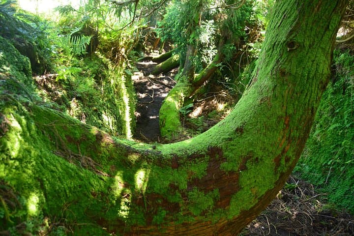
You step off the narrow lane into a cedar-shaded corridor; the trees hush and the trail narrows, the ocean nowhere but the air filled with birdsong. Passagem das Bestas is a compact, four-kilometre circuit that lays out volcanic history and island life in a single afternoon—rock, crater rim, and fern-carpeted soil moving at your boots’ pace.
Verified experiences and guided adventures in the surrounding area.
Operated by TuriAzores - Animação Turística · Angra do Heroísmo, Azores
You step off the narrow lane into a cedar-shaded corridor; the trees hush and the trail narrows, the ocean nowhere but the air filled with birdsong. Passagem das Bestas is a compact, four-kilometre circuit that lays out volcanic history and island life in a single afternoon—rock, crater rim, and fern-carpeted soil moving at your boots’ pace.
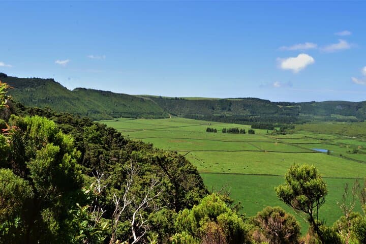
The route threads through a protected sector of Terceira Natural Park. Along the way you’ll see relheiras—deep grooves cut into basalt where ox carts once hauled timber—and the broad, cratered bowl of Caldeira Guilherme Moniz, a reminder of the island’s fire-forged origins. The geology is straightforward: weathered basalt, pockets of ash and scoria, and a crater rim that was sculpted by eruption and erosion.
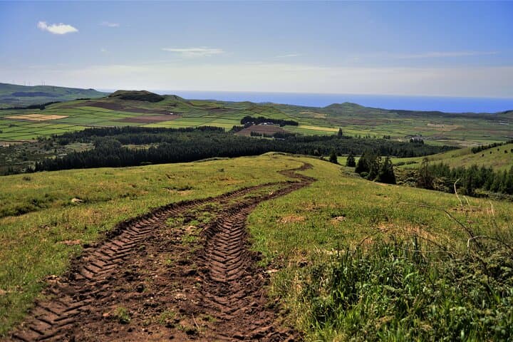
Culturally, the trail intersects old agricultural tracks and plantation stands of Japanese cedar, which contrast with endemic Azorean shrubs and the relentless green of invasive species. Migratory and resident birds use the caldera as a corridor; their calls punctuate the walk.
Practicalities: plan 3–4 hours for the loop, expect roughly 100 m of maximum elevation and intermittent steep, uneven footing. The trail is rated medium—good boots, layers for variable Azorean weather, and at least 1–1.5 L of water are recommended. Time the walk for morning or late afternoon light to avoid midday wind; group pickups are common, and the trail is suitable for moderately fit hikers. Leave no trace: the fragile crater edge and endemic plants recover slowly from disturbance.
moderate.
3–4 hours.
Moderate fitness; comfortable with several short climbs and uneven ground
The circuit is approximately 4 km and typically takes 3–4 hours at a steady pace, including stops for views and photo breaks.
Rated medium difficulty with uneven terrain and a maximum elevation around 100 m; suitable for those with moderate fitness.
Many operators include hotel or port pickup and drop-off; check your booking for exact pickup logistics and timing.
The trail is not recommended for people with significant back, heart issues, or pregnancy; older children used to hikes can do it with supervision.
Relheiras along the path are wheel-ruts carved into volcanic rock by centuries of ox-cart transport, connecting interior woodlands to coastal settlements.
The area sits within Terceira Natural Park—stick to trails to protect endemic plants and avoid introducing seeds from outside; invasive species management is ongoing.
TuriAzores - Animação Turística operates guided outdoor trips and adventures with an emphasis on safety, stewardship, and memorable experiences.
You step off the narrow lane into a cedar-shaded corridor; the trees hush and the trail narrows, the ocean nowhere but the air filled with birdsong. Passagem das Bestas is a compact, four-kilometre circuit that lays out volcanic history and island life in a single afternoon—rock, crater rim, and fern-carpeted soil moving at your boots’ pace.
You step off the narrow lane into a cedar-shaded corridor; the trees hush and the trail narrows, the ocean nowhere but the air filled with birdsong. Passagem das Bestas is a compact, four-kilometre circuit that lays out volcanic history and island life in a single afternoon—rock, crater rim, and fern-carpeted soil moving at your boots’ pace.
The route threads through a protected sector of Terceira Natural Park. Along the way you’ll see relheiras—deep grooves cut into basalt where ox carts once hauled timber—and the broad, cratered bowl of Caldeira Guilherme Moniz, a reminder of the island’s fire-forged origins. The geology is straightforward: weathered basalt, pockets of ash and scoria, and a crater rim that was sculpted by eruption and erosion.
Culturally, the trail intersects old agricultural tracks and plantation stands of Japanese cedar, which contrast with endemic Azorean shrubs and the relentless green of invasive species. Migratory and resident birds use the caldera as a corridor; their calls punctuate the walk.
Practicalities: plan 3–4 hours for the loop, expect roughly 100 m of maximum elevation and intermittent steep, uneven footing. The trail is rated medium—good boots, layers for variable Azorean weather, and at least 1–1.5 L of water are recommended. Time the walk for morning or late afternoon light to avoid midday wind; group pickups are common, and the trail is suitable for moderately fit hikers. Leave no trace: the fragile crater edge and endemic plants recover slowly from disturbance.