THE ADVENTURE COLLECTIVE® · Independent discovery and booking for outdoor travel

Launch from Hon En peak and float 10–15 minutes above Dac Loc valley and Nha Trang Bay. This guided tandem paragliding trip includes transfers, GoPro video, and a completion certificate—ideal for first-time flyers seeking a high-adrenaline coastal perspective.
Launch from Hon En peak and float 10–15 minutes above Dac Loc valley and Nha Trang Bay. This guided tandem paragliding trip includes transfers, GoPro video, and a completion certificate—ideal for first-time flyers seeking a high-adrenaline coastal perspective.
You stand at the edge of Hon En peak, wind already tugging at the fabric above you. Below, Dac Loc valley rolls out in green terraces and the city’s bay catches light like scattered coins; the pilot checks lines, the wing fills, and the moment between step and lift narrows to a single breath.
Verified experiences and guided adventures in the surrounding area.
Operated by Marmoris Yacht · Nha Trang, Khanh Hoa
You stand at the edge of Hon En peak, wind already tugging at the fabric above you. Below, Dac Loc valley rolls out in green terraces and the city’s bay catches light like scattered coins; the pilot checks lines, the wing fills, and the moment between step and lift narrows to a single breath.
The south-central Vietnamese coast around Nha Trang has long been a crossroads: Cham temples and fishing villages mark human history, while volcanic geology and coastal uplift built the ridgelines pilots now use. Hon En’s 520m spine offers the right mix of slope and exposure for reliable sea breezes; thermals push riders up and the ocean drafts test skill, making this stretch ideal for short tandem hops.
Local culture is present in details — vendors selling fruit at the landing, fishermen hauling nets in the distance, and the soft cadence of Vietnamese spoken in the village. Operators here combine certified harnesses and GoPro rides with short off-road transfers that climb through scrub and small farms to the launch.
Practical essentials: expect 10–15 minutes in the air and a 2–3 hour total window for pickup, safety briefing, and return. Weight and health checks are standard; bad weather cancels flights. Wear sturdy shoes for the off-road approach, sun protection, and clothes layered against wind chill at altitude. Bring a light daypack and a sense of calm — takeoffs are brisk but guided, and landings are supervised. This is an accessible aerial experience that hands you a new vantage on Nha Trang — the city shrinks, the wind dares you, and the coastline rearranges itself beneath your feet.
easy.
2–3 hours.
Minimal fitness required; participants should be mobile and able to run a few steps during takeoff.
Flights last about 10–15 minutes; the full experience including transfers and briefing typically takes 2–3 hours.
No — flights are tandem with a certified pilot and designed for first-time flyers, though operators screen for health and weight.
Flights are canceled in unsafe wind or rain conditions; the operator follows a weather-based cancellation policy and will refund if canceled at least 24 hours prior.
Yes — GoPro footage is recorded during the flight and usually included in the package.
The Nha Trang coast bears Cham-era sites and a maritime heritage; ridgelines near Hon En have been used locally for small-scale agriculture and seasonal grazing.
Stay on designated access tracks during the off-road transfer and avoid leaving litter; reputable operators use certified gear and limit group sizes to reduce erosion at launch sites.
Marmoris Yacht operates guided outdoor trips and adventures with an emphasis on safety, stewardship, and memorable experiences.
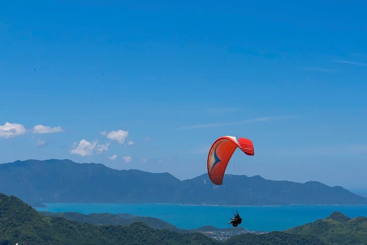
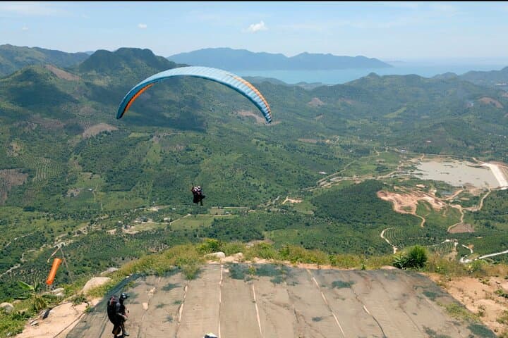
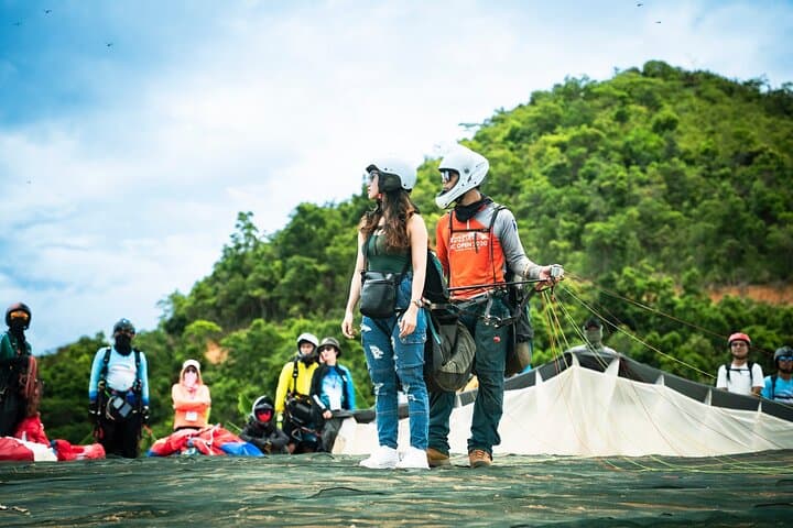
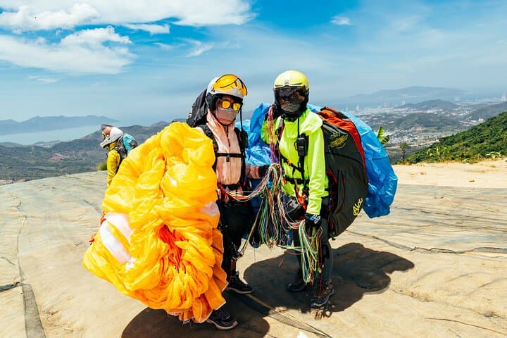
You stand at the edge of Hon En peak, wind already tugging at the fabric above you. Below, Dac Loc valley rolls out in green terraces and the city’s bay catches light like scattered coins; the pilot checks lines, the wing fills, and the moment between step and lift narrows to a single breath.
You stand at the edge of Hon En peak, wind already tugging at the fabric above you. Below, Dac Loc valley rolls out in green terraces and the city’s bay catches light like scattered coins; the pilot checks lines, the wing fills, and the moment between step and lift narrows to a single breath.
The south-central Vietnamese coast around Nha Trang has long been a crossroads: Cham temples and fishing villages mark human history, while volcanic geology and coastal uplift built the ridgelines pilots now use. Hon En’s 520m spine offers the right mix of slope and exposure for reliable sea breezes; thermals push riders up and the ocean drafts test skill, making this stretch ideal for short tandem hops.
Local culture is present in details — vendors selling fruit at the landing, fishermen hauling nets in the distance, and the soft cadence of Vietnamese spoken in the village. Operators here combine certified harnesses and GoPro rides with short off-road transfers that climb through scrub and small farms to the launch.
Practical essentials: expect 10–15 minutes in the air and a 2–3 hour total window for pickup, safety briefing, and return. Weight and health checks are standard; bad weather cancels flights. Wear sturdy shoes for the off-road approach, sun protection, and clothes layered against wind chill at altitude. Bring a light daypack and a sense of calm — takeoffs are brisk but guided, and landings are supervised. This is an accessible aerial experience that hands you a new vantage on Nha Trang — the city shrinks, the wind dares you, and the coastline rearranges itself beneath your feet.