THE ADVENTURE COLLECTIVE® · Independent discovery and booking for outdoor travel

Leave Cusco before dawn for a quieter, high-altitude walk to Palccoyo’s rainbow ridgeline and the nearby Stone Forest. This full-day tour combines geology, local culture, and manageable hiking above 4,600 m with meals and guided support included.
Leave Cusco before dawn for a quieter, high-altitude walk to Palccoyo’s rainbow ridgeline and the nearby Stone Forest. This full-day tour combines geology, local culture, and manageable hiking above 4,600 m with meals and guided support included.
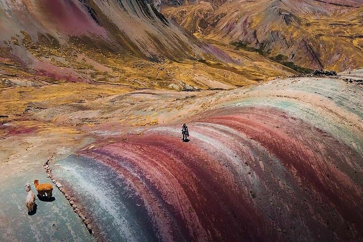
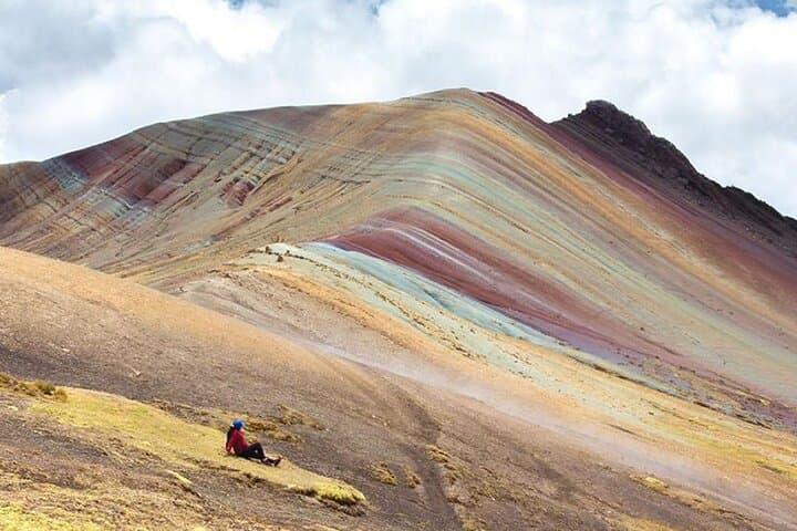
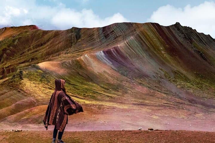
A lemon-blue predawn sky frames the van as it leaves Cusco at 5:30 a.m., the road unfurling through frost-tinged puna and small Andean villages. By the time you stop for breakfast in Cusipata the light has sharpened; farther on the world opens into broad slopes and the multicolored bands of Palccoyo that seem to have been painted into the mountain ridgeline.
Verified experiences and guided adventures in the surrounding area.
Operated by Lama Glama Travel · Cusco, Cusco Region
A lemon-blue predawn sky frames the van as it leaves Cusco at 5:30 a.m., the road unfurling through frost-tinged puna and small Andean villages. By the time you stop for breakfast in Cusipata the light has sharpened; farther on the world opens into broad slopes and the multicolored bands of Palccoyo that seem to have been painted into the mountain ridgeline.
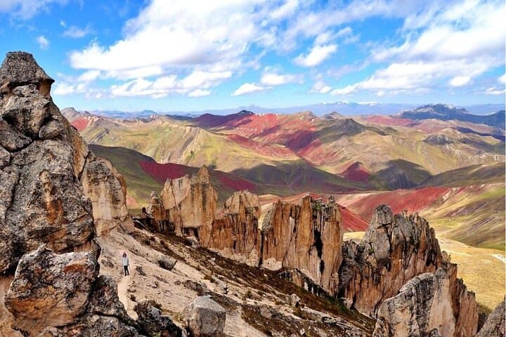
Palccoyo’s stripes come from iron and copper oxides layered in sedimentary and volcanic deposits, exposed and polished by millennia of glacial and wind erosion. The nearby Stone Forest—odd, wind-sculpted pillars of volcanic rock—offers a geological counterpoint and a reminder that this is working, changing terrain. Cultural threads run through the day: Quechua-speaking communities herd llamas and alpacas, and the colonial bridge at Checacupe hints at Spanish-era routes that still structure travel and trade.
Practically, expect a moderate 45–60 minute hike at altitudes above 4,600 m (≈15,000 ft), with roughly 150–250 m of elevation change on rocky, sometimes loose ground. Views pay off quickly; photographers and walkers alike will find multiple vantage points and a quieter, less crowded alternative to Vinicunca. Guides provide walking sticks and transport equipped with oxygen; breakfast and a traditional lunch in Cusipata are included. Come layered against cold mornings and strong sun, move deliberately to manage altitude, and plan the day to return before typical afternoon cloud build-up. The route is straightforward but high — respect the pace the mountains demand and the reward will be clear, raw landscape and close-up encounters with Andean life.
moderate.
12 hours.
Good cardiovascular fitness for high-altitude walking and short uphill sections; comfortable with 1–2 hours of hiking at steep grades.
The main walking section is about 45–60 minutes round-trip from the community trailhead with roughly 150–250 m of ascent; guides keep a steady, altitude-aware pace.
Yes—because the visit reaches ~4,600 m, spend 24–48 hours in Cusco or another high-altitude location first and monitor for symptoms of acute mountain sickness.
Yes, the tour supplies walking sticks; they’re helpful on steep or loose sections but proper boots matter most.
The tour accommodates a range of ages but requires moderate fitness; consult guides and consider altitude vulnerability for young children and seniors.
The route passes colonial-era bridges and Andean highland communities that trace pre-Columbian trade paths later adapted by Spanish road networks.
High puna ecosystems are fragile; stay on trails, avoid disturbing grazing animals, and pack out all waste to protect native grasslands and water sources.
Lama Glama Travel operates guided outdoor trips and adventures with an emphasis on safety, stewardship, and memorable experiences.
A lemon-blue predawn sky frames the van as it leaves Cusco at 5:30 a.m., the road unfurling through frost-tinged puna and small Andean villages. By the time you stop for breakfast in Cusipata the light has sharpened; farther on the world opens into broad slopes and the multicolored bands of Palccoyo that seem to have been painted into the mountain ridgeline.
A lemon-blue predawn sky frames the van as it leaves Cusco at 5:30 a.m., the road unfurling through frost-tinged puna and small Andean villages. By the time you stop for breakfast in Cusipata the light has sharpened; farther on the world opens into broad slopes and the multicolored bands of Palccoyo that seem to have been painted into the mountain ridgeline.
Palccoyo’s stripes come from iron and copper oxides layered in sedimentary and volcanic deposits, exposed and polished by millennia of glacial and wind erosion. The nearby Stone Forest—odd, wind-sculpted pillars of volcanic rock—offers a geological counterpoint and a reminder that this is working, changing terrain. Cultural threads run through the day: Quechua-speaking communities herd llamas and alpacas, and the colonial bridge at Checacupe hints at Spanish-era routes that still structure travel and trade.
Practically, expect a moderate 45–60 minute hike at altitudes above 4,600 m (≈15,000 ft), with roughly 150–250 m of elevation change on rocky, sometimes loose ground. Views pay off quickly; photographers and walkers alike will find multiple vantage points and a quieter, less crowded alternative to Vinicunca. Guides provide walking sticks and transport equipped with oxygen; breakfast and a traditional lunch in Cusipata are included. Come layered against cold mornings and strong sun, move deliberately to manage altitude, and plan the day to return before typical afternoon cloud build-up. The route is straightforward but high — respect the pace the mountains demand and the reward will be clear, raw landscape and close-up encounters with Andean life.