THE ADVENTURE COLLECTIVE® · Independent discovery and booking for outdoor travel

A flexible self-guided driving tour from Huntington Beach to Mission San Juan Capistrano that combines surf culture, coastal geology and mission-era history. Downloadable audio guides, turn-by-turn directions and offline maps let you explore at your own pace.
A flexible self-guided driving tour from Huntington Beach to Mission San Juan Capistrano that combines surf culture, coastal geology and mission-era history. Downloadable audio guides, turn-by-turn directions and offline maps let you explore at your own pace.
Start with the engine idling and the Pacific pressing against the passenger window — this self-guided drive unfurls from Huntington Beach’s salty boardwalk, threading the Pacific Coast Highway through surf towns, salt flats and rocky coves until it eases into the adobe courtyards of Mission San Juan Capistrano.
Verified experiences and guided adventures in the surrounding area.
Operated by VoiceMap Audio Tours · Huntington Beach, California
Start with the engine idling and the Pacific pressing against the passenger window — this self-guided drive unfurls from Huntington Beach’s salty boardwalk, threading the Pacific Coast Highway through surf towns, salt flats and rocky coves until it eases into the adobe courtyards of Mission San Juan Capistrano.
The route traces layers of Orange County history: Tongva and Acjachemen coastal use, 18th‑century Spanish missions, then 20th‑century surf culture that remade towns like Newport and Laguna. Geologically the coast is a study in folded marine terraces and coastal bluffs, where wave-cut platforms and sandy spits meet estuaries such as Bolsa Chica and the Seal Beach marshes.
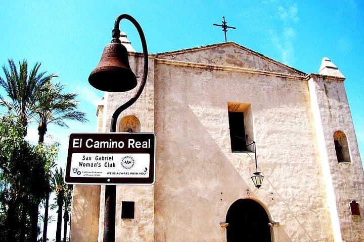
Along the way, piers, galleries and boutique strips offer quick detours — Balboa Island’s quaint main street, the raw reef break at The Wedge, and the quieter lagoons where migratory birds stage. The mission at San Juan Capistrano closes the loop with preserved chapel ruins and citrus groves that recall early ranching days.
Practical guidance: download the VoiceMap track and offline maps before you go, and start at 220 Walnut Avenue so geolocation cues align. Expect 3–4 hours of driving with multiple short stops; parking fees and entrance costs aren’t included. Timing matters — morning light is best for coves and fewer cars, while late afternoon slant-light favors the mission and harbor photos. Keep headphones and a phone charger handy, and plan for slow coastal traffic through Newport. Hydrate, keep sunscreen accessible, and treat wildlife refuges as observation zones — don’t disturb nesting birds. This drive rewards slow attention: surf, sea air, and the layered history of Southern California moving past the windshield.
easy.
3–4 hours.
Minimal physical exertion is required beyond brief walks to viewpoints and pier ends; suitable for most fitness levels.
Check your booking email for the eight‑character VoiceMap code, install the VoiceMap app, create an account, then enter the code under Tour Codes to download the tour.
Yes — the tour is self‑guided and allows detours, but note that parking and attraction entry fees are not included in the tour price.
The tour is wheelchair accessible where public roads and selected viewpoints provide access, but specific sites like piers or mission buildings may have limited access — check local site accessibility before planning stops.
Early mornings in winter and spring improve chances of seeing migrating whales and shorebirds in the marshes; always observe wildlife from a distance and avoid disturbing habitats.
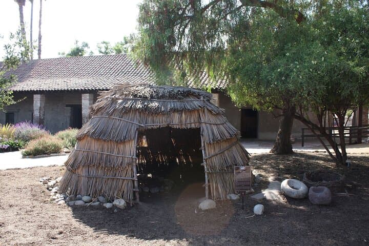
This coast was used for millennia by Tongva and Acjachemen peoples; Spanish missionaries established San Juan Capistrano in 1776, shaping the area’s ranching and agricultural history.
Tread lightly in coastal preserves like Bolsa Chica and Seal Beach Refuge — stay on designated paths, keep dogs leashed, and avoid disturbing nesting birds and fragile dune vegetation.
VoiceMap Audio Tours operates guided outdoor trips and adventures with an emphasis on safety, stewardship, and memorable experiences.
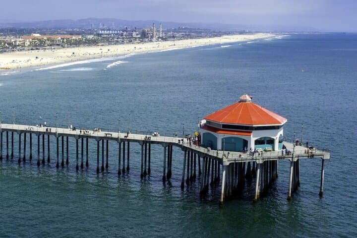
Start with the engine idling and the Pacific pressing against the passenger window — this self-guided drive unfurls from Huntington Beach’s salty boardwalk, threading the Pacific Coast Highway through surf towns, salt flats and rocky coves until it eases into the adobe courtyards of Mission San Juan Capistrano.
Start with the engine idling and the Pacific pressing against the passenger window — this self-guided drive unfurls from Huntington Beach’s salty boardwalk, threading the Pacific Coast Highway through surf towns, salt flats and rocky coves until it eases into the adobe courtyards of Mission San Juan Capistrano.
The route traces layers of Orange County history: Tongva and Acjachemen coastal use, 18th‑century Spanish missions, then 20th‑century surf culture that remade towns like Newport and Laguna. Geologically the coast is a study in folded marine terraces and coastal bluffs, where wave-cut platforms and sandy spits meet estuaries such as Bolsa Chica and the Seal Beach marshes.
Along the way, piers, galleries and boutique strips offer quick detours — Balboa Island’s quaint main street, the raw reef break at The Wedge, and the quieter lagoons where migratory birds stage. The mission at San Juan Capistrano closes the loop with preserved chapel ruins and citrus groves that recall early ranching days.
Practical guidance: download the VoiceMap track and offline maps before you go, and start at 220 Walnut Avenue so geolocation cues align. Expect 3–4 hours of driving with multiple short stops; parking fees and entrance costs aren’t included. Timing matters — morning light is best for coves and fewer cars, while late afternoon slant-light favors the mission and harbor photos. Keep headphones and a phone charger handy, and plan for slow coastal traffic through Newport. Hydrate, keep sunscreen accessible, and treat wildlife refuges as observation zones — don’t disturb nesting birds. This drive rewards slow attention: surf, sea air, and the layered history of Southern California moving past the windshield.