THE ADVENTURE COLLECTIVE® · Independent discovery and booking for outdoor travel

Stand above Crete on Pachnes (2,453 m) where limestone ridges open to the Libyan Sea. This full‑day trek from Anopoli delivers panoramic summits, compact scree sections and cool high‑altitude air—ideal for hikers who want a dramatic, nontechnical alpine day.
Stand above Crete on Pachnes (2,453 m) where limestone ridges open to the Libyan Sea. This full‑day trek from Anopoli delivers panoramic summits, compact scree sections and cool high‑altitude air—ideal for hikers who want a dramatic, nontechnical alpine day.
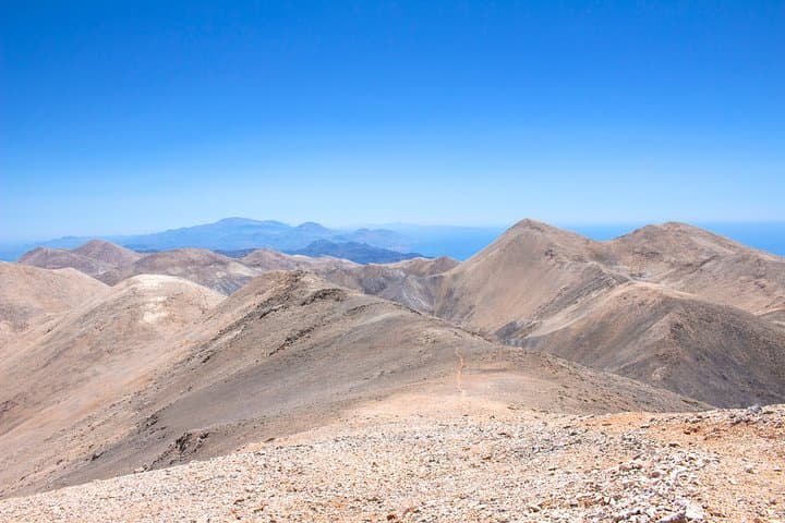
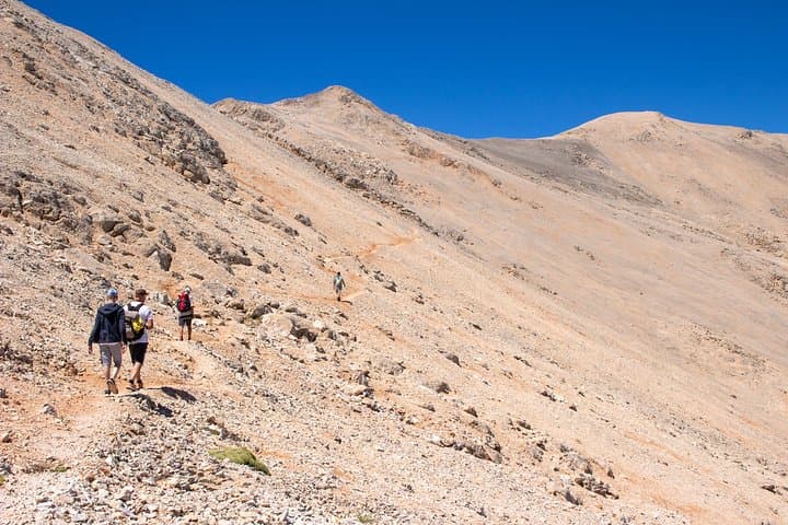
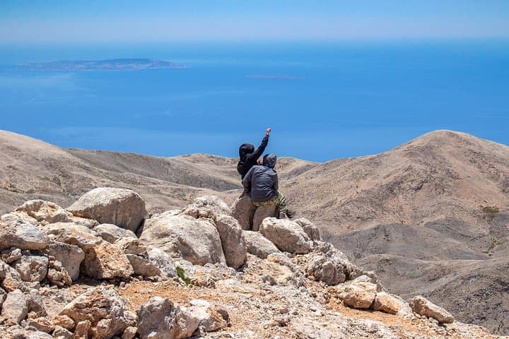
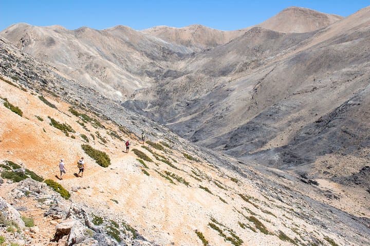
A pale wind moves across rock and short grass as hikers cut a clean line toward Pachnes, the White Mountains’ 2,453‑meter summit. The route begins above the southern slopes at high, open altitudes where the ground feels spare and the sky pushes distance into view. From the summit the landscape reads like a map: Samaria Gorge folding west, Cape Gramvousa jutting northwest, Gavdos and the Libyan Sea to the south, and Mount Ida rising to the east.
Verified experiences and guided adventures in the surrounding area.
Operated by Creta Trekking · Anopoli, Crete
A pale wind moves across rock and short grass as hikers cut a clean line toward Pachnes, the White Mountains’ 2,453‑meter summit. The route begins above the southern slopes at high, open altitudes where the ground feels spare and the sky pushes distance into view. From the summit the landscape reads like a map: Samaria Gorge folding west, Cape Gramvousa jutting northwest, Gavdos and the Libyan Sea to the south, and Mount Ida rising to the east.
The White Mountains—known locally as Lefka Ori—are geologically limestone scoured by glaciers and wind, leaving plateaus, steep ridgelines and a high desert of hardy plants. Anopoli, the local village, carries memory of 18th‑century resistance led by Daskalogiannis; shepherding and seasonal grazing shaped the human footprint here for centuries. Cultural traces are small: stone huts, shepherd paths and a few cairns marking old transhumance routes.
Practically, the standard day trip drives from Sfakia/Anopoli by 4x4 to approximately 1,950 m, then ascends roughly 400–500 m of elevation over mixed rock and compact scree—expect 1.5–2 hours to the top and similar for the descent. Weather is cooler and can change rapidly; afternoon storms are possible in shoulder seasons. Bring at least 2 liters of water, layered clothing, sturdy boots and sun protection. Trekking poles help on scree and descent. Time your hike for morning light to avoid afternoon winds and enjoy a long midday panorama at the summit before returning to the pickup. The trip suits hikers comfortable with sustained uphill walking and compact alpine terrain.
moderate.
9–10 hours (door-to-door); 3–4 hours actual hiking.
Suitable for hikers with regular aerobic activity and comfort on steep, uneven terrain; short steep sections require moderate leg strength
Expect about 1.5–2 hours ascent and roughly the same for descent; times vary by pace and breaks.
No technical gear or ropes are needed; the route is a nontechnical alpine trail with scree sections.
Fit beginners with prior hill walking experience can join, but the high altitude and loose terrain require sure footing and moderate fitness.
Temperatures are typically several degrees cooler than sea level with potential strong winds and sudden cloud; check forecasts and layer accordingly.
Anopoli was a stronghold in Cretan resistance; local routes reflect centuries of shepherding and seasonal grazing on these plateaus.
High‑altitude soils and endemic plants are fragile—stick to trails, carry out waste and avoid fires to protect the ecosystem.
Creta Trekking operates guided outdoor trips and adventures with an emphasis on safety, stewardship, and memorable experiences.
A pale wind moves across rock and short grass as hikers cut a clean line toward Pachnes, the White Mountains’ 2,453‑meter summit. The route begins above the southern slopes at high, open altitudes where the ground feels spare and the sky pushes distance into view. From the summit the landscape reads like a map: Samaria Gorge folding west, Cape Gramvousa jutting northwest, Gavdos and the Libyan Sea to the south, and Mount Ida rising to the east.
A pale wind moves across rock and short grass as hikers cut a clean line toward Pachnes, the White Mountains’ 2,453‑meter summit. The route begins above the southern slopes at high, open altitudes where the ground feels spare and the sky pushes distance into view. From the summit the landscape reads like a map: Samaria Gorge folding west, Cape Gramvousa jutting northwest, Gavdos and the Libyan Sea to the south, and Mount Ida rising to the east.
The White Mountains—known locally as Lefka Ori—are geologically limestone scoured by glaciers and wind, leaving plateaus, steep ridgelines and a high desert of hardy plants. Anopoli, the local village, carries memory of 18th‑century resistance led by Daskalogiannis; shepherding and seasonal grazing shaped the human footprint here for centuries. Cultural traces are small: stone huts, shepherd paths and a few cairns marking old transhumance routes.
Practically, the standard day trip drives from Sfakia/Anopoli by 4x4 to approximately 1,950 m, then ascends roughly 400–500 m of elevation over mixed rock and compact scree—expect 1.5–2 hours to the top and similar for the descent. Weather is cooler and can change rapidly; afternoon storms are possible in shoulder seasons. Bring at least 2 liters of water, layered clothing, sturdy boots and sun protection. Trekking poles help on scree and descent. Time your hike for morning light to avoid afternoon winds and enjoy a long midday panorama at the summit before returning to the pickup. The trip suits hikers comfortable with sustained uphill walking and compact alpine terrain.