THE ADVENTURE COLLECTIVE® · Independent discovery and booking for outdoor travel

Hike an active volcano from Antigua on a full-day trip that trades colonial streets for black lava fields and near-range views of recent flows. Expect steep, rocky terrain, local guides, and sweeping valley views—plan for sun, dust, and changing weather.
Hike an active volcano from Antigua on a full-day trip that trades colonial streets for black lava fields and near-range views of recent flows. Expect steep, rocky terrain, local guides, and sweeping valley views—plan for sun, dust, and changing weather.
Dawn breaks over colonial Antigua and the silhouette of Pacaya fills the eastern sky, a dark cone breathing faint plumes. After a short transfer the trail opens onto black, broken lava fields where every footstep kicks up dust and the ground itself seems to remember fire. The hike moves from shaded coffee terraces to exposed volcanic rock; wind and the stink of sulfur remind you this is an active landscape.
Verified experiences and guided adventures in the surrounding area.
Dawn breaks over colonial Antigua and the silhouette of Pacaya fills the eastern sky, a dark cone breathing faint plumes. After a short transfer the trail opens onto black, broken lava fields where every footstep kicks up dust and the ground itself seems to remember fire. The hike moves from shaded coffee terraces to exposed volcanic rock; wind and the stink of sulfur remind you this is an active landscape.
Geologically Pacaya is part of the Central American Volcanic Arc and stands at roughly 2,552 m, with frequent eruptions and recent lava flows visible from the hiking route. Culturally the volcano has long shaped local life—villagers guide treks, gather wood, and sell roasted corn and coffee at the trailhead. The trek offers close-range views of recent pahoehoe and a‘a flows and sweeping vistas of the Valle de Panchoy.
Expect a 7‑hour outing including transport, with 3–5 miles of walking and about 300–500 m of elevation gain on uneven volcanic rock and ash. Trails can be steep and loose; hiking boots with good tread are important. Guides handle permits and route choice—listen for local updates about activity and safe viewing distances. Bring 1.5–2 L water, sun protection, a warm layer for higher elevation, and gloves for rough rock if you plan to scramble.
Best times are dry-season mornings to avoid afternoon showers and volcanic haze. Respect local rules: stay on marked paths, avoid fragile fumaroles, and follow guides when viewing active flows. The result is a visceral day hike where raw geology and human resilience meet—close enough to feel the heat, far enough to stay safe.
moderate.
7 hours (including transport).
Moderate fitness—comfortable with sustained uphill walking, uneven terrain, and short scrambles.
Proximity depends on current activity; guides set safe viewing distances—do not approach active flows or fumaroles without instruction.
The route is rated moderate: uneven volcanic rock, some steep sections, and approximately 300–500 m of elevation gain over 3–5 miles round trip.
While not always legally required, local guides manage permits, choose the safest route, and provide important updates about volcanic activity—strongly recommended.
Bring sturdy boots, 1.5–2 L water, snacks, sun protection, a light warm layer, and a small first-aid kit; cash for local purchases.
Pacaya has been active for centuries and is part of the Central American Volcanic Arc; frequent eruptions in the 20th and 21st centuries have reshaped its slopes and local land use.
Stay on marked paths to limit erosion and disturbance; support local guides and vendors who benefit directly from sustainable tourism and stewardship.
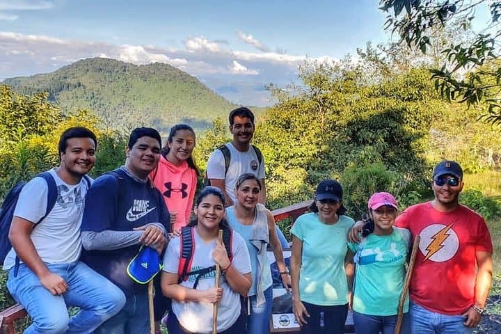
Dawn breaks over colonial Antigua and the silhouette of Pacaya fills the eastern sky, a dark cone breathing faint plumes. After a short transfer the trail opens onto black, broken lava fields where every footstep kicks up dust and the ground itself seems to remember fire. The hike moves from shaded coffee terraces to exposed volcanic rock; wind and the stink of sulfur remind you this is an active landscape.
Dawn breaks over colonial Antigua and the silhouette of Pacaya fills the eastern sky, a dark cone breathing faint plumes. After a short transfer the trail opens onto black, broken lava fields where every footstep kicks up dust and the ground itself seems to remember fire. The hike moves from shaded coffee terraces to exposed volcanic rock; wind and the stink of sulfur remind you this is an active landscape.
Geologically Pacaya is part of the Central American Volcanic Arc and stands at roughly 2,552 m, with frequent eruptions and recent lava flows visible from the hiking route. Culturally the volcano has long shaped local life—villagers guide treks, gather wood, and sell roasted corn and coffee at the trailhead. The trek offers close-range views of recent pahoehoe and a‘a flows and sweeping vistas of the Valle de Panchoy.
Expect a 7‑hour outing including transport, with 3–5 miles of walking and about 300–500 m of elevation gain on uneven volcanic rock and ash. Trails can be steep and loose; hiking boots with good tread are important. Guides handle permits and route choice—listen for local updates about activity and safe viewing distances. Bring 1.5–2 L water, sun protection, a warm layer for higher elevation, and gloves for rough rock if you plan to scramble.
Best times are dry-season mornings to avoid afternoon showers and volcanic haze. Respect local rules: stay on marked paths, avoid fragile fumaroles, and follow guides when viewing active flows. The result is a visceral day hike where raw geology and human resilience meet—close enough to feel the heat, far enough to stay safe.