THE ADVENTURE COLLECTIVE® · Independent discovery and booking for outdoor travel

Hike the active slopes of Pacaya on a guided day trip from Antigua Guatemala. Cross volcanic scree, peer into steam vents, and stand near recent lava flows while learning the geology and local culture that shape this dramatic landscape.
Hike the active slopes of Pacaya on a guided day trip from Antigua Guatemala. Cross volcanic scree, peer into steam vents, and stand near recent lava flows while learning the geology and local culture that shape this dramatic landscape.
Morning light slashes across volcanic rock as you leave Antigua and climb toward Pacaya—the landscape shifts from coffee fields to black, glassy flows that catch the sun like a rough-finished mirror.
Verified experiences and guided adventures in the surrounding area.
Morning light slashes across volcanic rock as you leave Antigua and climb toward Pacaya—the landscape shifts from coffee fields to black, glassy flows that catch the sun like a rough-finished mirror.
The trail guides you over cinder and hardened lava, through scrub pines and scattered agave, toward open vents where steam and sulphur scent the air. Pacaya is part of the Central American Volcanic Arc and one of Guatemala’s most accessible active volcanoes; eruptions in modern times have repeatedly remade its slopes since the mid-20th century. Locals work around its flanks—coffee farms and small hamlets sit low on the mountain, and guides from nearby villages know where recent flows have left walkable ridgelines.
Expect 3–5 km of hiking (roughly 2–3 miles round trip from the visitor area) with about 300–400 meters (1,000–1,300 ft) of elevation change on uneven volcanic scree and jagged rock. Terrain shifts from packed dirt to loose cinders and sharp, cooled lava; occasional steam vents and fresh-looking flow edges demand respect and local guidance.
Practical tips: go with a licensed guide, bring 2 liters of water, sun protection, and sturdy boots with good tread. Start early to avoid afternoon cloud build-up and rain during the wet season. Photography is rewarding but keep distance from hot vents and obey ranger closures. This hike trades alpine quiet for the raw energy of an active landscape—brisk, exposed, and frequently changing beneath your boots.
moderate.
5–6 hours (includes transport from Antigua).
Moderate fitness for sustained uphill walking and uneven terrain; ability to handle loose scree and short steep sections.
Most guided tours include about 2–3 hours of hiking round trip from the visitor area to the active lava fields, depending on stops and pace.
Guides will approach safe viewing areas, but active flows and vents are hazardous—stay behind any barriers and follow instructions.
Access rules and safety risks make a licensed guide strongly recommended; many tour operators provide transport and permit handling.
Early morning departures give clearer skies and firmer trail conditions; afternoons bring clouds and possible rain during the wet season.
Pacaya is part of a volcanic chain formed by the subduction of the Cocos Plate beneath the Caribbean Plate; frequent eruptions have reshaped the cone since the 1960s.
Stick to established trails to avoid damaging fragile volcanic soils and alpine vegetation; local guides and park authorities manage access to reduce impact.
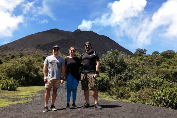
Morning light slashes across volcanic rock as you leave Antigua and climb toward Pacaya—the landscape shifts from coffee fields to black, glassy flows that catch the sun like a rough-finished mirror.
Morning light slashes across volcanic rock as you leave Antigua and climb toward Pacaya—the landscape shifts from coffee fields to black, glassy flows that catch the sun like a rough-finished mirror.
The trail guides you over cinder and hardened lava, through scrub pines and scattered agave, toward open vents where steam and sulphur scent the air. Pacaya is part of the Central American Volcanic Arc and one of Guatemala’s most accessible active volcanoes; eruptions in modern times have repeatedly remade its slopes since the mid-20th century. Locals work around its flanks—coffee farms and small hamlets sit low on the mountain, and guides from nearby villages know where recent flows have left walkable ridgelines.
Expect 3–5 km of hiking (roughly 2–3 miles round trip from the visitor area) with about 300–400 meters (1,000–1,300 ft) of elevation change on uneven volcanic scree and jagged rock. Terrain shifts from packed dirt to loose cinders and sharp, cooled lava; occasional steam vents and fresh-looking flow edges demand respect and local guidance.
Practical tips: go with a licensed guide, bring 2 liters of water, sun protection, and sturdy boots with good tread. Start early to avoid afternoon cloud build-up and rain during the wet season. Photography is rewarding but keep distance from hot vents and obey ranger closures. This hike trades alpine quiet for the raw energy of an active landscape—brisk, exposed, and frequently changing beneath your boots.