THE ADVENTURE COLLECTIVE® · Independent discovery and booking for outdoor travel

Walk from old-growth forest onto a raw Pacific shoreline on the Ozette Triangle day hike. Expect boardwalks, petroglyphs, tide pools and the option to reach Cape Alava—the westernmost point in the contiguous U.S.
Walk from old-growth forest onto a raw Pacific shoreline on the Ozette Triangle day hike. Expect boardwalks, petroglyphs, tide pools and the option to reach Cape Alava—the westernmost point in the contiguous U.S.
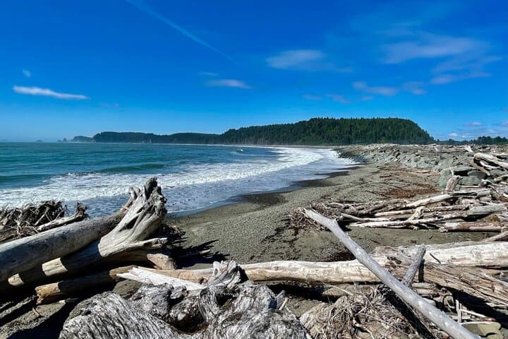
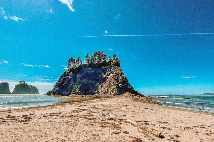
A damp cedar scent meets salt spray as you push through the boardwalk that lifts above the forest floor. Ferns brush your calves; sunlight slices in through towering spruce and western red cedar. Three miles from the trailhead the forest gives way and the ocean's voice grows louder — waves crashing against a coastline marked by sea stacks and jagged bluffs.
Verified experiences and guided adventures in the surrounding area.
Operated by Lasting Adventures · Forks, Washington
A damp cedar scent meets salt spray as you push through the boardwalk that lifts above the forest floor. Ferns brush your calves; sunlight slices in through towering spruce and western red cedar. Three miles from the trailhead the forest gives way and the ocean's voice grows louder — waves crashing against a coastline marked by sea stacks and jagged bluffs.
The Ozette Triangle stitches together distinct landscapes: glacially sculpted bedrock on the shore, peaty coastal meadows, and pockets of old-growth forest that have stood for centuries. The area sits within the traditional territory of the Makah people; carved petroglyphs at Wedding Rocks speak to a human history as old as the coastline itself. Geologically, the coast shows exposed marine terraces and basalt outcrops that shape tidepool habitat and sea-stack formations.
Wildlife is integral to the route — sea otters forage in kelp, bald eagles quarter the surf, and migrating gray whales pass offshore in season. Respect for tide schedules and culturally sensitive sites matters here: stay on trails and observe petroglyphs from designated viewpoints.
Practical guidance: plan for a 6–12 mile day depending on the turnaround point, check tide charts before exploring tide pools, and carry warm, waterproof layers even on sunny mornings. Footing shifts from boardwalk to sand to boggy meadow — footwear with grip and ankle support helps. Guides typically provide poles and water filtration; bring snacks, a daypack, and binoculars for marine and bird life. Start early for quieter beaches and the best low-tide windows.
moderate.
5–8 hours.
Moderate endurance and comfort on uneven terrain; able to walk several miles at a steady pace.
A typical guided outing runs 5–8 hours; distance varies by route but expect roughly 6–12 miles round-trip depending on whether you continue to Cape Alava.
Yes—low tide opens exposed tidepools and intertidal exploration. Guides plan shore segments around safe tidal windows to avoid being trapped by rising water.
Yes—sea otters, seals, bald eagles and migrating whales are commonly sighted. Maintain distance and avoid disturbing animals, especially in sensitive intertidal zones.
Service animals are permitted, but non-service pets are generally discouraged due to wildlife and fragile ecosystems—confirm with your guide or operator before bringing a pet.
This coastline lies within Makah traditional lands; petroglyphs and historic sites mark long-standing cultural connections to the sea.
Tide pools and coastal meadows are sensitive—stay on boardwalks where provided, pack out all waste, and avoid collecting marine life to minimize impact.
Lasting Adventures operates guided outdoor trips and adventures with an emphasis on safety, stewardship, and memorable experiences.
A damp cedar scent meets salt spray as you push through the boardwalk that lifts above the forest floor. Ferns brush your calves; sunlight slices in through towering spruce and western red cedar. Three miles from the trailhead the forest gives way and the ocean's voice grows louder — waves crashing against a coastline marked by sea stacks and jagged bluffs.
A damp cedar scent meets salt spray as you push through the boardwalk that lifts above the forest floor. Ferns brush your calves; sunlight slices in through towering spruce and western red cedar. Three miles from the trailhead the forest gives way and the ocean's voice grows louder — waves crashing against a coastline marked by sea stacks and jagged bluffs.
The Ozette Triangle stitches together distinct landscapes: glacially sculpted bedrock on the shore, peaty coastal meadows, and pockets of old-growth forest that have stood for centuries. The area sits within the traditional territory of the Makah people; carved petroglyphs at Wedding Rocks speak to a human history as old as the coastline itself. Geologically, the coast shows exposed marine terraces and basalt outcrops that shape tidepool habitat and sea-stack formations.
Wildlife is integral to the route — sea otters forage in kelp, bald eagles quarter the surf, and migrating gray whales pass offshore in season. Respect for tide schedules and culturally sensitive sites matters here: stay on trails and observe petroglyphs from designated viewpoints.
Practical guidance: plan for a 6–12 mile day depending on the turnaround point, check tide charts before exploring tide pools, and carry warm, waterproof layers even on sunny mornings. Footing shifts from boardwalk to sand to boggy meadow — footwear with grip and ankle support helps. Guides typically provide poles and water filtration; bring snacks, a daypack, and binoculars for marine and bird life. Start early for quieter beaches and the best low-tide windows.