THE ADVENTURE COLLECTIVE® · Independent discovery and booking for outdoor travel

Spend an overnight on Pacaya watching live lava seams and sunrise over Guatemala’s highland volcanoes. This guided camp-and-hike from Antigua combines a short drive, an evening on cooled lava fields and a morning descent back to town.
Spend an overnight on Pacaya watching live lava seams and sunrise over Guatemala’s highland volcanoes. This guided camp-and-hike from Antigua combines a short drive, an evening on cooled lava fields and a morning descent back to town.
The trail begins in late afternoon light as a small convoy pulls out of Antigua and climbs toward Pacaya’s rough flank.
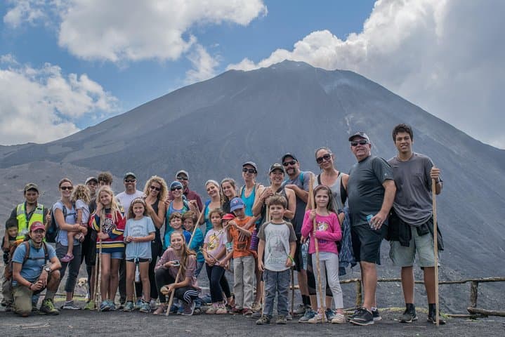
By the time hikers step onto the cooled lava fields the air tastes of sulphur and ash; a guide points toward glowing seams and the summit where steam and occasional orange veins still work beneath the surface.
Verified experiences and guided adventures in the surrounding area.
Operated by OLD TOWN OUTFITTERS · Antigua Guatemala, Sacatepéquez
The trail begins in late afternoon light as a small convoy pulls out of Antigua and climbs toward Pacaya’s rough flank.
By the time hikers step onto the cooled lava fields the air tastes of sulphur and ash; a guide points toward glowing seams and the summit where steam and occasional orange veins still work beneath the surface.
Pacaya is one of Guatemala’s most accessible active volcanoes, part of the Central American volcanic arc that has shaped the highland valleys and towns for millennia. Geologically young basaltic flows create a landscape of jagged ropy lava (aa and pahoehoe textures) mixed with volcanic ash. Culturally, the slopes have long been part of local life—farmers, guides and vendors maintain a practical relationship with this restless neighbor.
On this overnight route groups typically meet in Antigua in the afternoon, drive about an hour to the park office and hike up established trails to camp on hardened lava terraces. Temperatures drop quickly after sunset; the night tends to be cold and clear, with views of Agua, Fuego and Acatenango towering on the horizon. After camp, a relaxed descent returns hikers to Antigua around midday.
Practical guidance: carry a warm sleeping bag and an insulated pad (equipment often provided), a headlamp, sturdy boots and at least 2 liters of water. Expect uneven volcanic rock underfoot and short steep sections; moderate fitness and basic hiking experience make the trip comfortable. Respect active flow zones—follow your guide’s route—and layer for rapid temperature shifts between sunset and morning light.
moderate.
20–24 hours.
Moderate fitness: regular walkers comfortable on uneven terrain and short steep sections.
Expect roughly 3–4 hours ascent depending on pace and trail chosen, with several hundred meters of elevation gain from the park office to camping terraces; guides adjust route to group ability.
The tour typically provides a tent, sleeping pad and sleeping bag; confirm inclusions when booking and request any special sizes or vegetarian meals in advance.
Minimum age is usually 6; the hike is not recommended for people with serious spinal, heart or cardiovascular conditions—ask your provider about alternatives or porters.
Guides lead groups to safe observation points near active surface or subsurface flows, but volcanic activity varies—glows and steam are common, but location and visibility are not guaranteed.
Pacaya sits within the Guatemalan volcanic chain that has influenced settlement patterns and agriculture; its eruptions have redirected trade routes and local livelihoods for centuries.
Visitors are encouraged to stay on designated trails to minimize erosion and avoid fragile re-vegetation zones; support local guides and park fees that fund conservation and trail maintenance.
OLD TOWN OUTFITTERS operates guided outdoor trips and adventures with an emphasis on safety, stewardship, and memorable experiences.


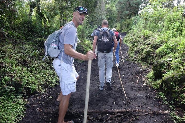
The trail begins in late afternoon light as a small convoy pulls out of Antigua and climbs toward Pacaya’s rough flank.
By the time hikers step onto the cooled lava fields the air tastes of sulphur and ash; a guide points toward glowing seams and the summit where steam and occasional orange veins still work beneath the surface.
Pacaya is one of Guatemala’s most accessible active volcanoes, part of the Central American volcanic arc that has shaped the highland valleys and towns for millennia. Geologically young basaltic flows create a landscape of jagged ropy lava (aa and pahoehoe textures) mixed with volcanic ash. Culturally, the slopes have long been part of local life—farmers, guides and vendors maintain a practical relationship with this restless neighbor.
On this overnight route groups typically meet in Antigua in the afternoon, drive about an hour to the park office and hike up established trails to camp on hardened lava terraces. Temperatures drop quickly after sunset; the night tends to be cold and clear, with views of Agua, Fuego and Acatenango towering on the horizon. After camp, a relaxed descent returns hikers to Antigua around midday.
Practical guidance: carry a warm sleeping bag and an insulated pad (equipment often provided), a headlamp, sturdy boots and at least 2 liters of water. Expect uneven volcanic rock underfoot and short steep sections; moderate fitness and basic hiking experience make the trip comfortable. Respect active flow zones—follow your guide’s route—and layer for rapid temperature shifts between sunset and morning light.