THE ADVENTURE COLLECTIVE® · Independent discovery and booking for outdoor travel

A guided two-day trek through Knuckles’ waterfalls, cloud forest and a 1,856 m summit. Expect steep ridgelines, riverside camps and vivid views—best for fit hikers ready for wet, muddy terrain.
A guided two-day trek through Knuckles’ waterfalls, cloud forest and a 1,856 m summit. Expect steep ridgelines, riverside camps and vivid views—best for fit hikers ready for wet, muddy terrain.
Mist clings to the ridgeline as you step off the vehicle and onto a trail threaded with ferns and tea-scented air. The Knuckles range—named for its knuckle-like peaks—opens like a living map: waterfalls that shout, cloud-swept meadows, and a narrow approach that asks you to move deliberately.
Verified experiences and guided adventures in the surrounding area.
Operated by Overa Tours · Kandy, Central Province
Mist clings to the ridgeline as you step off the vehicle and onto a trail threaded with ferns and tea-scented air. The Knuckles range—named for its knuckle-like peaks—opens like a living map: waterfalls that shout, cloud-swept meadows, and a narrow approach that asks you to move deliberately.
The two-day route follows village tracks and forested gullies to Hulu, Thaliya and Bambarella falls, then climbs toward the Knuckles summit at roughly 1,856 m. Geologically the area is part of Sri Lanka’s Central Highlands, where ancient metamorphic rock rises in steep ridges and soils support unique montane cloud forest. Culturally you’ll pass small upland farming settlements and pockets of tea cultivation; local guides often point out medicinal plants and explain traditional land uses.
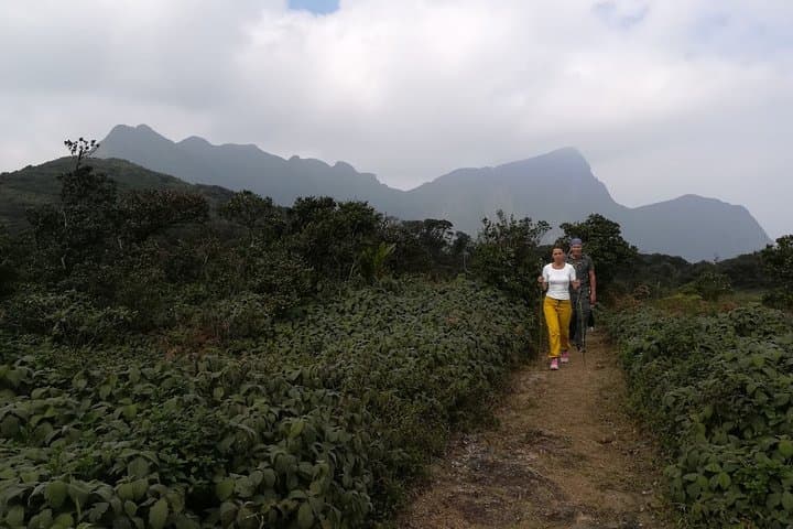
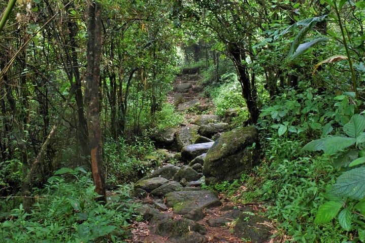
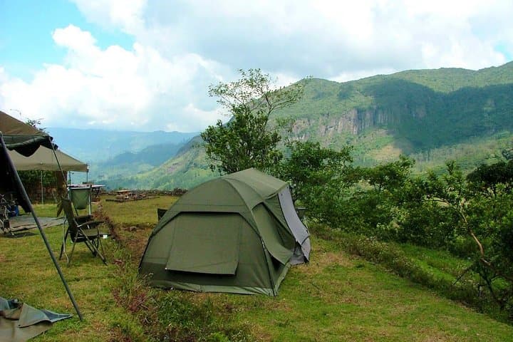
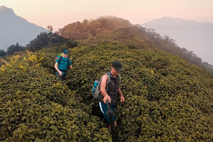
Expect a mix of muddy steps, rocky creek crossings and exposed ridgelines with sudden views. Wildlife is shy but present—look for forest birds and langurs between breaks. The campsite sits near a waterfall, offering an evening of tea by the fire and a predawn start for the summit push.
Practical note: this is guided and requires good cardiovascular fitness and steady footing—pack good boots, rain protection, and at least 2–3 L of water. Start early to avoid afternoon cloud build-up, protect electronics from humidity, and respect local trails—this is a protected landscape with fragile plants and seasonal streams that can swell quickly.
challenging.
2 days.
Requires a high level of cardiovascular fitness and leg strength; comfortable with sustained uphill sections and uneven ground.
This is a challenging two-day trek with sustained climbs, uneven terrain and river crossings; guides expect participants to have good fitness.
Overnight is at a standard campsite near the trail with basic bedding; expect communal cooking and a campfire evening.
Yes—meals, snacks and bottled water are included, but bring extra water if you drink heavily or on hot days.
At roughly 1,856 m the risk is low for most travelers, but take it slow, stay hydrated and tell the guide if you feel unwell.
Known locally as the Dumbara Range, Knuckles has long been a cultural boundary between upland farming communities and lowland plains, with historical tea cultivation on its flanks.
The Knuckles Conservation Forest is a biodiversity hotspot; stick to trails, pack out waste, and avoid disturbing streams and plants to reduce impact.
Overa Tours operates guided outdoor trips and adventures with an emphasis on safety, stewardship, and memorable experiences.
Mist clings to the ridgeline as you step off the vehicle and onto a trail threaded with ferns and tea-scented air. The Knuckles range—named for its knuckle-like peaks—opens like a living map: waterfalls that shout, cloud-swept meadows, and a narrow approach that asks you to move deliberately.
Mist clings to the ridgeline as you step off the vehicle and onto a trail threaded with ferns and tea-scented air. The Knuckles range—named for its knuckle-like peaks—opens like a living map: waterfalls that shout, cloud-swept meadows, and a narrow approach that asks you to move deliberately.
The two-day route follows village tracks and forested gullies to Hulu, Thaliya and Bambarella falls, then climbs toward the Knuckles summit at roughly 1,856 m. Geologically the area is part of Sri Lanka’s Central Highlands, where ancient metamorphic rock rises in steep ridges and soils support unique montane cloud forest. Culturally you’ll pass small upland farming settlements and pockets of tea cultivation; local guides often point out medicinal plants and explain traditional land uses.
Expect a mix of muddy steps, rocky creek crossings and exposed ridgelines with sudden views. Wildlife is shy but present—look for forest birds and langurs between breaks. The campsite sits near a waterfall, offering an evening of tea by the fire and a predawn start for the summit push.
Practical note: this is guided and requires good cardiovascular fitness and steady footing—pack good boots, rain protection, and at least 2–3 L of water. Start early to avoid afternoon cloud build-up, protect electronics from humidity, and respect local trails—this is a protected landscape with fragile plants and seasonal streams that can swell quickly.