THE ADVENTURE COLLECTIVE® · Independent discovery and booking for outdoor travel

A full-day journey from Marrakech into the High Atlas, the Ourika Valley blends short hikes, Berber villages, and waterfall views. This practical guide explains what to expect, how to prepare, and the best times to visit.
A full-day journey from Marrakech into the High Atlas, the Ourika Valley blends short hikes, Berber villages, and waterfall views. This practical guide explains what to expect, how to prepare, and the best times to visit.
You leave the noise of Marrakech behind and the road climbs into the High Atlas: olive terraces give way to almond trees and the air cools as the Ourika River begins to quicken. By mid-morning you’re in a landscape of steep, terraced slopes and flat-bottomed river meadows; the high ridges press close enough to feel the geology—red and gray schist folded into low mountains—while the valley narrows toward Setti Fatma and its cascading falls.
Verified experiences and guided adventures in the surrounding area.
Operated by The Moroccan Trip Planner · Ourika, Marrakesh-Safi
You leave the noise of Marrakech behind and the road climbs into the High Atlas: olive terraces give way to almond trees and the air cools as the Ourika River begins to quicken. By mid-morning you’re in a landscape of steep, terraced slopes and flat-bottomed river meadows; the high ridges press close enough to feel the geology—red and gray schist folded into low mountains—while the valley narrows toward Setti Fatma and its cascading falls.
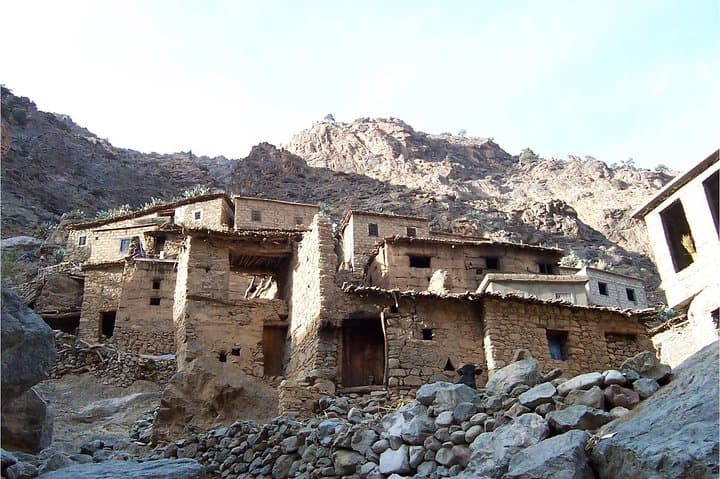
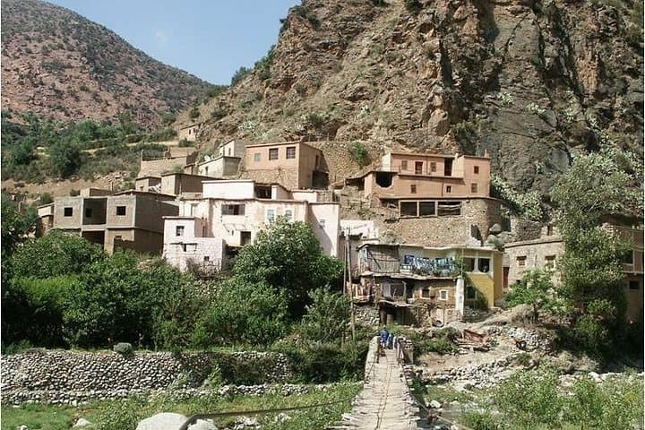
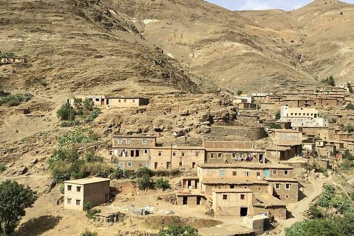
The Ourika Valley is inhabited primarily by Berber communities speaking the Chleuh dialect; centuries of small-scale irrigation and stone retaining walls shape the fields you pass. Geologically it’s an alluvial corridor cut by seasonal torrents fed from snowmelt in winter and spring; historically the route has linked mountain villages to Marrakech’s market economy for generations.
Expect a day of short, steep walks to viewpoints and waterfalls, light scrambling on rocky trails, and visits to roadside markets and a local house if included. Terrain alternates paved valley roads, gravel tracks, and dirt footpaths; elevation change is modest on valley-floor sections but some side trails gain a few hundred metres.
Practical tips: go early to avoid mid-day heat, carry water and sun protection, wear sturdy shoes for wet rock at falls, and bring cash for small purchases. If you’re hiking beyond the main waterfalls, a local guide is useful for route-finding and cultural context. The valley is a straightforward, scenic introduction to the High Atlas—accessible, culturally rich, and best experienced at a relaxed pace.
easy.
10 hours (full-day).
Suitable for people in general good health; minimal sustained exertion but some short steep sections possible
The valley sits about 50 km from Marrakech; typical road travel takes 45–75 minutes each way depending on traffic and exact drop-off point.
Main waterfall walks are short and family-friendly but include slippery rock and some stepped sections; basic footwear is advised.
No—many visitors explore independently or on organized tours; a local guide enhances cultural context and can lead longer, less-marked hikes.
Spring and autumn offer the most comfortable weather and reliable water flow; early mornings in summer avoid heat and crowds.
The Ourika Valley has long been a mountain corridor for Berber communities; terraced agriculture and irrigation systems reflect generations of local land use.
Increased tourism pressures require visitors to stick to trails, avoid littering, and support local businesses to keep benefits in the valley.
The Moroccan Trip Planner operates guided outdoor trips and adventures with an emphasis on safety, stewardship, and memorable experiences.
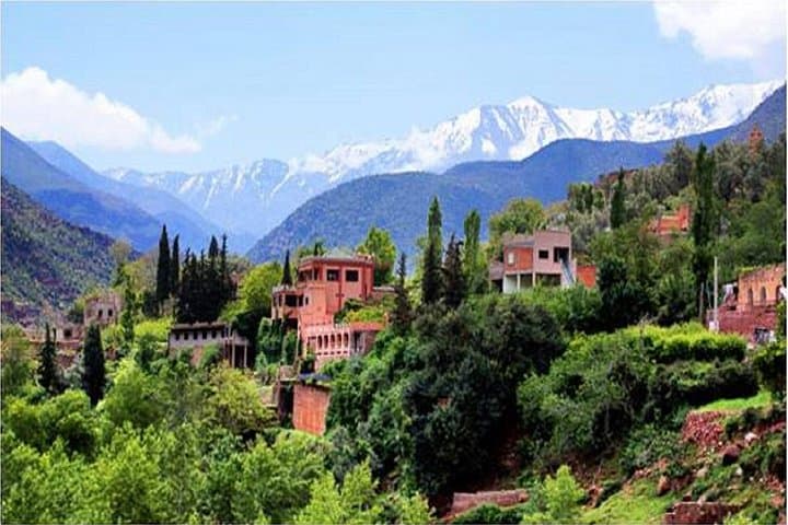
You leave the noise of Marrakech behind and the road climbs into the High Atlas: olive terraces give way to almond trees and the air cools as the Ourika River begins to quicken. By mid-morning you’re in a landscape of steep, terraced slopes and flat-bottomed river meadows; the high ridges press close enough to feel the geology—red and gray schist folded into low mountains—while the valley narrows toward Setti Fatma and its cascading falls.
You leave the noise of Marrakech behind and the road climbs into the High Atlas: olive terraces give way to almond trees and the air cools as the Ourika River begins to quicken. By mid-morning you’re in a landscape of steep, terraced slopes and flat-bottomed river meadows; the high ridges press close enough to feel the geology—red and gray schist folded into low mountains—while the valley narrows toward Setti Fatma and its cascading falls.
The Ourika Valley is inhabited primarily by Berber communities speaking the Chleuh dialect; centuries of small-scale irrigation and stone retaining walls shape the fields you pass. Geologically it’s an alluvial corridor cut by seasonal torrents fed from snowmelt in winter and spring; historically the route has linked mountain villages to Marrakech’s market economy for generations.
Expect a day of short, steep walks to viewpoints and waterfalls, light scrambling on rocky trails, and visits to roadside markets and a local house if included. Terrain alternates paved valley roads, gravel tracks, and dirt footpaths; elevation change is modest on valley-floor sections but some side trails gain a few hundred metres.
Practical tips: go early to avoid mid-day heat, carry water and sun protection, wear sturdy shoes for wet rock at falls, and bring cash for small purchases. If you’re hiking beyond the main waterfalls, a local guide is useful for route-finding and cultural context. The valley is a straightforward, scenic introduction to the High Atlas—accessible, culturally rich, and best experienced at a relaxed pace.