THE ADVENTURE COLLECTIVE® · Independent discovery and booking for outdoor travel

Short but dramatic, the Osmeña Peak hike rewards a brief climb with jagged limestone ridges and sweeping sea views. This practical guide explains what to expect—travel time, terrain, local culture, and tips to make the most of a half-day summit trip.
Short but dramatic, the Osmeña Peak hike rewards a brief climb with jagged limestone ridges and sweeping sea views. This practical guide explains what to expect—travel time, terrain, local culture, and tips to make the most of a half-day summit trip.
A low ridge opens to the sky and the air thins as you climb toward Osmeña Peak, the highest accessible point on Cebu Island. Grass slopes give way to knife-edged limestone teeth; beyond them the sea flashes on the horizon and small islands puncture the blue. The path is short but dramatic—each turn changes the panorama.
Verified experiences and guided adventures in the surrounding area.
Operated by Leisure Pro Journeys · Dalaguete, Cebu
A low ridge opens to the sky and the air thins as you climb toward Osmeña Peak, the highest accessible point on Cebu Island. Grass slopes give way to knife-edged limestone teeth; beyond them the sea flashes on the horizon and small islands puncture the blue. The path is short but dramatic—each turn changes the panorama.
Geology here is immediate: weathered limestone cut into sharp humps and narrow ridgelines, the result of uplift and erosion that shaped Cebu’s southern spine. The surrounding Mantalongon–Dalaguete hills are known locally as the province’s “vegetable basket,” and terraces and small farms sit at the ridge bases, feeding nearby towns.
Culturally, Dalaguete is a working agricultural town where local vendors sell fresh snacks and hot drinks near the trailhead; small chapels and community markers appear on rural roads. The peak has become a favorite for sunrise watchers and drone photographers—its open ridges and sea-facing vistas make aerial shots especially striking.
Practical guidance: the approach from Cebu City or Mactan takes about 2–3 hours by road depending on traffic. Expect a short hike from the parking/registration area—roughly 30–45 minutes of steady walking with modest elevation gain to the peak (~1,000 m above sea level). Trails are grassy and can be slippery when wet; wear sturdy shoes, bring sun protection, and carry at least 1–2 liters of water. Start early for cooler air and clearer views; late afternoons bring clouds and stronger winds. Entrance and trekking fees are typically low and often handled at local checkpoints. If photographing, check local rules for drones and respect private land and grazing areas. The route is family-friendly but avoid it during heavy rain or for those with mobility or serious cardiovascular issues.
moderate.
8–9 hours.
Suitable for most people in decent health; expect a 30–45 minute uphill walk plus travel time and short periods of uneven footing.
From the usual parking/registration area the walk to the summit takes roughly 30–45 minutes depending on pace and stops for photos.
A guide is not mandatory for the short summit walk, but local guides and organized tours can handle transport, fees, and logistics, especially if you’re unfamiliar with the route.
Drone activity is common for aerial shots, but operators should check local regulations, respect privacy, and ask permission if launching from private land or near crowds.
Yes—many families and casual hikers reach the summit, but avoid the path in heavy rain and supervise children on narrow ridgelines.
Osmeña Peak sits on hills long used for small-scale farming; the area’s name honors local geography and ties to southern Cebu communities.
Stick to durable surfaces and avoid littering; local initiatives focus on managing visitor impact and protecting agricultural plots and grazing land.
Leisure Pro Journeys operates guided outdoor trips and adventures with an emphasis on safety, stewardship, and memorable experiences.
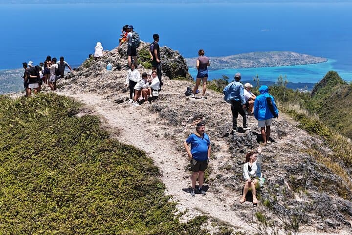
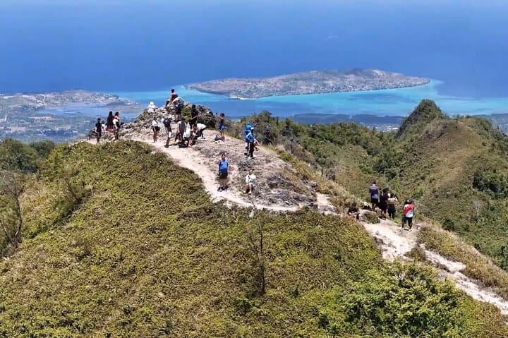
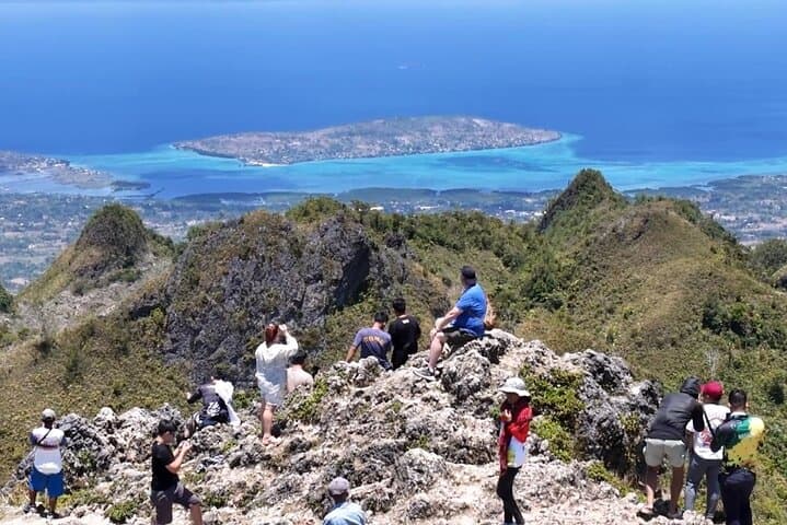
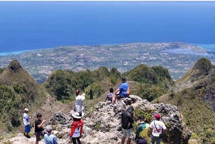
A low ridge opens to the sky and the air thins as you climb toward Osmeña Peak, the highest accessible point on Cebu Island. Grass slopes give way to knife-edged limestone teeth; beyond them the sea flashes on the horizon and small islands puncture the blue. The path is short but dramatic—each turn changes the panorama.
A low ridge opens to the sky and the air thins as you climb toward Osmeña Peak, the highest accessible point on Cebu Island. Grass slopes give way to knife-edged limestone teeth; beyond them the sea flashes on the horizon and small islands puncture the blue. The path is short but dramatic—each turn changes the panorama.
Geology here is immediate: weathered limestone cut into sharp humps and narrow ridgelines, the result of uplift and erosion that shaped Cebu’s southern spine. The surrounding Mantalongon–Dalaguete hills are known locally as the province’s “vegetable basket,” and terraces and small farms sit at the ridge bases, feeding nearby towns.
Culturally, Dalaguete is a working agricultural town where local vendors sell fresh snacks and hot drinks near the trailhead; small chapels and community markers appear on rural roads. The peak has become a favorite for sunrise watchers and drone photographers—its open ridges and sea-facing vistas make aerial shots especially striking.
Practical guidance: the approach from Cebu City or Mactan takes about 2–3 hours by road depending on traffic. Expect a short hike from the parking/registration area—roughly 30–45 minutes of steady walking with modest elevation gain to the peak (~1,000 m above sea level). Trails are grassy and can be slippery when wet; wear sturdy shoes, bring sun protection, and carry at least 1–2 liters of water. Start early for cooler air and clearer views; late afternoons bring clouds and stronger winds. Entrance and trekking fees are typically low and often handled at local checkpoints. If photographing, check local rules for drones and respect private land and grazing areas. The route is family-friendly but avoid it during heavy rain or for those with mobility or serious cardiovascular issues.