THE ADVENTURE COLLECTIVE® · Independent discovery and booking for outdoor travel

Navigate Provence with an IOF map on a three-hour orientation race across sites like the Calanques and Sainte-Victoire. It’s a practical, score-based half-day challenge that pairs navigation skills with rugged Mediterranean terrain.
Navigate Provence with an IOF map on a three-hour orientation race across sites like the Calanques and Sainte-Victoire. It’s a practical, score-based half-day challenge that pairs navigation skills with rugged Mediterranean terrain.
A morning wind off the Mediterranean pins the scent of pine and maquis to your jacket as teams fan out over limestone ridges and shaded tracks. The Orientation Race in Provence drops you onto detailed IOF maps and sends you into a landscape that alternately pushes and shelters: cliffs that dare you to look down toward the sea, soft forest floors that quiet your steps, and open scrub where the sun lays out the route.
Verified experiences and guided adventures in the surrounding area.
Operated by EXPENATURE · Marseille, Provence-Alpes-Côte d'Azur
A morning wind off the Mediterranean pins the scent of pine and maquis to your jacket as teams fan out over limestone ridges and shaded tracks. The Orientation Race in Provence drops you onto detailed IOF maps and sends you into a landscape that alternately pushes and shelters: cliffs that dare you to look down toward the sea, soft forest floors that quiet your steps, and open scrub where the sun lays out the route.
This half-day format has roots in orienteering traditions developed across Europe in the 20th century; the map style and control-tag scoring echo competitive practices used by clubs across France. Geologically, the routes run across folded limestone and sandstone scars carved by Mediterranean weathering; culturally, the terrain carries traces of shepherd paths and Provençal trails used for centuries.
Expect clear instructions and a brief on map symbols before you start, then three hours of flexible, score-based navigation—find as many tags as possible for points, choosing speed over thoroughness or vice versa. Sites rotate between the Calanques coast, Sainte-Victoire’s serrated profile, and inland massifs like Luberon and Alpilles, so terrain can shift from rocky coastal scrub to shaded pine slopes.
Practical guidance: wear sturdy trail shoes with good grip, bring 1–2 liters of water and sun protection, and practice basic compass bearing if you can. Start early in summer for cooler conditions, and allow time after the event to explore nearby villages or the seaside. The activity is suitable for mixed-ability groups and offers a hands-on way to read Provence’s landscape rather than just visit it.
moderate.
3 hours.
Suitable for most fitness levels; participants should be comfortable walking 5–10 km over uneven terrain and climbing short rocky sections.
No — the organizer provides a map legend and a short game to test understanding, though basic map-reading or compass familiarity helps.
Meeting points change by chosen site (Calanques, Sainte-Victoire, Alpilles, Luberon, Estérel); exact location is sent after booking and may require a short walk from parking or public transport stops.
The listing notes wheelchair-accessible options for some logistics, but terrain on course areas is natural and uneven—full course participation is best suited to ambulatory participants.
Yes — the experience is offered as a private tour and can be adapted for mixed-age or skill groups; contact the operator to adjust timing or site choice.
Many trails follow centuries-old shepherd and transhumance routes; local hilltops sometimes host ruins or wartime shelters revealing human use of the landscape.
Stick to marked approaches and avoid trampling fragile maquis; operators emphasize leave-no-trace practices to protect scrubland and calcareous soils.
EXPENATURE operates guided outdoor trips and adventures with an emphasis on safety, stewardship, and memorable experiences.
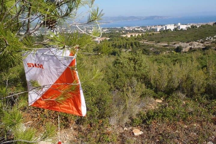
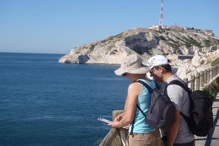
A morning wind off the Mediterranean pins the scent of pine and maquis to your jacket as teams fan out over limestone ridges and shaded tracks. The Orientation Race in Provence drops you onto detailed IOF maps and sends you into a landscape that alternately pushes and shelters: cliffs that dare you to look down toward the sea, soft forest floors that quiet your steps, and open scrub where the sun lays out the route.
A morning wind off the Mediterranean pins the scent of pine and maquis to your jacket as teams fan out over limestone ridges and shaded tracks. The Orientation Race in Provence drops you onto detailed IOF maps and sends you into a landscape that alternately pushes and shelters: cliffs that dare you to look down toward the sea, soft forest floors that quiet your steps, and open scrub where the sun lays out the route.
This half-day format has roots in orienteering traditions developed across Europe in the 20th century; the map style and control-tag scoring echo competitive practices used by clubs across France. Geologically, the routes run across folded limestone and sandstone scars carved by Mediterranean weathering; culturally, the terrain carries traces of shepherd paths and Provençal trails used for centuries.
Expect clear instructions and a brief on map symbols before you start, then three hours of flexible, score-based navigation—find as many tags as possible for points, choosing speed over thoroughness or vice versa. Sites rotate between the Calanques coast, Sainte-Victoire’s serrated profile, and inland massifs like Luberon and Alpilles, so terrain can shift from rocky coastal scrub to shaded pine slopes.
Practical guidance: wear sturdy trail shoes with good grip, bring 1–2 liters of water and sun protection, and practice basic compass bearing if you can. Start early in summer for cooler conditions, and allow time after the event to explore nearby villages or the seaside. The activity is suitable for mixed-ability groups and offers a hands-on way to read Provence’s landscape rather than just visit it.