THE ADVENTURE COLLECTIVE® · Independent discovery and booking for outdoor travel

Spend a single, full day trekking from Ha Giang city through rice terraces and ethnic minority villages. This guided route links Tay, Dao and Hmong communities and delivers cultural encounters alongside steep, scenic trail sections.
Spend a single, full day trekking from Ha Giang city through rice terraces and ethnic minority villages. This guided route links Tay, Dao and Hmong communities and delivers cultural encounters alongside steep, scenic trail sections.
You set out before dawn, headlamp lowering the world to a cone of light while the limestone ribs of the Dong Van plateau resolve against a washed-out sky. The trail drops into terraces that feel like steps carved by generations; children wave from houses painted in indigo and red, and the air tastes faintly of wood smoke and wet earth.
Verified experiences and guided adventures in the surrounding area.
Operated by Ha Giang Road Trip · Ha Giang, Ha Giang Province
You set out before dawn, headlamp lowering the world to a cone of light while the limestone ribs of the Dong Van plateau resolve against a washed-out sky. The trail drops into terraces that feel like steps carved by generations; children wave from houses painted in indigo and red, and the air tastes faintly of wood smoke and wet earth.
Ha Giang’s landscape is recent geology made public — karst ridges scoured by monsoon and decades of terracing that cling to stubborn slopes. The province is home to Tay, Dao and Hmong communities whose languages and textile patterns mark each village. Walking here is as much cultural translation as physical travel: songs, stilt houses, and woven clothes tell stories of land use and lineage.
This one-day route moves between Thon Tha, Khuoi My and Tung Vai villages, threading rice paddies and narrow ridgelines. Expect uneven dirt paths, short steep climbs, and sections that turn muddy after rain; stream crossings are common in the wet season. Guides from local ethnic groups lead with local knowledge — they’ll point out medicinal plants, seasonal crops and techniques used to farm steep ground.
Practical guidance: start early to avoid midday heat and to get the best light on terraces; carry at least 2–3 liters of water, a light rain shell, and sturdy boots with good grip. Respect private plots and ask before photographing people. A moderate-to-high fitness level makes the day enjoyable rather than punishing, and tipping guides directly supports the community tourism project driving this route.
challenging.
6–10 hours.
Good cardiovascular fitness and strong legs for sustained uphill and downhill sections; previous day-hike experience recommended.
It’s a challenging day with sustained climbs and descents; you should be comfortable hiking 6–10 hours and able to handle uneven terrain.
No formal permits for day treks, but always travel with a local guide and ask for permission before entering private village areas.
Lunch and bottled water are typically included; expect simple, local dishes prepared by village hosts.
Many local guides speak Vietnamese and basic English; guides from the Tay, Dao or Hmong communities may translate cultural details and help with interactions.
Ha Giang sits on a geological transition between the Red River Delta and the karst north; ethnic groups have managed steep slopes with terraces for centuries, preserving distinct textile and agricultural traditions.
Tourism here is growing; support locally run projects, stick to trails to avoid eroding terraces, and avoid single-use plastics where possible.
Ha Giang Road Trip operates guided outdoor trips and adventures with an emphasis on safety, stewardship, and memorable experiences.
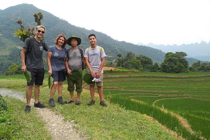
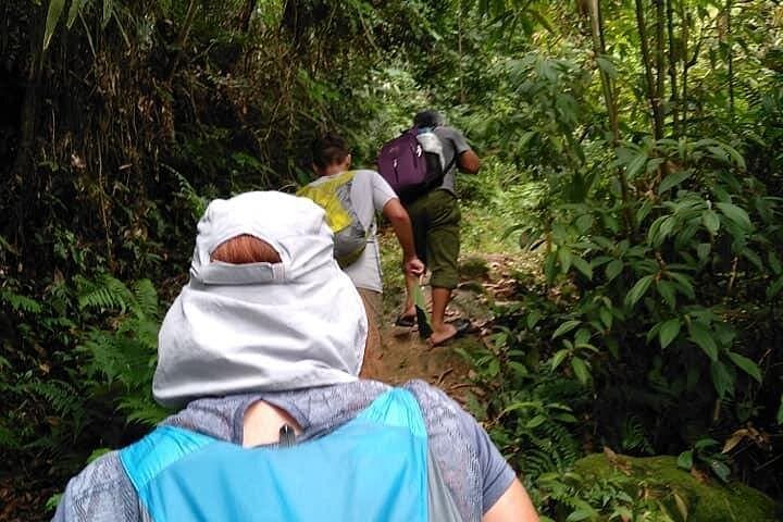
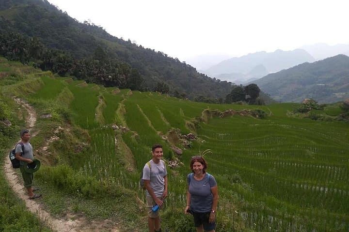
You set out before dawn, headlamp lowering the world to a cone of light while the limestone ribs of the Dong Van plateau resolve against a washed-out sky. The trail drops into terraces that feel like steps carved by generations; children wave from houses painted in indigo and red, and the air tastes faintly of wood smoke and wet earth.
You set out before dawn, headlamp lowering the world to a cone of light while the limestone ribs of the Dong Van plateau resolve against a washed-out sky. The trail drops into terraces that feel like steps carved by generations; children wave from houses painted in indigo and red, and the air tastes faintly of wood smoke and wet earth.
Ha Giang’s landscape is recent geology made public — karst ridges scoured by monsoon and decades of terracing that cling to stubborn slopes. The province is home to Tay, Dao and Hmong communities whose languages and textile patterns mark each village. Walking here is as much cultural translation as physical travel: songs, stilt houses, and woven clothes tell stories of land use and lineage.
This one-day route moves between Thon Tha, Khuoi My and Tung Vai villages, threading rice paddies and narrow ridgelines. Expect uneven dirt paths, short steep climbs, and sections that turn muddy after rain; stream crossings are common in the wet season. Guides from local ethnic groups lead with local knowledge — they’ll point out medicinal plants, seasonal crops and techniques used to farm steep ground.
Practical guidance: start early to avoid midday heat and to get the best light on terraces; carry at least 2–3 liters of water, a light rain shell, and sturdy boots with good grip. Respect private plots and ask before photographing people. A moderate-to-high fitness level makes the day enjoyable rather than punishing, and tipping guides directly supports the community tourism project driving this route.