THE ADVENTURE COLLECTIVE® · Independent discovery and booking for outdoor travel

Three days of high-altitude switchbacks, river canyons and ethnic homestays: the Ha Giang Loop condenses Vietnam's karst drama into a motorbike route that rewards steady riders. Read on for what to expect and how to prepare.
Three days of high-altitude switchbacks, river canyons and ethnic homestays: the Ha Giang Loop condenses Vietnam's karst drama into a motorbike route that rewards steady riders. Read on for what to expect and how to prepare.
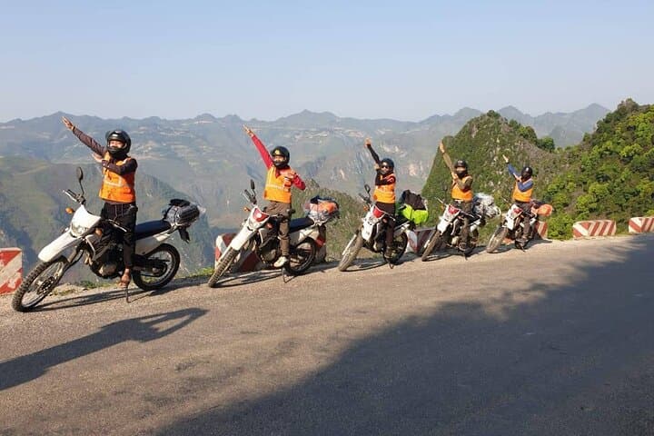
You start before dawn with the engine's low hum and mist clinging to karst ridges, tires finding traction on a road that climbs and narrows until the valley drops away beneath you.
Verified experiences and guided adventures in the surrounding area.
Operated by Local Tours ASIA · Ha Giang, Ha Giang Province
You start before dawn with the engine's low hum and mist clinging to karst ridges, tires finding traction on a road that climbs and narrows until the valley drops away beneath you.
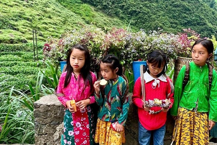
Across three days the Ha Giang Loop moves like a living map: limestone plateaus carved by wind and water, the vertiginous Ma Pi Leng Pass cresting near 2,000 m, and the ribbon of the Nho Que River far below cutting a gorge often shrouded in morning cloud. The region is part of the Ha Giang Karst Plateau Geopark, where geology meets centuries of ethnic life—Hmong, Tay and other communities whose stilt homes, brocade looms (see Lung Tam) and the Vuong family mansion recall layered histories of Chinese, French and local influence.
Expect a mix of paved and rough mountain road, frequent switchbacks, and short off-bike walks to view points and cultural sites. Nights are in simple homestays or dorm-style lodging where Tay and Hmong hospitality is the highlight—try local corn wine and brocade markets in Dong Van.
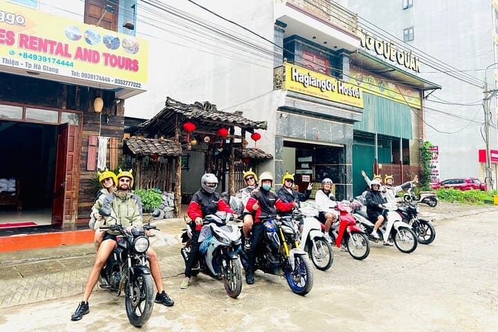
Practical notes: the loop covers roughly 300–350 km across three days with sustained elevation changes; a moderate level of fitness and basic motorcycle experience help. Operator-provided helmets, protective padding and basic rain gear are included, but bring a breathable rain shell, good riding gloves, and layered clothes for cold at higher passes. Ride mid-morning for best light and avoid tight schedules—roads here have mood swings and the landscape will insist you stop.
moderate.
3 days (approx. 72 hours).
Moderate — able to handle multiple hours on a motorcycle each day and short hikes at altitude
Yes—participants should have a valid motorcycle license and basic riding experience; guides expect riders to be confident on winding mountain roads.
Most of the loop is paved but includes narrow, gravelly sections and steep switchbacks; basic handling and clutch control are sufficient for the standard route.
Nights alternate between simple homestays and dorm-style or modest local hotels—expect shared facilities and authentic local meals included on the itinerary.
Operators monitor conditions; heavy rain or landslides can force route changes—cancellation policy allows refund if you cancel more than 3 days prior, but same-day weather closures are handled case-by-case.
The Vuong family mansion in Sa Phin reflects early 20th-century Hmong leadership and mixed French-Chinese architectural influence, symbolizing the region's layered past.
Stick to main roads and marked viewpoints, avoid single-use plastics in villages, and favor homestays to support local economies and conserve cultural landscapes.
Local Tours ASIA operates guided outdoor trips and adventures with an emphasis on safety, stewardship, and memorable experiences.

You start before dawn with the engine's low hum and mist clinging to karst ridges, tires finding traction on a road that climbs and narrows until the valley drops away beneath you.
You start before dawn with the engine's low hum and mist clinging to karst ridges, tires finding traction on a road that climbs and narrows until the valley drops away beneath you.
Across three days the Ha Giang Loop moves like a living map: limestone plateaus carved by wind and water, the vertiginous Ma Pi Leng Pass cresting near 2,000 m, and the ribbon of the Nho Que River far below cutting a gorge often shrouded in morning cloud. The region is part of the Ha Giang Karst Plateau Geopark, where geology meets centuries of ethnic life—Hmong, Tay and other communities whose stilt homes, brocade looms (see Lung Tam) and the Vuong family mansion recall layered histories of Chinese, French and local influence.
Expect a mix of paved and rough mountain road, frequent switchbacks, and short off-bike walks to view points and cultural sites. Nights are in simple homestays or dorm-style lodging where Tay and Hmong hospitality is the highlight—try local corn wine and brocade markets in Dong Van.
Practical notes: the loop covers roughly 300–350 km across three days with sustained elevation changes; a moderate level of fitness and basic motorcycle experience help. Operator-provided helmets, protective padding and basic rain gear are included, but bring a breathable rain shell, good riding gloves, and layered clothes for cold at higher passes. Ride mid-morning for best light and avoid tight schedules—roads here have mood swings and the landscape will insist you stop.