THE ADVENTURE COLLECTIVE® · Independent discovery and booking for outdoor travel

Drive up above Pokhara, walk ridge tracks between Naudanda and Sarangkot, and stand beneath a line of Himalayan peaks—Machhapuchhre, Annapurna and Dhaulagiri—on a single day. This guided outing pairs accessible trails with panoramic viewpoints and local cultural stops.
Drive up above Pokhara, walk ridge tracks between Naudanda and Sarangkot, and stand beneath a line of Himalayan peaks—Machhapuchhre, Annapurna and Dhaulagiri—on a single day. This guided outing pairs accessible trails with panoramic viewpoints and local cultural stops.
A pre-dawn jeep ride lifts you above Pokhara’s rim and drops you at Naudanda, where terraces and scrub slope away toward Phewa Lake and a wall of snow begins to rise on the horizon. The air is thin, clean and cold; the Annapurna massif—Machhapuchhre’s sharp blade, Annapurna II’s bulk and distant Dhaulagiri—compose a low, luminous skyline that changes color with every minute of sunrise.
Verified experiences and guided adventures in the surrounding area.
Operated by Altitude Himalaya · Pokhara, Gandaki Province
A pre-dawn jeep ride lifts you above Pokhara’s rim and drops you at Naudanda, where terraces and scrub slope away toward Phewa Lake and a wall of snow begins to rise on the horizon. The air is thin, clean and cold; the Annapurna massif—Machhapuchhre’s sharp blade, Annapurna II’s bulk and distant Dhaulagiri—compose a low, luminous skyline that changes color with every minute of sunrise.
Geology here is Himalayan: uplifted sedimentary layers pushed and folded into jagged peaks. Culturally the route crosses Gurung and Magar villages where stone houses and prayer flags mark centuries of mountain life; Kaskikot’s ruined kot on the ridge hints at the area's strategic past. Naudanda is also a recognized vulture viewing area, where thermal currents gather scavengers that circle the ridgelines.
The guided day hike typically follows a mix of dirt track and stone steps between Naudanda (≈1,443 m) and Sarangkot, with optional side trips to a grassy helicopter pad and Kaskikot fort. Expect 6–8 km of walking with 300–500 m cumulative ascent depending on your start point; terrain is uneven and includes steep stair sections.
Plan for early starts to catch the dawn light on the Annapurnas, bring layered clothing for wind and sun, and carry 1–2 liters of water. A local guide handles route-finding, lunch at the Sarangkot viewpoint (≈1,610 m) and any permits. The hike works as a gentle acclimatizing day before longer treks, a family outing, or a standalone morning that leaves the afternoon free in Pokhara.
moderate.
7–9 hours.
Suitable for people who can walk several hours and handle short steep sections; basic cardio fitness recommended.
The route is classified as moderate: mostly walking on dirt tracks and stone steps with 300–500 m cumulative ascent; a guide adjusts pace for groups.
Elevations reach about 1,600 m; risks are low for most visitors, but anyone with prior altitude sensitivity should take it slowly and stay hydrated.
This offering is a private guided hike—the guide manages route-finding and entrance fees; no special permits are required for a day hike.
Depart Pokhara early (pre-dawn) to reach Sarangkot for sunrise and the best mountain light; the full activity day runs about 7–9 hours including transfers.
The ridge has long been inhabited by Gurung and Magar communities; Kaskikot was historically a hill fort controlling trade routes into the valley.
Vulture populations are monitored here—avoid feeding birds and follow local guidelines to minimize disturbance; stick to trails to protect fragile alpine vegetation.
Altitude Himalaya operates guided outdoor trips and adventures with an emphasis on safety, stewardship, and memorable experiences.
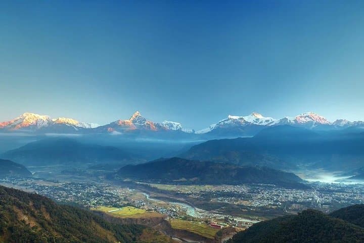
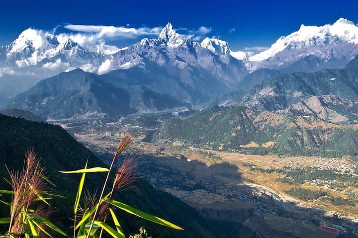
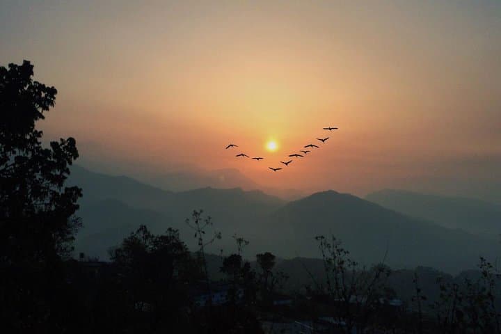
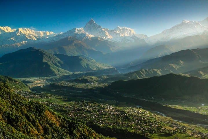
A pre-dawn jeep ride lifts you above Pokhara’s rim and drops you at Naudanda, where terraces and scrub slope away toward Phewa Lake and a wall of snow begins to rise on the horizon. The air is thin, clean and cold; the Annapurna massif—Machhapuchhre’s sharp blade, Annapurna II’s bulk and distant Dhaulagiri—compose a low, luminous skyline that changes color with every minute of sunrise.
A pre-dawn jeep ride lifts you above Pokhara’s rim and drops you at Naudanda, where terraces and scrub slope away toward Phewa Lake and a wall of snow begins to rise on the horizon. The air is thin, clean and cold; the Annapurna massif—Machhapuchhre’s sharp blade, Annapurna II’s bulk and distant Dhaulagiri—compose a low, luminous skyline that changes color with every minute of sunrise.
Geology here is Himalayan: uplifted sedimentary layers pushed and folded into jagged peaks. Culturally the route crosses Gurung and Magar villages where stone houses and prayer flags mark centuries of mountain life; Kaskikot’s ruined kot on the ridge hints at the area's strategic past. Naudanda is also a recognized vulture viewing area, where thermal currents gather scavengers that circle the ridgelines.
The guided day hike typically follows a mix of dirt track and stone steps between Naudanda (≈1,443 m) and Sarangkot, with optional side trips to a grassy helicopter pad and Kaskikot fort. Expect 6–8 km of walking with 300–500 m cumulative ascent depending on your start point; terrain is uneven and includes steep stair sections.
Plan for early starts to catch the dawn light on the Annapurnas, bring layered clothing for wind and sun, and carry 1–2 liters of water. A local guide handles route-finding, lunch at the Sarangkot viewpoint (≈1,610 m) and any permits. The hike works as a gentle acclimatizing day before longer treks, a family outing, or a standalone morning that leaves the afternoon free in Pokhara.