THE ADVENTURE COLLECTIVE® · Independent discovery and booking for outdoor travel

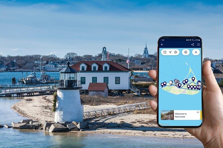
Ride or drive across Nantucket from Madaket to Sconset with a GPS-guided audio tour that highlights lighthouses, historic homes and coastal panoramas. Download the Drives & Detours app, bring your own bike (or take it by car), and expect 3–6 hours of exploration.
Ride or drive across Nantucket from Madaket to Sconset with a GPS-guided audio tour that highlights lighthouses, historic homes and coastal panoramas. Download the Drives & Detours app, bring your own bike (or take it by car), and expect 3–6 hours of exploration.
You start at the corner of Broad and South Beach Street, the harbor’s salt breeze pushing at your jacket and gulls cutting the sky. The town’s clapboard roofs and narrow lanes give way quickly to long, open roads where dunes lean toward the sea and the island unfolds—Madaket’s low skyline to the west, Sconset’s bluffs and lighthouse to the east.
Verified experiences and guided adventures in the surrounding area.
Operated by Drives & Detours · Nantucket, Massachusetts
You start at the corner of Broad and South Beach Street, the harbor’s salt breeze pushing at your jacket and gulls cutting the sky. The town’s clapboard roofs and narrow lanes give way quickly to long, open roads where dunes lean toward the sea and the island unfolds—Madaket’s low skyline to the west, Sconset’s bluffs and lighthouse to the east.
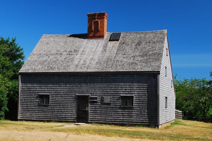
Nantucket’s story is written in whaling ships, cranberry bogs and 19th-century stone foundations. Geologically the island is a glacial outwash—sand and gravel shaped by currents and wind—so roads are mostly flat to gently rolling with occasional dunes and beachside exposure. Cultural markers appear as you go: the Maria Mitchell House, historic windmills and the Whaling Museum recall a maritime past; small village pockets like Sconset reveal gardens and summer cottages once owned by whaling families.
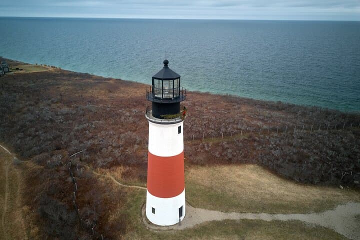
This self-guided Drives & Detours route lets the audio and map lead you: GPS-triggered narration punctuates stops like Sankaty Head Lighthouse, the “Serengeti” undeveloped plain and the old cranberry bogs. Expect paved roads, quiet back lanes and short walks to viewpoints. If you bike, plan for 10–20 miles depending on detours; most riders complete the coast-to-coast in 3–6 hours at a steady pace.
Practical tips: download the Drives & Detours app and the included tour before you arrive (access code provided), bring sun protection against strong coastal light, and carry water and a basic repair kit if cycling. If you prefer a relaxed day, drive the route and make selective stops—museums listed on the tour have separate admissions. Time your trip for lower wind in the morning or late afternoon to keep crosswinds from turning rides into chores.
moderate.
3–6 hours.
Suitable for most riders and drivers; cyclists should be comfortable on mixed paved roads for 10–20 miles with light rolling grades.
No—this listing is a self-guided tour only; you must bring or rent a bike separately (Young's Bike Shop and Cook's Cycles are recommended).
Download the Drives & Detours app, enter access code JTV552, download the Nantucket tour and start at Broad & South Beach Street in town.
Yes—the tour supports driving or biking; driving reduces physical demand and lets you hit more museum stops without fatigue.
No—museums such as Maria Mitchell ($8) and the Whaling Museum ($12) have separate admissions noted in the tour content.
Nantucket rose to prominence in the 18th–19th centuries as a global whaling hub; later cranberry farming and summer tourism reshaped the island’s economy and landscape.
Many coastal areas are protected to preserve nesting shorebirds and fragile dunes—stay on designated paths and respect closures to limit erosion and disturbance.
Drives & Detours operates guided outdoor trips and adventures with an emphasis on safety, stewardship, and memorable experiences.

You start at the corner of Broad and South Beach Street, the harbor’s salt breeze pushing at your jacket and gulls cutting the sky. The town’s clapboard roofs and narrow lanes give way quickly to long, open roads where dunes lean toward the sea and the island unfolds—Madaket’s low skyline to the west, Sconset’s bluffs and lighthouse to the east.
You start at the corner of Broad and South Beach Street, the harbor’s salt breeze pushing at your jacket and gulls cutting the sky. The town’s clapboard roofs and narrow lanes give way quickly to long, open roads where dunes lean toward the sea and the island unfolds—Madaket’s low skyline to the west, Sconset’s bluffs and lighthouse to the east.
Nantucket’s story is written in whaling ships, cranberry bogs and 19th-century stone foundations. Geologically the island is a glacial outwash—sand and gravel shaped by currents and wind—so roads are mostly flat to gently rolling with occasional dunes and beachside exposure. Cultural markers appear as you go: the Maria Mitchell House, historic windmills and the Whaling Museum recall a maritime past; small village pockets like Sconset reveal gardens and summer cottages once owned by whaling families.
This self-guided Drives & Detours route lets the audio and map lead you: GPS-triggered narration punctuates stops like Sankaty Head Lighthouse, the “Serengeti” undeveloped plain and the old cranberry bogs. Expect paved roads, quiet back lanes and short walks to viewpoints. If you bike, plan for 10–20 miles depending on detours; most riders complete the coast-to-coast in 3–6 hours at a steady pace.
Practical tips: download the Drives & Detours app and the included tour before you arrive (access code provided), bring sun protection against strong coastal light, and carry water and a basic repair kit if cycling. If you prefer a relaxed day, drive the route and make selective stops—museums listed on the tour have separate admissions. Time your trip for lower wind in the morning or late afternoon to keep crosswinds from turning rides into chores.