THE ADVENTURE COLLECTIVE® · Independent discovery and booking for outdoor travel

Turn Nantes into a live puzzle: this app-driven, self-guided scavenger hunt leads you to Château des ducs de Bretagne, Passage Pommeraye and Place Graslin with clues, photo tasks and local history. Ideal for curious walkers who want a compact, playful city exploration.
Turn Nantes into a live puzzle: this app-driven, self-guided scavenger hunt leads you to Château des ducs de Bretagne, Passage Pommeraye and Place Graslin with clues, photo tasks and local history. Ideal for curious walkers who want a compact, playful city exploration.
You step off the tram and the Loire breathes across the quay; cobblestones underfoot lead you toward a compact city center that rewards curiosity. This self-guided scavenger hunt turns Nantes into a playable map—phone in hand you follow clues from the shadowed ramparts of Château des ducs de Bretagne to the glass-covered galleries of Passage Pommeraye and the theater-lit facades of Place Graslin.
Verified experiences and guided adventures in the surrounding area.
Operated by Explorial · Nantes, Pays de la Loire
You step off the tram and the Loire breathes across the quay; cobblestones underfoot lead you toward a compact city center that rewards curiosity. This self-guided scavenger hunt turns Nantes into a playable map—phone in hand you follow clues from the shadowed ramparts of Château des ducs de Bretagne to the glass-covered galleries of Passage Pommeraye and the theater-lit facades of Place Graslin.
Nantes wears history openly: a medieval ducal seat, a Renaissance port and an industrial hub reshaped by 20th-century shipbuilding. Geologically, the city sits where Loire plain deposits meet older schists, giving way to tree-lined canals and narrow alleys. Local culture mixes Breton roots with contemporary art—street sculptures, market stalls and cafés spill into public squares.
The experience is practical: download the app, enter an access code, and follow map prompts to each waypoint. Tasks range from observation questions at monuments to creative photo challenges that reward ingenuity rather than speed. The route is flat and largely on paved streets, making it accessible for most walkers, though the provider notes it's not wheelchair accessible.
Plan for 1–2 hours, wear comfortable shoes, and bring a charged smartphone and data or Wi‑Fi. Peak crowds arrive mid-afternoon in summer; early mornings or late afternoons deliver cooler light and clearer photos. Public transport hubs sit near starting points, and the self-paced format lets you pause for a coffee or detour to Île Feydeau. Treat historic sites respectfully, carry water, and keep an eye on pickpockets in busy areas—this is urban adventure with a practical, playful edge.
easy.
1–2 hours.
Suitable for most fitness levels; mainly flat walking with stairs at some historic sites
After purchase you receive an access code; download the app, enter the code at the starting point indicated, then follow the in-app map and tasks.
The experience is offered in French and English; language selection appears in the app when you begin.
Yes—tasks are designed for a broad audience and can be adapted for families; children will enjoy photo challenges but parental supervision is advised in busy areas.
The provider notes it is not wheelchair accessible due to stairs and uneven cobbles at some waypoints, though many streets are level and public transport is nearby.
Nantes was once the capital of the Duchy of Brittany and later an important Atlantic port; Château des ducs de Bretagne holds a museum tracing that history.
The city promotes river restoration and sustainable transport—stick to marked areas, avoid littering and respect historic sites to minimize impact.
Explorial operates guided outdoor trips and adventures with an emphasis on safety, stewardship, and memorable experiences.


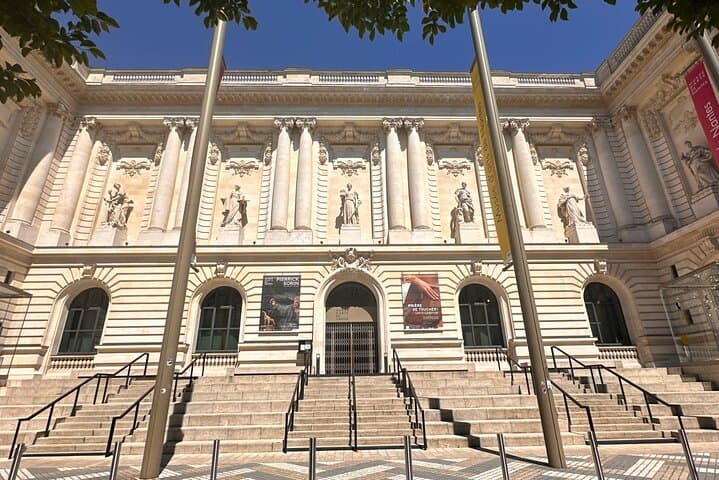

You step off the tram and the Loire breathes across the quay; cobblestones underfoot lead you toward a compact city center that rewards curiosity. This self-guided scavenger hunt turns Nantes into a playable map—phone in hand you follow clues from the shadowed ramparts of Château des ducs de Bretagne to the glass-covered galleries of Passage Pommeraye and the theater-lit facades of Place Graslin.
You step off the tram and the Loire breathes across the quay; cobblestones underfoot lead you toward a compact city center that rewards curiosity. This self-guided scavenger hunt turns Nantes into a playable map—phone in hand you follow clues from the shadowed ramparts of Château des ducs de Bretagne to the glass-covered galleries of Passage Pommeraye and the theater-lit facades of Place Graslin.
Nantes wears history openly: a medieval ducal seat, a Renaissance port and an industrial hub reshaped by 20th-century shipbuilding. Geologically, the city sits where Loire plain deposits meet older schists, giving way to tree-lined canals and narrow alleys. Local culture mixes Breton roots with contemporary art—street sculptures, market stalls and cafés spill into public squares.
The experience is practical: download the app, enter an access code, and follow map prompts to each waypoint. Tasks range from observation questions at monuments to creative photo challenges that reward ingenuity rather than speed. The route is flat and largely on paved streets, making it accessible for most walkers, though the provider notes it's not wheelchair accessible.
Plan for 1–2 hours, wear comfortable shoes, and bring a charged smartphone and data or Wi‑Fi. Peak crowds arrive mid-afternoon in summer; early mornings or late afternoons deliver cooler light and clearer photos. Public transport hubs sit near starting points, and the self-paced format lets you pause for a coffee or detour to Île Feydeau. Treat historic sites respectfully, carry water, and keep an eye on pickpockets in busy areas—this is urban adventure with a practical, playful edge.