THE ADVENTURE COLLECTIVE® · Independent discovery and booking for outdoor travel

A compact Himalayan day-hike from Nagarkot to the 7th-century Changunarayan temple, this route serves sunrise mountain views, village culture and mixed forest trails. Expect 3–4 hours of hiking across terraces and stone steps, with rich cultural stops at the endpoint.
A compact Himalayan day-hike from Nagarkot to the 7th-century Changunarayan temple, this route serves sunrise mountain views, village culture and mixed forest trails. Expect 3–4 hours of hiking across terraces and stone steps, with rich cultural stops at the endpoint.
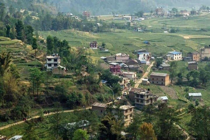
Before dawn the ridge at Nagarkot stiffens into silhouette: rows of stone houses, terraced fields, and the distant teeth of the Himalaya catching first light. The climb and descent from that ridge push you through Tamang villages, pocket orchards and a forest where moss-dripped trunks lean over narrow footpaths.
Verified experiences and guided adventures in the surrounding area.
Operated by Mountain Hike Nepal · Nagarkot, Bagmati Province
Before dawn the ridge at Nagarkot stiffens into silhouette: rows of stone houses, terraced fields, and the distant teeth of the Himalaya catching first light. The climb and descent from that ridge push you through Tamang villages, pocket orchards and a forest where moss-dripped trunks lean over narrow footpaths.
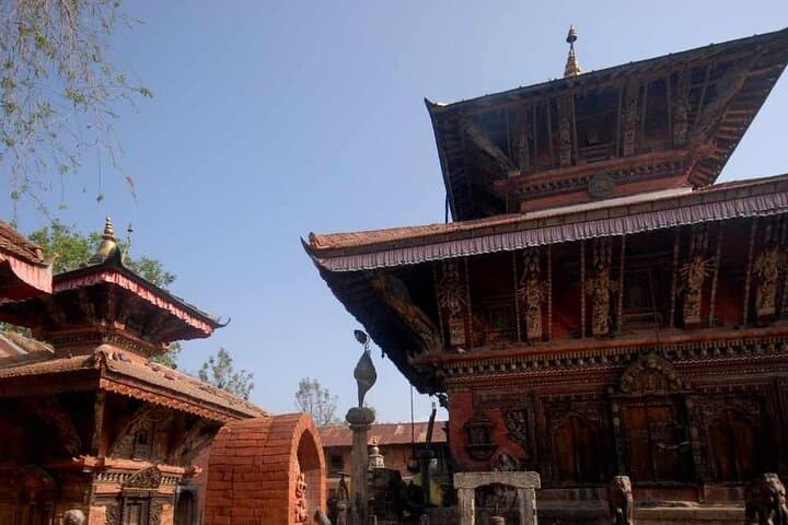
This route links Nagarkot (about 2,200 m / 7,200 ft) with the ancient Changunarayan temple, part of the Kathmandu Valley’s UNESCO sites and dating to the 7th century. Geologically you walk the outer rim of the Kathmandu basin — weathered slopes, human-cut terraces, and mixed broadleaf forest that gives way to cultivated land. Culturally the trail is a living corridor: Tamang households, traditional brickwork, and small shrines line the way, while local farmers tend seasonal crops.
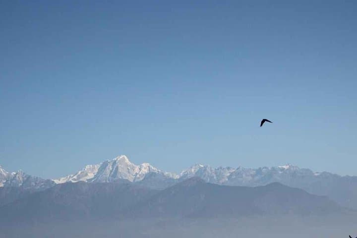
Expect roughly 6–8 km of trail one-way depending on the path chosen, with an overall elevation change of about 300–500 m (mostly descending toward Changunarayan). Terrain alternates packed dirt, stone steps and narrow village lanes; sections can be steep but non-technical. Sunrise departures reward clear mountain panoramas — Ganesh Himal, Langtang, Gauri Shankar and, on exceptional mornings, Everest.
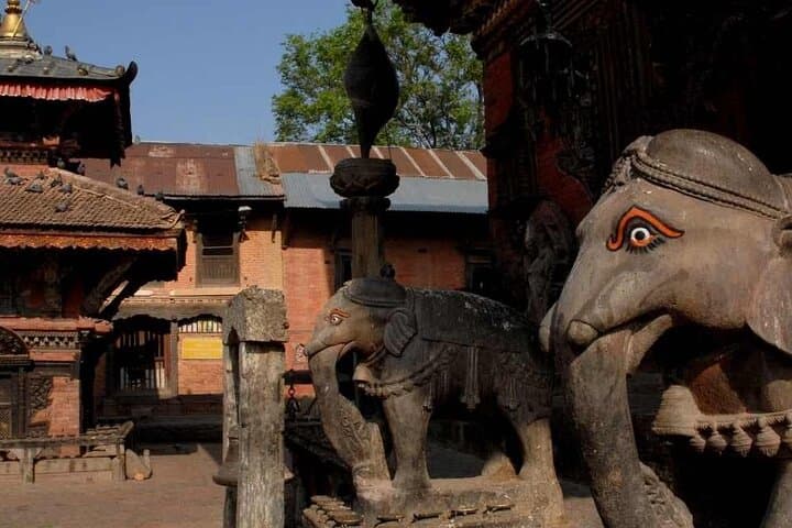
Practical guidance: start very early for sunrise, bring layers and a headlamp, and plan for variable footing after rain. Respect temple etiquette at Changunarayan: modest clothing and removing shoes where requested. Water is limited on route—carry enough, pack out waste, and allow time to explore the temple courtyard and carved woodwork before the drive back to Kathmandu.
moderate.
3–4 hours (hiking portion).
Suitable for fit walkers and casual hikers who can manage sustained up-and-down walking for a few hours; not technical but requires steady legs.
The walking section typically takes 3–4 hours round-trip depending on route, pace and stops—expect 6–8 km one-way options and a net descent of a few hundred meters.
Yes—it's non-technical and suitable for most people in reasonable health, though uneven steps and some steep sections mean sturdy shoes and basic fitness are required.
On very clear mornings the high Himalayan skyline includes Everest in the eastern chain, but visibility depends on season and air clarity—autumn and spring are best.
Small tea houses and village stalls appear near Nagarkot and around Changunarayan, but on-trail facilities are limited—carry toilet paper and snacks.
Changu Narayan temple dates back to the 7th century and is part of the Kathmandu Valley UNESCO World Heritage complex, noted for its ancient stone inscriptions and woodcarving.
Trails are susceptible to erosion and litter; stick to established paths, carry out waste, and support local homestays or guides to benefit village economies.
Mountain Hike Nepal operates guided outdoor trips and adventures with an emphasis on safety, stewardship, and memorable experiences.
Before dawn the ridge at Nagarkot stiffens into silhouette: rows of stone houses, terraced fields, and the distant teeth of the Himalaya catching first light. The climb and descent from that ridge push you through Tamang villages, pocket orchards and a forest where moss-dripped trunks lean over narrow footpaths.
Before dawn the ridge at Nagarkot stiffens into silhouette: rows of stone houses, terraced fields, and the distant teeth of the Himalaya catching first light. The climb and descent from that ridge push you through Tamang villages, pocket orchards and a forest where moss-dripped trunks lean over narrow footpaths.
This route links Nagarkot (about 2,200 m / 7,200 ft) with the ancient Changunarayan temple, part of the Kathmandu Valley’s UNESCO sites and dating to the 7th century. Geologically you walk the outer rim of the Kathmandu basin — weathered slopes, human-cut terraces, and mixed broadleaf forest that gives way to cultivated land. Culturally the trail is a living corridor: Tamang households, traditional brickwork, and small shrines line the way, while local farmers tend seasonal crops.
Expect roughly 6–8 km of trail one-way depending on the path chosen, with an overall elevation change of about 300–500 m (mostly descending toward Changunarayan). Terrain alternates packed dirt, stone steps and narrow village lanes; sections can be steep but non-technical. Sunrise departures reward clear mountain panoramas — Ganesh Himal, Langtang, Gauri Shankar and, on exceptional mornings, Everest.
Practical guidance: start very early for sunrise, bring layers and a headlamp, and plan for variable footing after rain. Respect temple etiquette at Changunarayan: modest clothing and removing shoes where requested. Water is limited on route—carry enough, pack out waste, and allow time to explore the temple courtyard and carved woodwork before the drive back to Kathmandu.