THE ADVENTURE COLLECTIVE® · Independent discovery and booking for outdoor travel

A brisk 10 km loop from 1,530m to 2,100m across tea plantations, grassland and forest — this four-hour trek mixes big ridge views with textured plantation landscapes. Ideal for hikers with moderate fitness who want a concise, locally guided hike in the Western Ghats.
A brisk 10 km loop from 1,530m to 2,100m across tea plantations, grassland and forest — this four-hour trek mixes big ridge views with textured plantation landscapes. Ideal for hikers with moderate fitness who want a concise, locally guided hike in the Western Ghats.
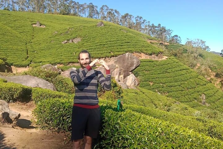
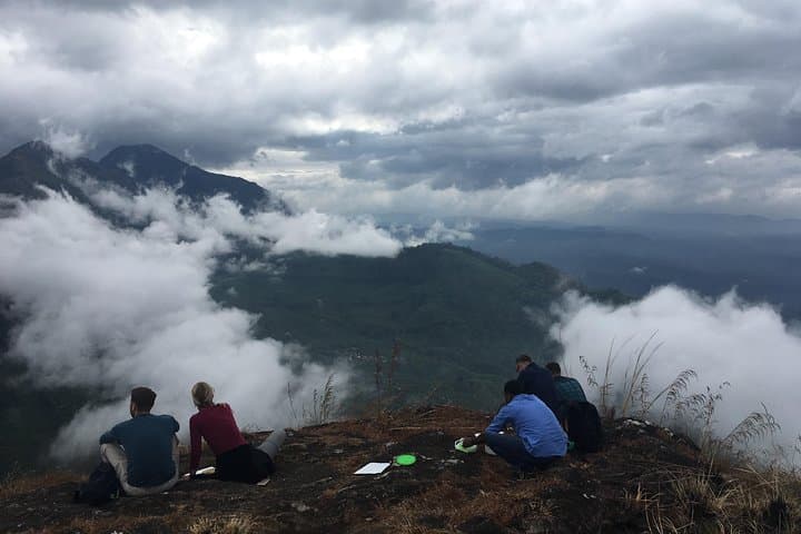
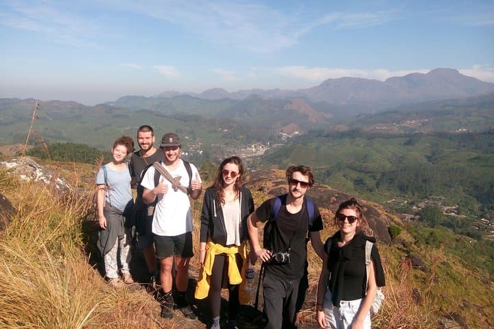
Fog lifts off the tea rows as you step onto a narrow dirt track at 1,530 metres, the world shrinking to the hiss of leaves and a steady boot rhythm. The trail climbs through neat, manicured tea fields, gives way to shoulder-high grassland and then tight, cool forest; rocks appear like punctuation marks underfoot. By 10:30 you reach the ridge at about 2,100 metres — a wide, wind-brushed vantage where plantation slopes fall away and the Western Ghats roll toward the horizon.
Verified experiences and guided adventures in the surrounding area.
Operated by munnar valley trekking & tours · Munnar, Kerala
Fog lifts off the tea rows as you step onto a narrow dirt track at 1,530 metres, the world shrinking to the hiss of leaves and a steady boot rhythm. The trail climbs through neat, manicured tea fields, gives way to shoulder-high grassland and then tight, cool forest; rocks appear like punctuation marks underfoot. By 10:30 you reach the ridge at about 2,100 metres — a wide, wind-brushed vantage where plantation slopes fall away and the Western Ghats roll toward the horizon.
This route threads colonial-era tea country and older geology: weathered laterite and hornblende schist carved by monsoon run-off. Culturally, the walk passes land worked by generations of laborers; small tea huts and winding access lanes are reminders that the views are framed by a living agricultural landscape.
Expect a 10 km loop completed in roughly four hours with about 570 m of ascent overall, moderate footing and some short, steeper pitches when crossing rock slabs. The operator includes a local guide, tea-plantation entry, bottled water, fruits and snacks — luggage storage and restrooms are available at the meeting point (Rijo Villa). Groups are kept small (up to 10).
Practical notes: wear grippy trail shoes, use layered clothing for quick temperature swings, and start early to avoid midday humidity. Monsoon months make rock sections slippery; if rain is forecast the operator may reschedule. Bring a light daypack, sun protection and respect private plantation boundaries — stick to the guide’s route.
moderate.
4 hours.
Moderate—regular hikers or active visitors comfortable with sustained climbs and uneven terrain.
It’s rated medium-hard: 10 km with roughly 570 m of elevation gain; expect steady climbs and short steep sections but no technical climbing.
Guide, tea-plantation entry, bottled water, fruits, snacks, and access to luggage storage and restrooms at the meeting point.
September–March offers clearer skies and cooler temperatures; avoid peak monsoon months (June–August) due to heavy rain and slippery trails.
Pickup and drop-off can be arranged for an additional cost—confirm with the operator when booking.
The walk crosses estates established during British colonial tea expansion; many access roads began as plantation service tracks.
Stick to trails and follow guides’ directions—tea-country erosion and litter are local concerns; use refillable bottles to reduce plastic waste.
munnar valley trekking & tours operates guided outdoor trips and adventures with an emphasis on safety, stewardship, and memorable experiences.

Fog lifts off the tea rows as you step onto a narrow dirt track at 1,530 metres, the world shrinking to the hiss of leaves and a steady boot rhythm. The trail climbs through neat, manicured tea fields, gives way to shoulder-high grassland and then tight, cool forest; rocks appear like punctuation marks underfoot. By 10:30 you reach the ridge at about 2,100 metres — a wide, wind-brushed vantage where plantation slopes fall away and the Western Ghats roll toward the horizon.
Fog lifts off the tea rows as you step onto a narrow dirt track at 1,530 metres, the world shrinking to the hiss of leaves and a steady boot rhythm. The trail climbs through neat, manicured tea fields, gives way to shoulder-high grassland and then tight, cool forest; rocks appear like punctuation marks underfoot. By 10:30 you reach the ridge at about 2,100 metres — a wide, wind-brushed vantage where plantation slopes fall away and the Western Ghats roll toward the horizon.
This route threads colonial-era tea country and older geology: weathered laterite and hornblende schist carved by monsoon run-off. Culturally, the walk passes land worked by generations of laborers; small tea huts and winding access lanes are reminders that the views are framed by a living agricultural landscape.
Expect a 10 km loop completed in roughly four hours with about 570 m of ascent overall, moderate footing and some short, steeper pitches when crossing rock slabs. The operator includes a local guide, tea-plantation entry, bottled water, fruits and snacks — luggage storage and restrooms are available at the meeting point (Rijo Villa). Groups are kept small (up to 10).
Practical notes: wear grippy trail shoes, use layered clothing for quick temperature swings, and start early to avoid midday humidity. Monsoon months make rock sections slippery; if rain is forecast the operator may reschedule. Bring a light daypack, sun protection and respect private plantation boundaries — stick to the guide’s route.