THE ADVENTURE COLLECTIVE® · Independent discovery and booking for outdoor travel

A compact day hike from Manila, Mt. Talamitam pairs river crossings and open cogon ridges with wide summit views. This practical guide explains what to expect, route features, and how to prepare for a 5–6 hour excursion into Batangas’ grassy hills.
A compact day hike from Manila, Mt. Talamitam pairs river crossings and open cogon ridges with wide summit views. This practical guide explains what to expect, route features, and how to prepare for a 5–6 hour excursion into Batangas’ grassy hills.
You step off the jeepney into a wash of open sky and cogon grass that shivers like an anxious crowd. The trail to Mt. Talamitam quickly opens into three clear sections: a wooded river crossing that dares your footing, a lowland stretch through fields, then long rolling hills of tall cogon leading to an exposed summit where the horizon widens.
Verified experiences and guided adventures in the surrounding area.
Operated by Hike Manila · Nasugbu, Batangas
You step off the jeepney into a wash of open sky and cogon grass that shivers like an anxious crowd. The trail to Mt. Talamitam quickly opens into three clear sections: a wooded river crossing that dares your footing, a lowland stretch through fields, then long rolling hills of tall cogon leading to an exposed summit where the horizon widens.
Historically the mountain was named for once-abundant talamitam trees; today locals and DENR-led planting efforts aim to restore those native stands. Geologically the ridge is part of Batangas’ volcanic foothills—weathered volcanic rock under thin soils produces the broad, grassy slopes and quick-draining footpaths you’ll walk. Culturally, nearby barangays treat the peak as a community landmark and gathering spot for planting drives and weekend escapes.
Expect roughly 6–8 km round trip with about 350–550 m of elevation gain depending on the route, and a hiking window of about 3–5 hours on-trail (the full tour, including transfers, fills a 10-hour day). Terrain alternates mud and river stones, open grassland, and steeper, exposed ridgelines. Bring sun protection for the exposed final ascent, and gaiters if recent rains have swollen the river crossing.
Plan a steady pace, filter or carry enough water, and leave no trace: local restoration efforts depend on hikers who respect the fragile summit environment. Arrive early to catch cooler air and clearer views back toward the Batangas coastline.
moderate.
5–6 hours (hiking portion).
Moderate fitness required: comfortable walking on uneven terrain and sustained uphill sections for several hours.
On-trail time is typically 3–5 hours round trip depending on route and pace; the full organized tour includes transfers and runs about 10 hours.
Yes for active beginners with moderate fitness—expect river crossings and open, steep sections; guides usually keep the pace approachable.
Facilities are minimal; bring water, snacks, and use toilets in town before the hike.
Older children with hiking experience and good balance can participate, but the river crossing and steep sections may be challenging for very young kids.
Named for the talamitam tree, the mountain once supported native hardwoods; community and DENR tree-planting projects have been active in recent years.
Trail use is concentrated on narrow paths to protect new plantings; pack out all waste and avoid off-trail detours that damage recovering soils.
Hike Manila operates guided outdoor trips and adventures with an emphasis on safety, stewardship, and memorable experiences.
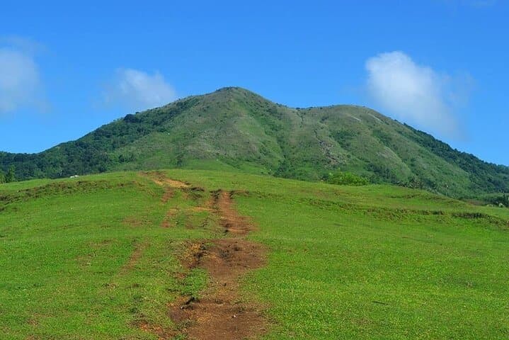
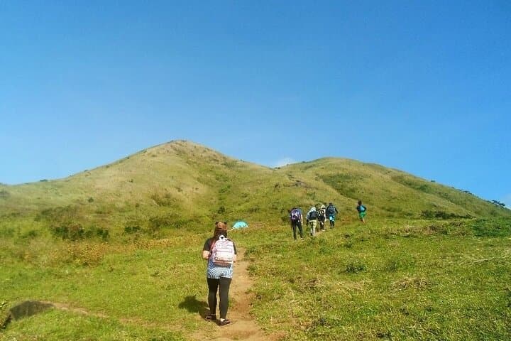
You step off the jeepney into a wash of open sky and cogon grass that shivers like an anxious crowd. The trail to Mt. Talamitam quickly opens into three clear sections: a wooded river crossing that dares your footing, a lowland stretch through fields, then long rolling hills of tall cogon leading to an exposed summit where the horizon widens.
You step off the jeepney into a wash of open sky and cogon grass that shivers like an anxious crowd. The trail to Mt. Talamitam quickly opens into three clear sections: a wooded river crossing that dares your footing, a lowland stretch through fields, then long rolling hills of tall cogon leading to an exposed summit where the horizon widens.
Historically the mountain was named for once-abundant talamitam trees; today locals and DENR-led planting efforts aim to restore those native stands. Geologically the ridge is part of Batangas’ volcanic foothills—weathered volcanic rock under thin soils produces the broad, grassy slopes and quick-draining footpaths you’ll walk. Culturally, nearby barangays treat the peak as a community landmark and gathering spot for planting drives and weekend escapes.
Expect roughly 6–8 km round trip with about 350–550 m of elevation gain depending on the route, and a hiking window of about 3–5 hours on-trail (the full tour, including transfers, fills a 10-hour day). Terrain alternates mud and river stones, open grassland, and steeper, exposed ridgelines. Bring sun protection for the exposed final ascent, and gaiters if recent rains have swollen the river crossing.
Plan a steady pace, filter or carry enough water, and leave no trace: local restoration efforts depend on hikers who respect the fragile summit environment. Arrive early to catch cooler air and clearer views back toward the Batangas coastline.