THE ADVENTURE COLLECTIVE® · Independent discovery and booking for outdoor travel

Short and accessible, the Mt. Kunimi guided trek from JR Tsuda Station delivers cedar-scented trails and sweeping views over the Osaka–Kyoto plain in about two hours. Ideal for visitors seeking a compact, private hiking experience close to the city.
Short and accessible, the Mt. Kunimi guided trek from JR Tsuda Station delivers cedar-scented trails and sweeping views over the Osaka–Kyoto plain in about two hours. Ideal for visitors seeking a compact, private hiking experience close to the city.
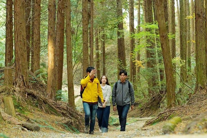
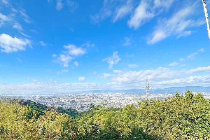
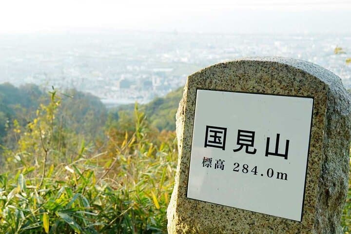
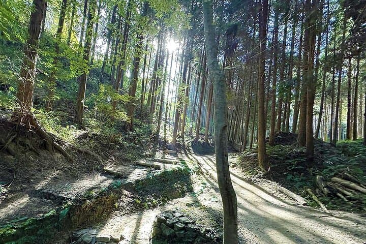
A short street walk out of JR Tsuda Station drops you into the low, green shoulders of eastern Hirakata. The path quickly moves from neighborhood sidewalks to a narrow dirt trail that threads cedar groves, a clear mountain stream, and the stone hints of former mountain fortifications. By the time the summit opens up, the plain between Kyoto and Osaka spreads below in a wide, human-made plain — roofs, rail lines and distant towers under a frequently changing sky.
Verified experiences and guided adventures in the surrounding area.
Operated by LINKTIVITY Inc. · Hirakata, Osaka Prefecture
A short street walk out of JR Tsuda Station drops you into the low, green shoulders of eastern Hirakata. The path quickly moves from neighborhood sidewalks to a narrow dirt trail that threads cedar groves, a clear mountain stream, and the stone hints of former mountain fortifications. By the time the summit opens up, the plain between Kyoto and Osaka spreads below in a wide, human-made plain — roofs, rail lines and distant towers under a frequently changing sky.
Geologically this ridge is part of the low hills that edge the Kyoto-Osaka plain, formed by uplift and river terraces rather than alpine glaciation; trails are mostly packed earth with rock outcrops and root networks. Culturally the route passes places where small mountain castles and farm settlements once watched the corridor between the two cities; local shrines and stone markers still punctuate the walk.
Expect about 80 minutes uphill at a steady, moderate pace with varied terrain: paved approach, dirt tracks, stream crossings and cedar stands. The summit offers more than 180-degree views on clear days and quick weather shifts on cloudy ones.
Practical guidance: start from JR Tsuda Station, wear lace-up hiking shoes, carry 1–1.5 L of water and a light rain shell in shoulder seasons. Guided private format means a steady group pace and local route knowledge — useful when the trail narrows or forks. This trek is compact and accessible, ideal for visitors based in Hirakata or making a side trip from Osaka or Kyoto who want a brisk, scenic introduction to Kansai’s low-mountain hiking.
moderate.
2 hours.
Suitable for someone with moderate fitness who can sustain steady uphill walking for ~80 minutes.
The guided trek is about 2 hours total with ~80 minutes uphill at a steady pace; it’s moderate — suitable for most people with basic fitness.
Meet at JR Tsuda Station; the guide leads a short walk through local streets to the Mt. Kunimi trailhead.
No — Mt. Kunimi is free to access; the tour fee covers guiding services only.
Yes, the tour proceeds in light rain; heavy weather may prompt cancellation with refund if within policy window.
The ridgeline was once dotted with small mountain castles and watch posts guarding the Kyoto–Osaka corridor; stone markers and shrine sites along the route recall that past.
Stick to established trails, pack out all waste and avoid disturbing plants and wildlife; low-impact use helps preserve the cedar groves and streamside habitats.
LINKTIVITY Inc. operates guided outdoor trips and adventures with an emphasis on safety, stewardship, and memorable experiences.
A short street walk out of JR Tsuda Station drops you into the low, green shoulders of eastern Hirakata. The path quickly moves from neighborhood sidewalks to a narrow dirt trail that threads cedar groves, a clear mountain stream, and the stone hints of former mountain fortifications. By the time the summit opens up, the plain between Kyoto and Osaka spreads below in a wide, human-made plain — roofs, rail lines and distant towers under a frequently changing sky.
A short street walk out of JR Tsuda Station drops you into the low, green shoulders of eastern Hirakata. The path quickly moves from neighborhood sidewalks to a narrow dirt trail that threads cedar groves, a clear mountain stream, and the stone hints of former mountain fortifications. By the time the summit opens up, the plain between Kyoto and Osaka spreads below in a wide, human-made plain — roofs, rail lines and distant towers under a frequently changing sky.
Geologically this ridge is part of the low hills that edge the Kyoto-Osaka plain, formed by uplift and river terraces rather than alpine glaciation; trails are mostly packed earth with rock outcrops and root networks. Culturally the route passes places where small mountain castles and farm settlements once watched the corridor between the two cities; local shrines and stone markers still punctuate the walk.
Expect about 80 minutes uphill at a steady, moderate pace with varied terrain: paved approach, dirt tracks, stream crossings and cedar stands. The summit offers more than 180-degree views on clear days and quick weather shifts on cloudy ones.
Practical guidance: start from JR Tsuda Station, wear lace-up hiking shoes, carry 1–1.5 L of water and a light rain shell in shoulder seasons. Guided private format means a steady group pace and local route knowledge — useful when the trail narrows or forks. This trek is compact and accessible, ideal for visitors based in Hirakata or making a side trip from Osaka or Kyoto who want a brisk, scenic introduction to Kansai’s low-mountain hiking.