THE ADVENTURE COLLECTIVE® · Independent discovery and booking for outdoor travel

A guided two-day ascent of Mount Toubkal reaches North Africa’s highest peak for sunrise views. Expect steep, rocky trails, an overnight at Toubkal Refuge and strong local culture in Imlil and Sidi Chamharouch.
A guided two-day ascent of Mount Toubkal reaches North Africa’s highest peak for sunrise views. Expect steep, rocky trails, an overnight at Toubkal Refuge and strong local culture in Imlil and Sidi Chamharouch.
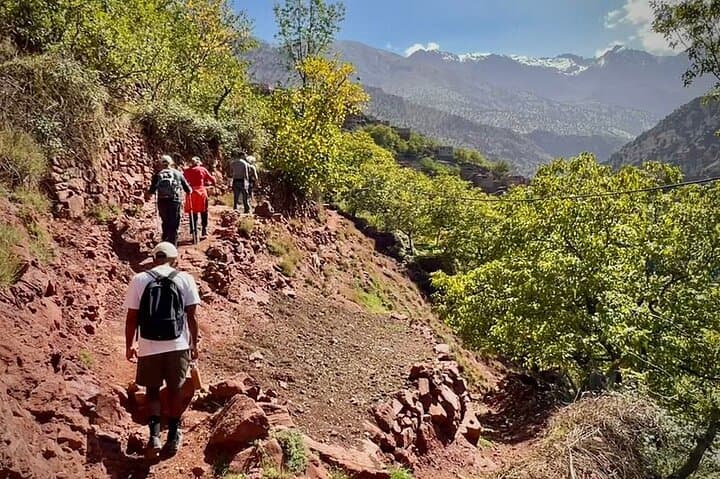
A headlamp beam threads through chill pre-dawn air as a small group picks its way up talus toward the silhouette of Toubkal. The High Atlas rises like a raw spine south of Marrakech; on this two-day route the landscape tightens from cultivated terraces and walnut groves to wind-scoured rock and open sky.
Verified experiences and guided adventures in the surrounding area.
Operated by MaraTrek · Marrakech, Marrakesh-Safi
A headlamp beam threads through chill pre-dawn air as a small group picks its way up talus toward the silhouette of Toubkal. The High Atlas rises like a raw spine south of Marrakech; on this two-day route the landscape tightens from cultivated terraces and walnut groves to wind-scoured rock and open sky.
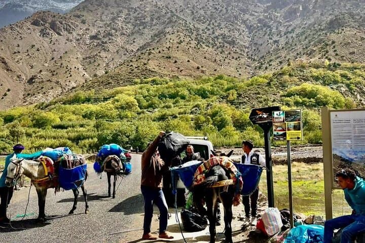
Geology and history show in the cliffs and villages: the range was lifted by the collision of the African and Eurasian plates, leaving hard metamorphic and igneous rock, steep drainage lines and loose scree underfoot. The valleys are home to Amazigh (Berber) communities whose stone houses and irrigation terraces have shaped travel routes for centuries; Sidi Chamharouch, a small shrine at about 2,350 m, is both spiritual waypoint and rest stop on the way to the refuge.
Practically, the trip is a guided, overnight trek: transfer from Marrakech to Imlil, a 4–7 hour day 1 walk to Refuge du Toubkal (3,206 m), then a pre-dawn summit push to 4,165 m on day 2 for sunrise views over the plain toward the Sahara. Expect steep, rocky trails, loose scree on ascent and short exposed sections; total elevation gain from Imlil is roughly 1,400–1,600 m over the two days, with the refuge-to-summit leg adding about 950 m.
Plan for big temperature swings, layered clothing, sturdy boots, trekking poles and a headlamp. Hydrate and eat well before the summit day, pace conservatively to reduce altitude strain, and be prepared for rapid weather changes—this is high-altitude trekking in a remote mountain setting supported by local guides.
challenging.
2 days (Day 1: ~5 hours; Day 2: ~9 hours of hiking).
Good aerobic fitness and previous multi‑hour hiking experience recommended; comfortable with long ascents and altitude.
The climb is physically demanding due to long ascent and altitude; guided parties divide it over two days to make it achievable for fit hikers.
No technical climbing is required in summer conditions, but winter routes may need crampons and ice axe; the tour provides guided support.
Participants should be free of serious cardiovascular, spinal or pregnancy-related restrictions and have at least moderate fitness; check with the operator for age limits.
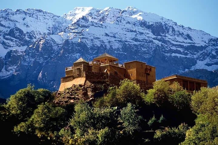
The standard night is at Refuge du Toubkal (3,206 m) or camping when conditions allow; refuges are basic with shared bunks and meals provided by guides.
High Atlas valleys are home to Amazigh (Berber) communities whose trails and terraced fields have guided travel and trade routes for centuries.
Stick to established trails, pack out waste and use local guides—tourism income supports mountain communities but foot traffic accelerates erosion.
MaraTrek operates guided outdoor trips and adventures with an emphasis on safety, stewardship, and memorable experiences.
A headlamp beam threads through chill pre-dawn air as a small group picks its way up talus toward the silhouette of Toubkal. The High Atlas rises like a raw spine south of Marrakech; on this two-day route the landscape tightens from cultivated terraces and walnut groves to wind-scoured rock and open sky.
A headlamp beam threads through chill pre-dawn air as a small group picks its way up talus toward the silhouette of Toubkal. The High Atlas rises like a raw spine south of Marrakech; on this two-day route the landscape tightens from cultivated terraces and walnut groves to wind-scoured rock and open sky.
Geology and history show in the cliffs and villages: the range was lifted by the collision of the African and Eurasian plates, leaving hard metamorphic and igneous rock, steep drainage lines and loose scree underfoot. The valleys are home to Amazigh (Berber) communities whose stone houses and irrigation terraces have shaped travel routes for centuries; Sidi Chamharouch, a small shrine at about 2,350 m, is both spiritual waypoint and rest stop on the way to the refuge.
Practically, the trip is a guided, overnight trek: transfer from Marrakech to Imlil, a 4–7 hour day 1 walk to Refuge du Toubkal (3,206 m), then a pre-dawn summit push to 4,165 m on day 2 for sunrise views over the plain toward the Sahara. Expect steep, rocky trails, loose scree on ascent and short exposed sections; total elevation gain from Imlil is roughly 1,400–1,600 m over the two days, with the refuge-to-summit leg adding about 950 m.
Plan for big temperature swings, layered clothing, sturdy boots, trekking poles and a headlamp. Hydrate and eat well before the summit day, pace conservatively to reduce altitude strain, and be prepared for rapid weather changes—this is high-altitude trekking in a remote mountain setting supported by local guides.