THE ADVENTURE COLLECTIVE® · Independent discovery and booking for outdoor travel

Short, seaside ascents and wide coastal views define this 5 km hike from Alessia to Monte San Liberatore. Expect 350 m of climbing and panoramic vistas over Vietri, Salerno and the Cilento hills—ideal for a half-day outing.
Short, seaside ascents and wide coastal views define this 5 km hike from Alessia to Monte San Liberatore. Expect 350 m of climbing and panoramic vistas over Vietri, Salerno and the Cilento hills—ideal for a half-day outing.
The trail starts in Alessia, a village shoulder to Cava dei Tirreni, and immediately climbs into chestnut and Mediterranean scrub. You feel the slope beneath your boots — a steady pull of stone steps and dirt switchbacks that open suddenly to a blue slice of sea: Vietri sul Mare and the Amalfi coastline laid out like a ragged coastline map.
Verified experiences and guided adventures in the surrounding area.
Operated by Enzo Masullo · Cava dei Tirreni, Campania
The trail starts in Alessia, a village shoulder to Cava dei Tirreni, and immediately climbs into chestnut and Mediterranean scrub. You feel the slope beneath your boots — a steady pull of stone steps and dirt switchbacks that open suddenly to a blue slice of sea: Vietri sul Mare and the Amalfi coastline laid out like a ragged coastline map.
Geology here is coastal Apennine: limestone ridges carved by winter streams, small terraces of ancient agriculture and scattered beech and holm oak that buffer the sun. The area’s human story is visible in the terraces and mule tracks — agrarian routes that once linked hill hamlets to the ports below and fed the maritime towns of the Amalfi coast.
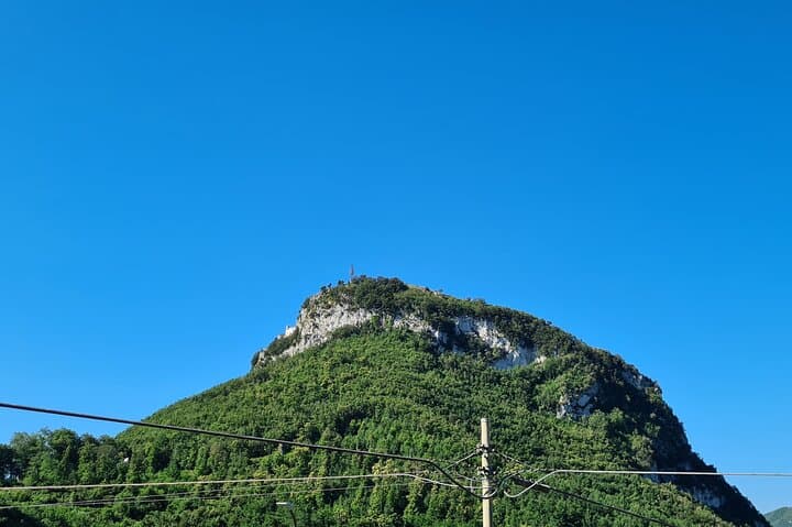
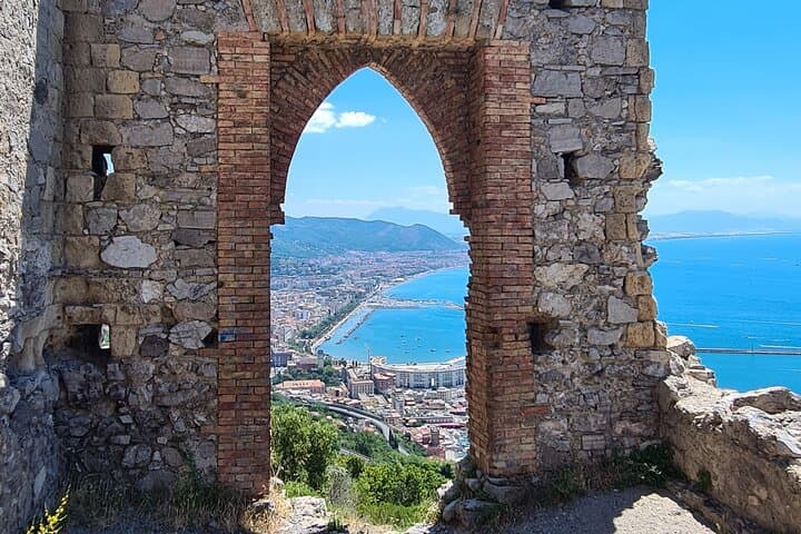
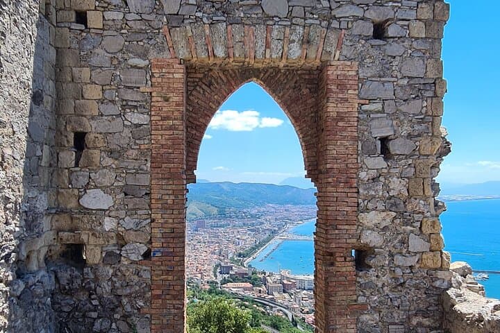
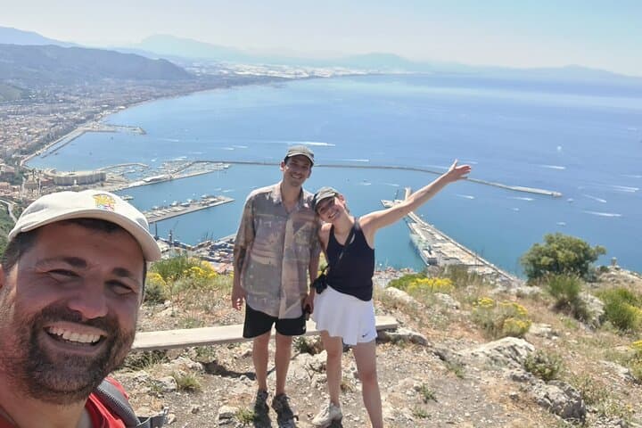
From the summit of Monte San Liberatore (about 500 m above sea level) the hike’s 350 m of ascent rewards you with long views to Salerno to the east and the Cilento range to the south. On a clear day you can pick out the Amalfi promontories and the bright roofs of Vietri.
Practical guidance: the route is roughly 5 km roundtrip and typically takes 3–4 hours at an easy, steady pace. Expect narrow singletrack, some stone steps and loose scree on steeper pitches. Poles are often used and are included by guides. Start early in summer to avoid heat, carry at least 1–1.5 L of water, and wear grippy hiking shoes — the trail is straightforward but exposed in sections. Local guides provide route knowledge and context; stick to the path to protect fragile vegetation and terraced slopes.
easy.
3–4 hours.
Suitable for hikers with basic fitness who can sustain steady uphill walking for a few hours.
The route is about 5 km roundtrip with roughly 350 m of elevation gain; plan on 3–4 hours including stops.
It starts in Alessia near Cava dei Tirreni. Alessia is reachable by local bus or a short taxi ride from Cava dei Tirreni or Salerno.
Yes — the tour lists a guide and walking poles as inclusions, which is useful for route-finding and stability.
The operator notes stroller access for infants in some sections, but parts of the trail include steps and uneven ground; assess your child’s ability and use a carrier for steeper sections.
The trail follows old pastoral and agricultural routes linking hillside communities to coastal towns; the terraces reflect centuries of small-scale farming on steep slopes.
Stick to the marked paths to protect fragile terraced soils and native maquis; avoid collecting plants or disturbing nesting birds during spring.
Enzo Masullo operates guided outdoor trips and adventures with an emphasis on safety, stewardship, and memorable experiences.
The trail starts in Alessia, a village shoulder to Cava dei Tirreni, and immediately climbs into chestnut and Mediterranean scrub. You feel the slope beneath your boots — a steady pull of stone steps and dirt switchbacks that open suddenly to a blue slice of sea: Vietri sul Mare and the Amalfi coastline laid out like a ragged coastline map.
The trail starts in Alessia, a village shoulder to Cava dei Tirreni, and immediately climbs into chestnut and Mediterranean scrub. You feel the slope beneath your boots — a steady pull of stone steps and dirt switchbacks that open suddenly to a blue slice of sea: Vietri sul Mare and the Amalfi coastline laid out like a ragged coastline map.
Geology here is coastal Apennine: limestone ridges carved by winter streams, small terraces of ancient agriculture and scattered beech and holm oak that buffer the sun. The area’s human story is visible in the terraces and mule tracks — agrarian routes that once linked hill hamlets to the ports below and fed the maritime towns of the Amalfi coast.
From the summit of Monte San Liberatore (about 500 m above sea level) the hike’s 350 m of ascent rewards you with long views to Salerno to the east and the Cilento range to the south. On a clear day you can pick out the Amalfi promontories and the bright roofs of Vietri.
Practical guidance: the route is roughly 5 km roundtrip and typically takes 3–4 hours at an easy, steady pace. Expect narrow singletrack, some stone steps and loose scree on steeper pitches. Poles are often used and are included by guides. Start early in summer to avoid heat, carry at least 1–1.5 L of water, and wear grippy hiking shoes — the trail is straightforward but exposed in sections. Local guides provide route knowledge and context; stick to the path to protect fragile vegetation and terraced slopes.