THE ADVENTURE COLLECTIVE® · Independent discovery and booking for outdoor travel

A sharp, one-day ascent to Mount Sabyinyo rewards effort with boundary-straddling summit views across Rwanda, Uganda and the DRC. This guided hike combines rugged ridgelines, diverse forest habitats and clear, practical logistics for a full-day alpine challenge.
A sharp, one-day ascent to Mount Sabyinyo rewards effort with boundary-straddling summit views across Rwanda, Uganda and the DRC. This guided hike combines rugged ridgelines, diverse forest habitats and clear, practical logistics for a full-day alpine challenge.
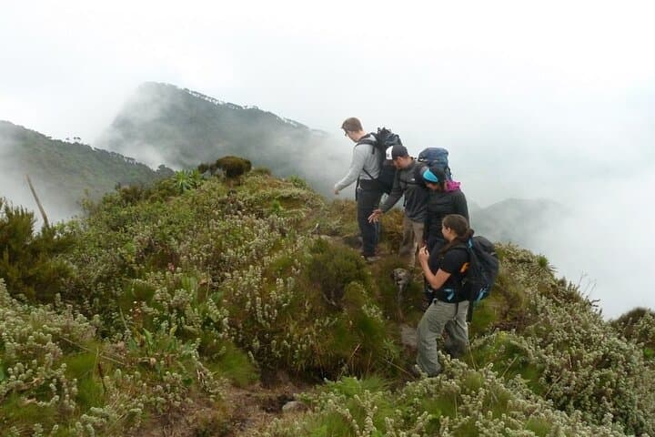
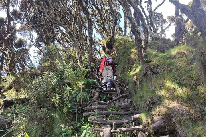
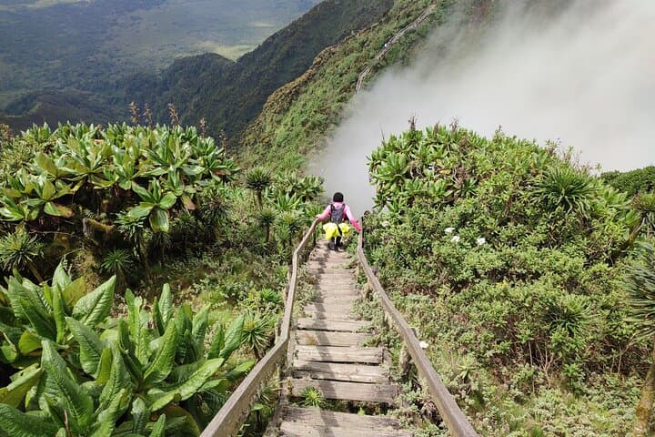
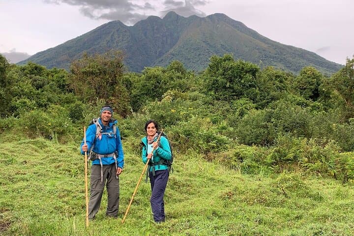
The morning air on the Virunga ridges bites with the clean, metal edge of altitude as hikers unload at Volcanoes National Park headquarters and begin the ascent of Mount Sabyinyo. Early light strips the ridge into hard shapes; the trail threads narrow cols and serrated rock that earned the peak its local name—"old man's teeth." The mountain pushes and prods, the wind urging boots up steep, root-laced slopes toward a summit that sits at the meeting point of Rwanda, Uganda and the Democratic Republic of Congo.
Verified experiences and guided adventures in the surrounding area.
Operated by Silverbird Tours Agency · Musanze, Northern Province
The morning air on the Virunga ridges bites with the clean, metal edge of altitude as hikers unload at Volcanoes National Park headquarters and begin the ascent of Mount Sabyinyo. Early light strips the ridge into hard shapes; the trail threads narrow cols and serrated rock that earned the peak its local name—"old man's teeth." The mountain pushes and prods, the wind urging boots up steep, root-laced slopes toward a summit that sits at the meeting point of Rwanda, Uganda and the Democratic Republic of Congo.
Geologically Sabyinyo is part of the ancient Virunga volcanic chain—eroded, exposed and older than its neighbors—where lava flows and glacial sculpting have left jagged ridgelines and blocky outcrops. The slope supports afro-montane forest, bamboo bands and rocky heath, and the area has long cultural ties to communities on all three borders, who once used ridge corridors for trade and grazing.
Expect 6–8 hours on trail; narrow ridges and steep pitches reward persistence with views across crater lakes, distant peaks and cross-border valleys. Wildlife is real but discreet—golden monkeys and forest potto are more likely than large herds; keep noise low and distance respectful.
Practically, start very early, carry 2–3 liters of water, layered clothing and a packed lunch (provided on many organized trips). Good ankle-supporting boots and trekking poles cut fatigue on rocky descents. Weather changes fast—rain, sun and wind can come in hours—so plan for mud, strong sun at the summit, and slow, steady pacing. Guided permits are required; follow ranger instructions and stay on marked routes to protect fragile alpine flora and the park’s long-term conservation goals.
challenging.
6–8 hours (hiking).
Good aerobic fitness and strong legs for sustained elevation gain; previous day-hiking experience recommended
Yes—hiking in Volcanoes National Park requires a permit and registered guides; organized tours typically include permit fees.
Expect a challenging full-day hike with steep sections and 6–8 hours on trail; hikers should be comfortable with sustained climbs and uneven terrain.
Summit altitude (~3,645 m) can affect visitors; acclimatize with light activity at altitude beforehand, stay hydrated and ascend at a steady pace.
Yes, but sightings are variable—golden monkeys, forest duikers and birds are common; larger mammals are possible but less predictable.
Mount Sabyinyo is the oldest of the Virunga chain and has long been a cultural landmark for border communities; its jagged summit inspired the local name referencing 'old man's teeth.'
Trails are strictly managed to limit erosion and protect alpine flora; use established paths, pack out waste and follow ranger guidance to minimize impact.
Silverbird Tours Agency operates guided outdoor trips and adventures with an emphasis on safety, stewardship, and memorable experiences.
The morning air on the Virunga ridges bites with the clean, metal edge of altitude as hikers unload at Volcanoes National Park headquarters and begin the ascent of Mount Sabyinyo. Early light strips the ridge into hard shapes; the trail threads narrow cols and serrated rock that earned the peak its local name—"old man's teeth." The mountain pushes and prods, the wind urging boots up steep, root-laced slopes toward a summit that sits at the meeting point of Rwanda, Uganda and the Democratic Republic of Congo.
The morning air on the Virunga ridges bites with the clean, metal edge of altitude as hikers unload at Volcanoes National Park headquarters and begin the ascent of Mount Sabyinyo. Early light strips the ridge into hard shapes; the trail threads narrow cols and serrated rock that earned the peak its local name—"old man's teeth." The mountain pushes and prods, the wind urging boots up steep, root-laced slopes toward a summit that sits at the meeting point of Rwanda, Uganda and the Democratic Republic of Congo.
Geologically Sabyinyo is part of the ancient Virunga volcanic chain—eroded, exposed and older than its neighbors—where lava flows and glacial sculpting have left jagged ridgelines and blocky outcrops. The slope supports afro-montane forest, bamboo bands and rocky heath, and the area has long cultural ties to communities on all three borders, who once used ridge corridors for trade and grazing.
Expect 6–8 hours on trail; narrow ridges and steep pitches reward persistence with views across crater lakes, distant peaks and cross-border valleys. Wildlife is real but discreet—golden monkeys and forest potto are more likely than large herds; keep noise low and distance respectful.
Practically, start very early, carry 2–3 liters of water, layered clothing and a packed lunch (provided on many organized trips). Good ankle-supporting boots and trekking poles cut fatigue on rocky descents. Weather changes fast—rain, sun and wind can come in hours—so plan for mud, strong sun at the summit, and slow, steady pacing. Guided permits are required; follow ranger instructions and stay on marked routes to protect fragile alpine flora and the park’s long-term conservation goals.