THE ADVENTURE COLLECTIVE® · Independent discovery and booking for outdoor travel

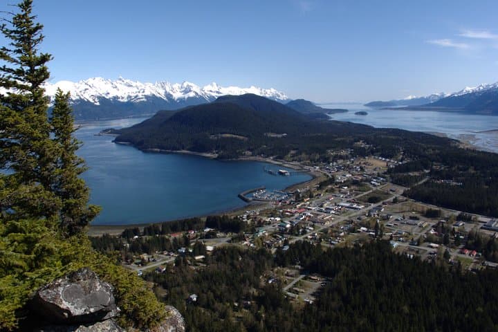
A full-day guided hike to Mount Riley climbs through temperate rainforest to a 360-degree summit above Lynn Canal. Expect 5–8 miles, ~1,500 ft of gain, natural-history interpretation, and panoramic coastal views.
A full-day guided hike to Mount Riley climbs through temperate rainforest to a 360-degree summit above Lynn Canal. Expect 5–8 miles, ~1,500 ft of gain, natural-history interpretation, and panoramic coastal views.
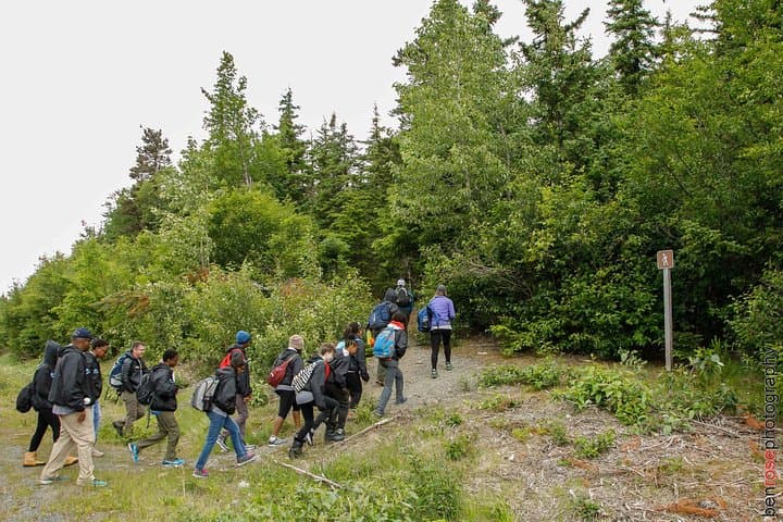
You step off the pier in Haines and the air feels cold and clear — seawater scent, evergreen resin, and the distant percussion of gulls. The guide gathers the small group, points toward a road that leads into temperate rainforest, and the town slips behind you as the trail begins to climb. Trees lean in like curious neighbors; streams thread the ravine and the Lynn Canal waits below, a deep, glacial fjord that dares you to look down.
Verified experiences and guided adventures in the surrounding area.
Operated by Alaska Mountain Guides Adventures, inc. Chilkat Guides Ltd · Haines, Alaska
You step off the pier in Haines and the air feels cold and clear — seawater scent, evergreen resin, and the distant percussion of gulls. The guide gathers the small group, points toward a road that leads into temperate rainforest, and the town slips behind you as the trail begins to climb. Trees lean in like curious neighbors; streams thread the ravine and the Lynn Canal waits below, a deep, glacial fjord that dares you to look down.
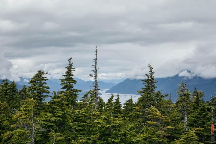
The route crosses lands with military and Gold Rush history — a quick pass by Fort Seward recalls early Army presence on the peninsula, then the trail moves through Chilkat State Park’s old-growth stands. Geologically, the hike is a coastal foothill ascent carved by ice and sea, offering rock outcrops, mossy benches, and viewpoints that frame snow-capped peaks and the narrow canal. Local Tlingit history echoes in place names and the long relationship people here have with salmon and the shoreline.
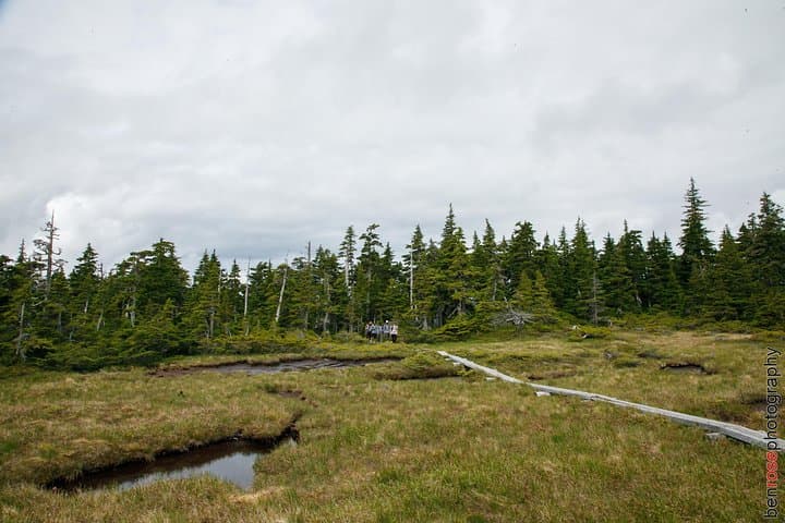
Practically, expect a strenuous full-day outing: 5–8 miles round-trip, about 1,500 ft of gain to the summit near 1,760 ft, and roughly six hours including stops. Trails are mostly singletrack with switchbacks, root and rock steps, and muddy sections after rain. Guides supply water, snacks, lunch, and hiking poles; they also share natural-history interpretation and keep an eye out for bald eagles, whales offshore, and signs of bears.
Plan to start early, layer for wet coastal weather, carry at least 1–2 liters of water, and wear stable hiking boots. If you have cardiovascular or back concerns, this route is not recommended. On a clear day the summit delivers a 360-degree panorama that rewards the steady climb — raw, direct, and undeniably Alaskan.
challenging.
5–7 hours (itinerary lists 6 hours).
Participants should have strong cardiovascular fitness and comfort with sustained uphill hiking and uneven terrain
Expect a challenging day hike: 5–8 miles round-trip with about 1,500 ft of elevation gain over uneven singletrack and switchbacks; good fitness is required.
The guide meets at the end of the pier near the cruise port in Haines — the tour departs within walking distance of the dock, with paperwork completed before leaving.
No special permits are typically required for day hikes in Chilkat State Park, but check with guides for current local regulations.
Common sightings include bald eagles, shorebirds, and occasionally marine mammals offshore; hikers should also be aware of black bears and follow guide instructions.
The route passes near Fort Seward, an early U.S. Army installation, and traverses lands long used by Tlingit communities tied to salmon and coastal trade.
Chilkat State Park protects coastal rainforest and salmon habitat; visitors are asked to pack out waste, stay on trail to limit erosion, and respect wildlife distances.
Alaska Mountain Guides Adventures, inc. Chilkat Guides Ltd operates guided outdoor trips and adventures with an emphasis on safety, stewardship, and memorable experiences.
You step off the pier in Haines and the air feels cold and clear — seawater scent, evergreen resin, and the distant percussion of gulls. The guide gathers the small group, points toward a road that leads into temperate rainforest, and the town slips behind you as the trail begins to climb. Trees lean in like curious neighbors; streams thread the ravine and the Lynn Canal waits below, a deep, glacial fjord that dares you to look down.
You step off the pier in Haines and the air feels cold and clear — seawater scent, evergreen resin, and the distant percussion of gulls. The guide gathers the small group, points toward a road that leads into temperate rainforest, and the town slips behind you as the trail begins to climb. Trees lean in like curious neighbors; streams thread the ravine and the Lynn Canal waits below, a deep, glacial fjord that dares you to look down.
The route crosses lands with military and Gold Rush history — a quick pass by Fort Seward recalls early Army presence on the peninsula, then the trail moves through Chilkat State Park’s old-growth stands. Geologically, the hike is a coastal foothill ascent carved by ice and sea, offering rock outcrops, mossy benches, and viewpoints that frame snow-capped peaks and the narrow canal. Local Tlingit history echoes in place names and the long relationship people here have with salmon and the shoreline.
Practically, expect a strenuous full-day outing: 5–8 miles round-trip, about 1,500 ft of gain to the summit near 1,760 ft, and roughly six hours including stops. Trails are mostly singletrack with switchbacks, root and rock steps, and muddy sections after rain. Guides supply water, snacks, lunch, and hiking poles; they also share natural-history interpretation and keep an eye out for bald eagles, whales offshore, and signs of bears.
Plan to start early, layer for wet coastal weather, carry at least 1–2 liters of water, and wear stable hiking boots. If you have cardiovascular or back concerns, this route is not recommended. On a clear day the summit delivers a 360-degree panorama that rewards the steady climb — raw, direct, and undeniably Alaskan.