THE ADVENTURE COLLECTIVE® · Independent discovery and booking for outdoor travel

Hike Mount Liamuiga to stand on a 3,792 ft volcanic summit with rainforest trails, a visible crater, and sweeping views of neighboring Caribbean islands. This day hike blends geology, tropical ecology, and practical trail advice for a full-day ascent.
Hike Mount Liamuiga to stand on a 3,792 ft volcanic summit with rainforest trails, a visible crater, and sweeping views of neighboring Caribbean islands. This day hike blends geology, tropical ecology, and practical trail advice for a full-day ascent.
You start before dawn under a humid, slow-turning sky; the rainforest exhales around you and the trail climbs, roots and rock alternating underfoot. As the island tightens into single-file switchbacks, the sea peeks between trunks—turquoise bands that promise distant islands—until the air thins and the crater finally opens like a private room at the summit.
Verified experiences and guided adventures in the surrounding area.
Operated by Jungle Bikes ATV Tours · Basseterre, Saint Kitts
You start before dawn under a humid, slow-turning sky; the rainforest exhales around you and the trail climbs, roots and rock alternating underfoot. As the island tightens into single-file switchbacks, the sea peeks between trunks—turquoise bands that promise distant islands—until the air thins and the crater finally opens like a private room at the summit.
Mount Liamuiga rises to 3,792 ft (1,156 m) and is the high point of Saint Kitts. Geologically it’s a stratovolcano whose broad crater and steep inner walls date from multiple eruptive phases; its slopes host a montane rainforest that supports endemic plants and migratory birds. Culturally, the mountain has long been a landmark for Kittitians and sailors, and early colonial maps labeled it as a navigational high point.
On the hike you’ll move through layered vegetation—lowland palms giving way to moss-draped hardwoods—and encounter the island’s characteristic fauna. Guides point out rare orchids and explain traditional uses of some plants, tying natural history to island life.
Practical guidance: expect 4–6 hours round-trip on uneven, sometimes muddy trails with roughly 900–1,100 m of elevation gain depending on start point. Wear sturdy hiking boots, bring 2–3 liters of water, rain protection, and sunscreen. Start early to avoid midday heat and to see the clearest island views; weather can shift quickly, so layers are necessary. If you’re coming by cruise ship, allow ample reboarding time—transport is provided on many tours but confirm pickup windows. The summit’s crater provides a restful spot to photograph a wide Caribbean horizon before the descent.
challenging.
4–6 hours.
Good aerobic fitness and ability to manage sustained uphill hiking for several hours; prior day-hike experience helpful.
Most tours plan for about 4–6 hours round-trip depending on pace and exact trailhead; expect sustained climbing sections.
Children can join if closely supervised and physically fit for steep climbs; tour notes require adult accompaniment and recommend moderate fitness.
Guided hikes are the common offering—local operators provide guides and transport; no special government permit is typically required for day hikes.
Bring a lightweight rain jacket, start early, and check forecasts—afternoon showers are frequent; guides monitor conditions and may alter timing.
Mount Liamuiga—formerly called Mount Misery—has been a landmark since pre-colonial and colonial periods; its slopes were historically limited in agricultural use due to steep terrain.
Trails pass through sensitive montane forest; stay on marked paths, avoid removing plants, and use local guides to support sustainable tourism practices.
Jungle Bikes ATV Tours operates guided outdoor trips and adventures with an emphasis on safety, stewardship, and memorable experiences.
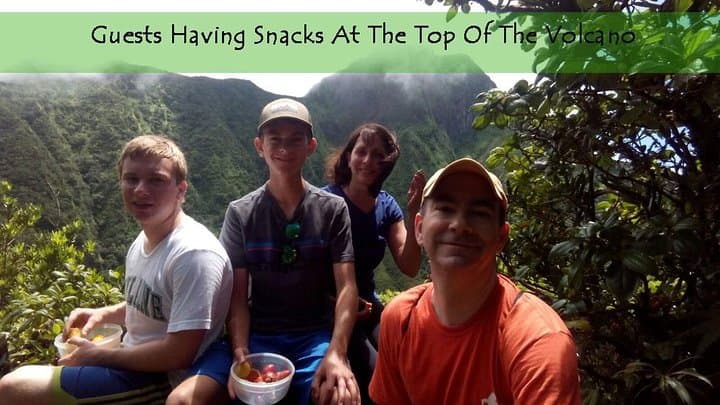
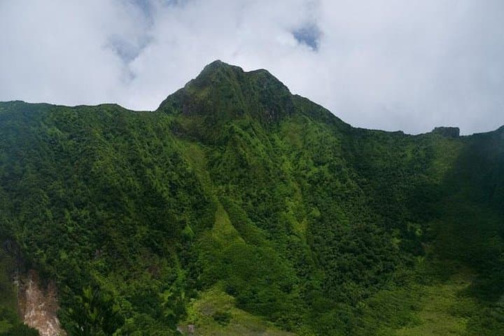
You start before dawn under a humid, slow-turning sky; the rainforest exhales around you and the trail climbs, roots and rock alternating underfoot. As the island tightens into single-file switchbacks, the sea peeks between trunks—turquoise bands that promise distant islands—until the air thins and the crater finally opens like a private room at the summit.
You start before dawn under a humid, slow-turning sky; the rainforest exhales around you and the trail climbs, roots and rock alternating underfoot. As the island tightens into single-file switchbacks, the sea peeks between trunks—turquoise bands that promise distant islands—until the air thins and the crater finally opens like a private room at the summit.
Mount Liamuiga rises to 3,792 ft (1,156 m) and is the high point of Saint Kitts. Geologically it’s a stratovolcano whose broad crater and steep inner walls date from multiple eruptive phases; its slopes host a montane rainforest that supports endemic plants and migratory birds. Culturally, the mountain has long been a landmark for Kittitians and sailors, and early colonial maps labeled it as a navigational high point.
On the hike you’ll move through layered vegetation—lowland palms giving way to moss-draped hardwoods—and encounter the island’s characteristic fauna. Guides point out rare orchids and explain traditional uses of some plants, tying natural history to island life.
Practical guidance: expect 4–6 hours round-trip on uneven, sometimes muddy trails with roughly 900–1,100 m of elevation gain depending on start point. Wear sturdy hiking boots, bring 2–3 liters of water, rain protection, and sunscreen. Start early to avoid midday heat and to see the clearest island views; weather can shift quickly, so layers are necessary. If you’re coming by cruise ship, allow ample reboarding time—transport is provided on many tours but confirm pickup windows. The summit’s crater provides a restful spot to photograph a wide Caribbean horizon before the descent.