THE ADVENTURE COLLECTIVE® · Independent discovery and booking for outdoor travel

Climb Mount Liamuiga on a guided 5–6 hour rainforest hike to a 3,792 ft crater rim with sweeping 360° views of St Kitts, Nevis and nearby islands. Learn geology and local history en route while enjoying included transport and refreshments.
Climb Mount Liamuiga on a guided 5–6 hour rainforest hike to a 3,792 ft crater rim with sweeping 360° views of St Kitts, Nevis and nearby islands. Learn geology and local history en route while enjoying included transport and refreshments.
Dawn on St Kitts begins humid and sharp; the rainforest exhales mist that clings to hanging vines as hikers step off the safari into the mountain’s shadow. The trail teethes upward through wet, moss-slick roots, then opens to a ridge where clouds break and the island falls away in every direction—Basseterre, Nevis and, on a clear day, distant Saint Barts spread like a map below.
Verified experiences and guided adventures in the surrounding area.
Operated by stkitts-taxi-and-tours · Basseterre, Saint Kitts
Dawn on St Kitts begins humid and sharp; the rainforest exhales mist that clings to hanging vines as hikers step off the safari into the mountain’s shadow. The trail teethes upward through wet, moss-slick roots, then opens to a ridge where clouds break and the island falls away in every direction—Basseterre, Nevis and, on a clear day, distant Saint Barts spread like a map below.
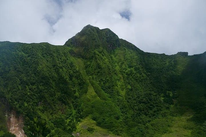
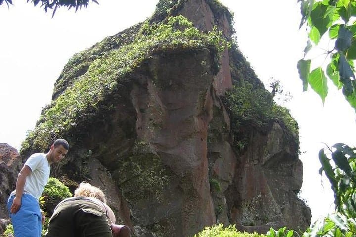
Mount Liamuiga is a dormant stratovolcano (3,792 ft / 1,156 m) whose slopes record volcanic geology and colonial history: pumice-rich outcrops, old goat paths, and traces of plantation roads that once cut through the forest. The ascent passes through lower tropical forest into a cooler, cloud-forest band where endemic plants regain ground over former sugar estates. Local guides weave cultural notes into the walk—stories of sugar-era routes, and how the mountain’s water and soil shaped island settlement.
Expect 5–6 hours total time including travel from Port Zante, with steep switchbacks, muddy steps after rain, and sections of loose rock near the crater rim. The summit bowl looks alive—winds pushing up from the sea and rainclouds daring you to stay for the view.
Practical guidance: start early to avoid mid-day heat and cloud build-up, carry 1–2 liters of water, wear ankle-supporting boots and gaited trousers, and bring layers for rapid temperature change. The operator typically includes round-trip transport, bottled water and light snacks; fitness at a moderate level will make the ascent comfortable. Stay on marked paths to protect regrowth and reduce erosion on this volcanic landscape.
moderate.
5–6 hours.
Moderately fit: able to sustain steady uphill hiking, negotiate uneven ground and short steep sections.
The guided outing is about 5–6 hours round trip, ascending to Mount Liamuiga’s summit at roughly 3,792 ft (1,156 m).
Yes—operators usually include round-trip transport from Port Zante or selected hotels; confirm pickup details when booking.
A moderate level of fitness is recommended: steady uphill walking for several hours, comfortable on uneven terrain; not recommended for those with serious heart or back conditions.
Wear sturdy hiking shoes, quick-dry clothing, and bring 1–2 liters of water, a rain shell, sun protection and insect repellent.
Mount Liamuiga’s slopes record volcanic activity and later colonial-era land use—old plantation routes and water catchments shaped settlement patterns below.
Stay on marked trails to prevent erosion and protect native forest regeneration; guides manage group size to limit impact.
stkitts-taxi-and-tours operates guided outdoor trips and adventures with an emphasis on safety, stewardship, and memorable experiences.
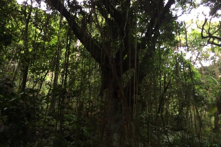
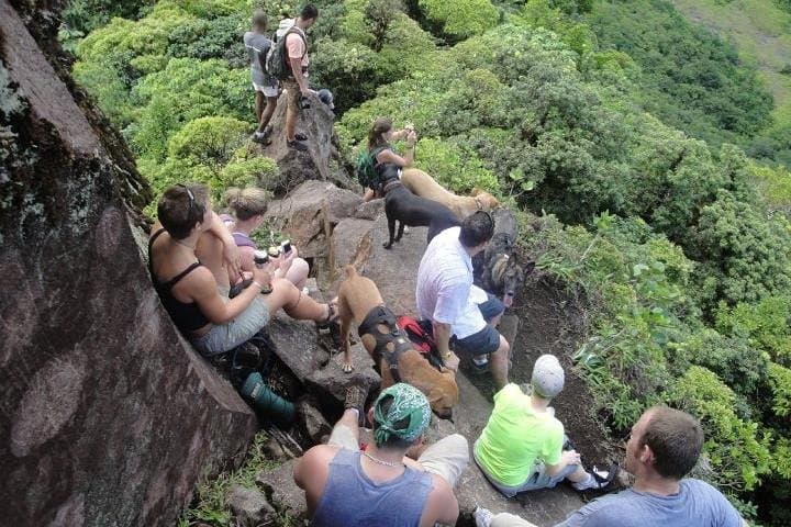
Dawn on St Kitts begins humid and sharp; the rainforest exhales mist that clings to hanging vines as hikers step off the safari into the mountain’s shadow. The trail teethes upward through wet, moss-slick roots, then opens to a ridge where clouds break and the island falls away in every direction—Basseterre, Nevis and, on a clear day, distant Saint Barts spread like a map below.
Dawn on St Kitts begins humid and sharp; the rainforest exhales mist that clings to hanging vines as hikers step off the safari into the mountain’s shadow. The trail teethes upward through wet, moss-slick roots, then opens to a ridge where clouds break and the island falls away in every direction—Basseterre, Nevis and, on a clear day, distant Saint Barts spread like a map below.
Mount Liamuiga is a dormant stratovolcano (3,792 ft / 1,156 m) whose slopes record volcanic geology and colonial history: pumice-rich outcrops, old goat paths, and traces of plantation roads that once cut through the forest. The ascent passes through lower tropical forest into a cooler, cloud-forest band where endemic plants regain ground over former sugar estates. Local guides weave cultural notes into the walk—stories of sugar-era routes, and how the mountain’s water and soil shaped island settlement.
Expect 5–6 hours total time including travel from Port Zante, with steep switchbacks, muddy steps after rain, and sections of loose rock near the crater rim. The summit bowl looks alive—winds pushing up from the sea and rainclouds daring you to stay for the view.
Practical guidance: start early to avoid mid-day heat and cloud build-up, carry 1–2 liters of water, wear ankle-supporting boots and gaited trousers, and bring layers for rapid temperature change. The operator typically includes round-trip transport, bottled water and light snacks; fitness at a moderate level will make the ascent comfortable. Stay on marked paths to protect regrowth and reduce erosion on this volcanic landscape.